Ault Field, Washington
| Ault Field, Washington | |
|---|---|
| CDP | |
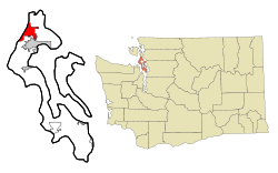 Location of Ault Field, Washington | |
| Coordinates: 48°19′29″N 122°39′53″W / 48.32472°N 122.66472°WCoordinates: 48°19′29″N 122°39′53″W / 48.32472°N 122.66472°W | |
| Country | United States |
| State | Washington |
| County | Island |
| Area | |
| • Total | 10.4 sq mi (26.9 km2) |
| • Land | 6.9 sq mi (17.8 km2) |
| • Water | 3.5 sq mi (9.1 km2) |
| Population (2000) | |
| • Total | 2,064 |
| • Density | 299.9/sq mi (115.8/km2) |
| Time zone | Pacific (PST) (UTC-8) |
| • Summer (DST) | PDT (UTC-7) |
| ZIP code | 98277 |
| Area code(s) | 360 |
| FIPS code | 53-03215[1] |
| GNIS feature ID | 2407783[2] |
| Highways |
|
Ault Field is a census-designated place (CDP) in Island County, Washington, United States. The population was 2,064 at the 2000 census. It is the primary location of Naval Air Station Whidbey Island.
Geography
Ault Field is located at 48°19′29″N 122°39′53″W / 48.32472°N 122.66472°W (48.324860, -122.664772).[3]
According to the United States Census Bureau, the CDP has a total area of 10.4 square miles (26.9 km²), of which, 6.9 square miles (17.8 km²) of it is land and 3.5 square miles (9.1 km²) of it (33.78%) is water.
Climate
This region experiences warm (but not hot) and dry summers, with no average monthly temperatures above 71.6 °F. According to the Köppen Climate Classification system, Ault Field has a warm-summer Mediterranean climate, abbreviated "Csb" on climate maps.[4]
Demographics
As of the census[1] of 2000, there were 2,064 people, 306 households, and 291 families residing in the CDP. The population density was 299.9 people per square mile (115.8/km²). There were 311 housing units at an average density of 45.2/sq mi (17.5/km²). The racial makeup of the CDP was 65.99% White, 10.22% African American, 1.70% Native American, 10.76% Asian, 1.16% Pacific Islander, 5.81% from other races, and 4.36% from two or more races. Hispanic or Latino of any race were 11.19% of the population.
There were 306 households out of which 67.3% had children under the age of 18 living with them, 82.0% were married couples living together, 11.1% had a female householder with no husband present, and 4.6% were non-families. 3.6% of all households were made up of individuals and none had someone living alone who was 65 years of age or older. The average household size was 2.82 and the average family size was 2.86.
In the CDP the population was spread out with 14.1% under the age of 18, 56.2% from 18 to 24, 28.5% from 25 to 44, 1.0% from 45 to 64, and 0.2% who were 65 years of age or older. The median age was 22 years. For every 100 females there were 216.6 males. For every 100 females age 18 and over, there were 244.9 males.
The median income for a household in the CDP was $24,406, and the median income for a family was $24,125. Males had a median income of $15,498 versus $14,792 for females. The per capita income for the CDP was $12,036. About 5.1% of families and 5.2% of the population were below the poverty line, including 4.6% of those under age 18 and none of those age 65 or over.
References
- 1 2 "American FactFinder". United States Census Bureau. Archived from the original on 2013-09-11. Retrieved 2008-01-31.
- ↑ "Whidbey Island Station Census Designated Place". Geographic Names Information System. United States Geological Survey.
- ↑ "US Gazetteer files: 2010, 2000, and 1990". United States Census Bureau. 2011-02-12. Retrieved 2011-04-23.
- ↑ Climate Summary for Ault Field, Washington
Municipalities and communities of Island County, Washington, United States | ||
|---|---|---|
| Cities | 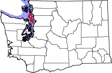 | |
| Town | ||
| CDPs | ||
| Other unincorporated communities | ||