California State Route 186
| ||||
|---|---|---|---|---|
| Algodones Road | ||||
|
SR 186 highlighted in red | ||||
| Route information | ||||
| Defined by Streets and Highways Code § 486 | ||||
| Maintained by Caltrans | ||||
| Length: | 2.070 mi[1] (3.331 km) | |||
| Existed: | 1972[2] – present | |||
| Major junctions | ||||
| South end: | Mexican border near Algodones | |||
| North end: |
| |||
| Location | ||||
| Counties: | Imperial | |||
| Highway system | ||||
| ||||


State Route 186 (SR 186) is a route that connects Interstate 8 (I-8) with the U.S.–Mexico border near the Colorado River. Its southern terminus is near Los Algodones, Baja California, and its northern terminus is near Winterhaven, California in the location of Araz Junction. The route is only 2.070 miles (3.331 km) long, heading along the length of the Alamo Canal and the All-American Canal within the boundaries of the Fort Yuma-Quechan Reservation. The route was assigned in 1972 in Imperial County, and the interchange with I-8 was constructed a year later.
Route description
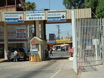
SR 186 begins at the United States–Mexico border (near Avenue International) in the community of Los Algodones. The route heads to the northeast along the Alamo Canal and crosses the center of the Fort Yuma-Quechan Reservation. Most of the surroundings of SR 186 are desolate, compared to the developed region across the border in Mexico. The highway continues northward, crossing the All-American Canal, where it turns to the north. SR 186 continues northward to an interchange with I-8 in Araz Junction, where the route terminates at the northbound ramps. The route continues northward as locally maintained Araz Road.[3] Near the interchange is a casino operated by the Quechan Native American tribe that opened in 2009.[4]
SR 186 is not part of the National Highway System,[5] a network of highways that are essential to the country's economy, defense, and mobility.[6] In 2013, SR 186 had an annual average daily traffic (AADT) of 3,700 at the southern end, and 8,100 at the junction with I-8, the latter of which was the highest AADT for the highway.[7]
History
A road south from the Ocean-to-Ocean Highway to the Mexican border just west of the Colorado River existed by 1917,[8] and was paved between 1956 and 1965.[9][10] The Andrade Port of Entry at the southern end of the highway was built in 1970.[4] The current alignment of SR 186 was assigned in 1972 by the California State Legislature.[2]
There are two bridges along the alignment of SR 186. The first one to be constructed was a concrete slab bridge over the All-American Canal, with the structure opening in 1938. The bridge is 140.09 feet (42.70 m) long, and is considered unable to sustain the traffic it was designed to handle.[11] The second bridge is located at the interchange with I-8 in Araz Junction. This bridge, constructed in 1973 (a year after the route was assigned), is a 227.03-foot-long (69.20 m) concrete box beam structure. This structure, unlike the other, is recorded to be in usable shape.[12]
Major intersections
The entire route is in Imperial County.
| Location | mi [1][7][13] | km | Destinations | Notes | |
|---|---|---|---|---|---|
| | 0.00 | 0.00 | Andrade Port of Entry | South end of SR 186; continues beyond the Mexican border as Calle 2 | |
| Araz Junction | 2.07 | 3.33 | North end of SR 186; exit 166 on I-8; continues east as Araz Road | ||
| 1.000 mi = 1.609 km; 1.000 km = 0.621 mi | |||||
See also
 California Roads portal
References
- 1 2 California Department of Transportation. "State Truck Route List". Sacramento: California Department of Transportation. Archived from the original (XLS file) on June 30, 2015. Retrieved June 30, 2015.
- 1 2 California State Assembly. "An act to amend Sections 263.3, 263.8, and 415 of, and to add Section 486 to, the Streets and Highways Code, relating to state highways". 1972 Session of the Legislature. Statutes of California. State of California. Ch. 742.
- ↑ Google (June 10, 2015). "Overview map of California State Route 186" (Map). Google Maps. Google. Retrieved June 10, 2015.
- 1 2 Staff (August 2010). "State-Route 186 Transportation Concept Summary" (PDF). Caltrans. p. 1. Retrieved June 21, 2014.
- ↑ Federal Highway Administration (March 25, 2015). National Highway System: California (South) (PDF) (Map). Scale not given. Washington, DC: Federal Highway Administration. Retrieved May 25, 2015.
- ↑ Natzke, Stefan; Neathery, Mike & Adderly, Kevin (June 20, 2012). "What is the National Highway System?". National Highway System. Washington, DC: Federal Highway Administration. Retrieved July 1, 2012.
- 1 2 California Department of Transportation (2013). "All Traffic Volumes on CSHS". Sacramento: California Department of Transportation.
- ↑ California (Map). American Automobile Association. 1917. Retrieved June 21, 2014.
- ↑ California (Map). Shell Oil Company. 1956.
- ↑ California (Map). Shell Oil Company. 1965.
- ↑ Federal Highway Administration (2012). "NBI Structure Number: 580320". National Bridge Inventory. Federal Highway Administration.
- ↑ Federal Highway Administration (2012). "NBI Structure Number: 580305". National Bridge Inventory. Federal Highway Administration.
- ↑ California Department of Transportation (July 2007). "Log of Bridges on State Highways". Sacramento: California Department of Transportation.