Los Algodones
| Los Algodones | |
|---|---|
|
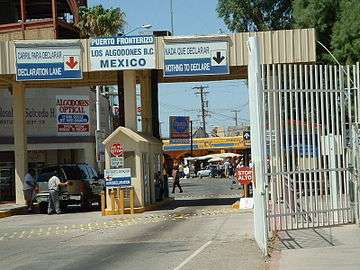
Border crossing into Los Algodones from Andrade, California | |
|
Los Algodones Location in Mexico | |
| Coordinates: 32°42′55″N 114°43′44″W / 32.71528°N 114.72889°W | |
| Country |
|
| State | Baja California |
| Municipality | Municipality of Mexicali |
| Elevation | 108 ft (33 m) |
| Population (2010) | |
| • Total | 5,474 |
Los Algodones, Baja California, is a small Mexican town located on the extreme northeastern tip of the municipality of Mexicali, approximately 16 km (9.9 mi) west of Yuma, Arizona, USA. Its official name is Vicente Guerrero, although most people use Algodones or Molar City when referring to it. It reported a population of 5,474 as of the 2010 Mexican census. It also serves as a borough seat of its surrounding area.
Los Algodones is the northernmost town in Mexico, and at its northeastern tip is the northernmost point in Mexico, and in Latin America. Another interesting geographical distinction is that if someone were to travel in any of the four cardinal directions from anywhere in Algodones (due north, due east, due south, or due west), they would cross a U.S. border.
Situated near the borders of both southeastern California and southwestern Arizona, Los Algodones has become a popular tourist attraction in recent years due in part to inexpensive shopping and restaurants as well as inexpensive medical care and prescription medicines. The warm, dry climate of the area attracts a number of older tourists from across the United States and Canada who settle during the winter in the nearby towns of Yuma, Arizona and Winterhaven, California. Organized day trips from the Coachella Valley are popular among seniors as well.
From the U.S. side, Los Algodones is most easily reached via Interstate 8 and south a short distance (3.33 Km / 2.07 mi) along State Route 186/Andrade Road to the international border at Andrade, California. From Andrade, visitors can elect to park their vehicles for a small fee (overnight parking US $16) and walk across the border, or they can drive across.
The popularity of both inexpensive prescriptions and medical care catering to Canadian and U.S. senior citizens has prompted a virtual explosion of pharmacies, opticians and dental offices since the 1980s.[1][2] They have largely displaced many of the open-air shops and restaurants immediately across the border, and have effectively shifted the town's focus from tourism to medicine. Nevertheless, a number of shops and restaurants remain, and Los Algodones capitalizes on the tourist trade with frequent fiestas throughout the year, most notably around the Christmas season.
The exact geographical location is 32°42′55″N 114°43′44″W / 32.71528°N 114.72889°W at an elevation of 110 feet/33.5 m above mean sea level.
The Spanish-language name Los Algodones translates into English as "the cotton plants". The origin of the name is unknown.[3]
Transportation
Transportes Miguel Siga, a private bus company, provides service between Mexicali and Los Algodones.[4] Yuma County Area Transit provides service from Andrade to Yuma.
Climate
| Climate data for Los Algodones (Presa Morelos) 1951–2010 | |||||||||||||
|---|---|---|---|---|---|---|---|---|---|---|---|---|---|
| Month | Jan | Feb | Mar | Apr | May | Jun | Jul | Aug | Sep | Oct | Nov | Dec | Year |
| Record high °C (°F) | 31.0 (87.8) |
34.0 (93.2) |
45.0 (113) |
48.0 (118.4) |
47.0 (116.6) |
49.0 (120.2) |
50.0 (122) |
48.0 (118.4) |
48.0 (118.4) |
45.0 (113) |
43.5 (110.3) |
32.0 (89.6) |
50.0 (122) |
| Average high °C (°F) | 20.3 (68.5) |
22.9 (73.2) |
26.2 (79.2) |
29.7 (85.5) |
34.8 (94.6) |
39.0 (102.2) |
41.4 (106.5) |
41.0 (105.8) |
38.1 (100.6) |
32.5 (90.5) |
25.4 (77.7) |
20.3 (68.5) |
31.0 (87.8) |
| Daily mean °C (°F) | 13.1 (55.6) |
15.0 (59) |
17.8 (64) |
20.9 (69.6) |
25.6 (78.1) |
29.7 (85.5) |
33.1 (91.6) |
32.9 (91.2) |
29.8 (85.6) |
23.8 (74.8) |
17.4 (63.3) |
13.0 (55.4) |
22.7 (72.9) |
| Average low °C (°F) | 5.8 (42.4) |
7.1 (44.8) |
9.4 (48.9) |
12.2 (54) |
16.4 (61.5) |
20.3 (68.5) |
24.8 (76.6) |
24.9 (76.8) |
21.5 (70.7) |
15.1 (59.2) |
9.4 (48.9) |
5.8 (42.4) |
14.4 (57.9) |
| Record low °C (°F) | −4.0 (24.8) |
−1.0 (30.2) |
0.1 (32.2) |
2.0 (35.6) |
7.0 (44.6) |
11.0 (51.8) |
13.0 (55.4) |
17.0 (62.6) |
2.0 (35.6) |
1.0 (33.8) |
0.0 (32) |
−5.0 (23) |
−5.0 (23) |
| Average precipitation mm (inches) | 8.7 (0.343) |
6.0 (0.236) |
4.7 (0.185) |
2.0 (0.079) |
0.5 (0.02) |
0.3 (0.012) |
3.3 (0.13) |
8.9 (0.35) |
5.5 (0.217) |
5.7 (0.224) |
4.9 (0.193) |
12.3 (0.484) |
62.8 (2.472) |
| Average precipitation days (≥ 0.1 mm) | 2.0 | 1.5 | 1.2 | 0.4 | 0.2 | 0.1 | 0.7 | 1.1 | 0.8 | 0.9 | 0.9 | 2.5 | 12.3 |
| Source: Servicio Meteorologico Nacional[5][6] | |||||||||||||
References
| Wikivoyage has a travel guide for Los Algodones. |
- Link to tables of population data from Census of 2010 INEGI: Instituto Nacional de Estadística, Geografía e Informática
Algodones Mexico Official Website
- ↑ Robbins, Ted. "A Reason To Smile: Mexican Town Is A Destination For Dental Tourism". NPR. National Public Radio. Retrieved 29 December 2015.
- ↑ Judkins, Gabriel (2007-06). "Persistence of the U. S.--Mexico Border: Expansion of Medical-Tourism amid Trade Liberalization". Journal of Latin American Geography. 6 (2): 11–32. ISSN 1545-2476. Check date values in:
|date=(help) - ↑ Gyek, Juana M. (2006-08-14). "Mystery surrounds origin of town's name". The Sun.
- ↑ Autobuses nuevos cubren la ruta desde el poblado Algodones a la zona
- ↑ "Estado de Baja California-Estacion: Presa Morelos". Normales Climatologicas 1951–2010 (in Spanish). Servicio Meteorologico Nacional. Retrieved 8 May 2015.
- ↑ "Extreme Temperatures and Precipitation for Presa Morelos (SMN) 1961–2010" (in Spanish). Servicio Meteorológico Nacional. Retrieved 8 May 2015.