Bulla, Victoria
| Bulla Victoria | |||||||||||||
|---|---|---|---|---|---|---|---|---|---|---|---|---|---|
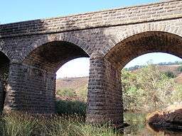
 View of Bulla and the Deep Creek valley | |||||||||||||
 Bulla | |||||||||||||
| Coordinates | 37°38′13″S 144°48′11″E / 37.63694°S 144.80306°ECoordinates: 37°38′13″S 144°48′11″E / 37.63694°S 144.80306°E | ||||||||||||
| Population | 651 (2011 census)[1] | ||||||||||||
| Established | 1850s | ||||||||||||
| Postcode(s) | 3428 | ||||||||||||
| Elevation | 129 m (423 ft) | ||||||||||||
| Location |
| ||||||||||||
| LGA(s) | City of Hume | ||||||||||||
| State electorate(s) | Sunbury | ||||||||||||
| Federal Division(s) | McEwen | ||||||||||||
| |||||||||||||
Bulla is a locality and township of Melbourne, Victoria, Australia, 29 kilometres (18 mi) north-west from Melbourne's central business district. Its local government area is the City of Hume. At the 2011 Census, Bulla had a population of 651, and is adjacent to the Melbourne metropolitan area.
Deep Creek, a tributary of the Maribyrnong River, flows through the township.
History
The word Bulla is of indigenous Australian origins meaning 'two'.[2] It was first settled by William "Tulip" Wright, the former chief constable of Melbourne in 1843. In 1851 the village was surveyed. A flour mill, brickworks and pottery works were built to exploit local kaolinite reserves, and facilities were quickly erected to serve the local population, including several churches (two of which are now listed by the National Trust), a school, general store, and from 1862, council offices.
Bulla Post Office opened on 1 March 1851 but was known as Bulla Bulla until 1854.[3]
At the time it was the largest town in the region, but competition from Sunbury limited the growth of the town. In 1956, the Bulla Shire Council (now part of the City of Hume following amalgamation in 1994) moved to Sunbury, and in 1996, the Kennett Liberal government closed the primary school.
In 1910, the Bulla Cream Company took up dairy farming in the area, transporting the cream by horse and cart to their processing facility at Moonee Ponds in suburban Melbourne.
Present day
The town centre of Bulla contains a large reserve which includes a sports centre, tennis club and community centre. This reserve is home to the Tullamarine Live Steam Society, who maintain a miniature railway which is open to the public on the first and third Sunday afternoon of each month, with a monthly market on the third Sunday between 9am and 3pm with train rides all day. It also contains hotel-motel accommodation and a country fire station.[4]
The ABS reported in 2001 that 12% of the town's residents are of Italian descent. A Calabria Club is located on Uniting Lane.
Next to the former Shire's bluestone hall in the main street of Bulla is the Alister Clark Memorial Rose Garden. Alister Clark, who was the Shire's president several times and whose house 'Glenara' lies on Deep Creek in the old Shire of Bulla, was the most prolific and best known of Australian rose breeders.[5] The garden, created and maintained by local volunteers, has a nearly complete collection of his surviving roses.[6]
Transport
Bus route 479 connects both suburban Melbourne and Sunbury Railway station.[7]
See also
- Shire of Bulla - A former local government area
- List of reduplicated Australian place names
References
- ↑ Australian Bureau of Statistics (31 October 2012). "Bulla (State Suburb)". 2011 Census QuickStats. Retrieved 2011-06-21.
- ↑ Reed, A. W. (1973). Place Names of Australia (1984 reprint first ed.). Frenchs Forest: Reed Books Pty Limited. p. 47. ISBN 0-589-50128-3.
- ↑ "Post Office List", Premier Postal History, eAgecy Vietnam, retrieved 11 April 2008
- ↑ Map 177, Melway street directory (28th ed., 2001)
- ↑ TR Garnett, Man of Roses: Alister Clark of Glenara, Kangaroo Press, 1990. ISBN 0-86417-332-6.
- ↑ The Alister Clark Memorial Rose Garden Archived 11 July 2010 at the Wayback Machine.
- ↑ Tullamarine Bus Lines website, accessed 23 November 2006
External links
| Wikimedia Commons has media related to Bulla, Victoria. |