Bloomdale, Ohio
| Bloomdale, Ohio | |
|---|---|
| Village | |
|
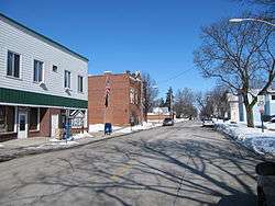
Main Street in downtown Bloomdale, Ohio, showing the local post office. | |
 Location of Bloomdale, Ohio | |
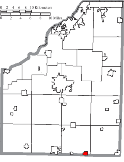 Location of Bloomdale in Wood County | |
| Coordinates: 41°10′18″N 83°33′19″W / 41.17167°N 83.55528°WCoordinates: 41°10′18″N 83°33′19″W / 41.17167°N 83.55528°W | |
| Country | United States |
| State | Ohio |
| County | Wood |
| Township | Bloom |
| Government | |
| • Mayor | Gary Allan Schafer |
| Area[1] | |
| • Total | 0.67 sq mi (1.74 km2) |
| • Land | 0.67 sq mi (1.74 km2) |
| • Water | 0 sq mi (0 km2) |
| Elevation[2] | 748 ft (228 m) |
| Population (2010)[3] | |
| • Total | 678 |
| • Estimate (2012[4]) | 681 |
| • Density | 1,011.9/sq mi (390.7/km2) |
| Time zone | Eastern (EST) (UTC-5) |
| • Summer (DST) | EDT (UTC-4) |
| ZIP code | 44817 |
| Area code(s) | 419 Exchange: 454 |
| FIPS code | 39-07062[5] |
| GNIS feature ID | 1064450[2] |
Bloomdale is a village in Wood County, Ohio, United States. The population was 678 at the 2010 census.
History
Bloomdale had its start when the Baltimore and Ohio Railroad was extended to that point.[6] The village was platted in 1852, and given its commendatory name.[7] A post office called Bloomdale has been in operation since 1874.[8] Bloomdale was incorporated in 1887.[9]
Geography
According to the United States Census Bureau, the village has a total area of 0.67 square miles (1.74 km2), all land.[1]
Demographics
| Historical population | |||
|---|---|---|---|
| Census | Pop. | %± | |
| 1880 | 130 | — | |
| 1890 | 419 | 222.3% | |
| 1900 | 740 | 76.6% | |
| 1910 | 602 | −18.6% | |
| 1920 | 509 | −15.4% | |
| 1930 | 578 | 13.6% | |
| 1940 | 575 | −0.5% | |
| 1950 | 592 | 3.0% | |
| 1960 | 669 | 13.0% | |
| 1970 | 727 | 8.7% | |
| 1980 | 744 | 2.3% | |
| 1990 | 632 | −15.1% | |
| 2000 | 724 | 14.6% | |
| 2010 | 678 | −6.4% | |
| Est. 2015 | 692 | [10] | 2.1% |
2010 census
As of the census[3] of 2010, there were 678 people, 244 households, and 197 families residing in the village. The population density was 1,011.9 inhabitants per square mile (390.7/km2). There were 270 housing units at an average density of 403.0 per square mile (155.6/km2). The racial makeup of the village was 98.1% White, 0.3% Asian, 0.3% from other races, and 1.3% from two or more races. Hispanic or Latino of any race were 2.7% of the population.
There were 244 households of which 43.0% had children under the age of 18 living with them, 66.0% were married couples living together, 9.8% had a female householder with no husband present, 4.9% had a male householder with no wife present, and 19.3% were non-families. 14.8% of all households were made up of individuals and 3.7% had someone living alone who was 65 years of age or older. The average household size was 2.78 and the average family size was 3.06.
The median age in the village was 36.4 years. 28.2% of residents were under the age of 18; 7.3% were between the ages of 18 and 24; 26.6% were from 25 to 44; 26.3% were from 45 to 64; and 11.7% were 65 years of age or older. The gender makeup of the village was 51.8% male and 48.2% female.
2000 census
As of the census[5] of 2000, there were 724 people, 256 households, and 201 families residing in the village. The population density was 1,082.6 people per square mile (417.2/km²). There were 267 housing units at an average density of 399.3 per square mile (153.9/km²). The racial makeup of the village was 97.93% White, 0.28% Native American, 0.41% Asian, 0.55% from other races, and 0.83% from two or more races. Hispanic or Latino of any race were 1.66% of the population.

There were 256 households out of which 41.4% had children under the age of 18 living with them, 64.1% were married couples living together, 11.3% had a female householder with no husband present, and 21.1% were non-families. 18.0% of all households were made up of individuals and 9.0% had someone living alone who was 65 years of age or older. The average household size was 2.83 and the average family size was 3.23.
In the village the population was spread out with 30.7% under the age of 18, 9.7% from 18 to 24, 33.0% from 25 to 44, 18.6% from 45 to 64, and 8.0% who were 65 years of age or older. The median age was 32 years. For every 100 females there were 100.0 males. For every 100 females age 18 and over, there were 96.9 males.
The median income for a household in the village was $41,053, and the median income for a family was $45,625. Males had a median income of $32,411 versus $24,792 for females. The per capita income for the village was $16,342. About 2.5% of families and 3.7% of the population were below the poverty line, including 5.4% of those under age 18 and none of those age 65 or over.
Notable people
- Chris Hoiles, MLB Baltimore Orioles
- Gus Wasson, NASCAR driver
References
- 1 2 "US Gazetteer files 2010". United States Census Bureau. Archived from the original on 2012-01-24. Retrieved 2013-01-06.
- 1 2 "US Board on Geographic Names". United States Geological Survey. 2007-10-25. Retrieved 2008-01-31.
- 1 2 "American FactFinder". United States Census Bureau. Retrieved 2013-01-06.
- ↑ "Population Estimates". United States Census Bureau. Archived from the original on 2013-06-17. Retrieved 2013-06-17.
- 1 2 "American FactFinder". United States Census Bureau. Archived from the original on 2013-09-11. Retrieved 2008-01-31.
- ↑ Leeson, Michael A. (1897). Commemorative Historical and Biographical Record of Wood County, Ohio: Its Past and Present, Early Settlement and Development. J.H. Beers & Company. p. 238.
- ↑ Overman, William Daniel (1958). Ohio Town Names. Akron, OH: Atlantic Press. p. 15.
- ↑ "Wood County". Jim Forte Postal History. Archived from the original on 29 January 2016. Retrieved 11 January 2016.
- ↑ "Cities, Townships, & Villages". Wood County Government. Archived from the original on June 6, 2015. Retrieved 11 January 2016.
- ↑ "Annual Estimates of the Resident Population for Incorporated Places: April 1, 2010 to July 1, 2015". Retrieved July 2, 2016.
- ↑ "Census of Population and Housing". Census.gov. Archived from the original on May 11, 2015. Retrieved June 4, 2015.
External links
Municipalities and communities of Wood County, Ohio, United States | ||
|---|---|---|
| Cities |  | |
| Villages | ||
| Townships | ||
| CDPs | ||
| Other unincorporated communities | ||
| Footnotes | ‡This populated place also has portions in an adjacent county or counties | |