Bleaklow
| Bleaklow Head | |
|---|---|
 | |
| Highest point | |
| Elevation | 633 m (2,077 ft) [1] |
| Prominence | 128 m[1] |
| Parent peak | Kinder Scout |
| Listing | Hewitt, Nuttall, HuMP |
| Coordinates | 53°27′36″N 1°51′45″W / 53.4600°N 1.8626°WCoordinates: 53°27′36″N 1°51′45″W / 53.4600°N 1.8626°W |
| Geography | |
| Location | Derbyshire, England, UK |
| Parent range | Peak District |
| OS grid | SK094960 |
| Topo map | OS Landranger 110 |
| Listed summits of Bleaklow | ||||
| Name | Grid ref | Height | Status | |
|---|---|---|---|---|
| Higher Shelf Stones | SK089948 | 621 m | Nuttall | |
| Bleaklow Stones | SK116964 | 628 m | ||
Bleaklow is a high, largely peat-covered, gritstone moorland, just north of Kinder Scout, across the Snake Pass (A57), in the Derbyshire High Peak near the town of Glossop. Much of it is nearly 2,000 feet (610 m) above sea level and the shallow bowl of Swains Greave on its eastern side is the source of the River Derwent.
Bleaklow Head (633 m), marked by a huge cairn of stones, is the high point at the western side of the moor, is a Hewitt and is crossed by the Pennine Way. It is one of three summits on this plateau above 2,000 feet, the others being Bleaklow Stones, some 1.9 miles (3 km) to the east along an indefinite ridge, and Higher Shelf Stones, 0.9 miles (1.5 km) south of Bleaklow Head. At 633 metres (2,077 feet), Bleaklow is the second-highest point in Derbyshire and the area includes the most easterly point in the British Isles over 2,000 feet, near Bleaklow Stones.
Description
Much of the main plateau of Bleaklow is a boggy peat moorland, seamed by 'groughs' (pronounced 'gruffs', water-eroded channels in the peat), and lacking strong changes in elevation – in poor conditions its traverse is probably the most navigationally challenging in the Peak District. [2]
Conservation
Bleaklow is part of the National Trust's High Peak Estate. There has been considerable investment of resources in recent years to block many of the eroded peat gulleys as part of major schemes to re-wet and restore healthy Sphagnum moss communities which are essential for peat formation, carbon-capture, and reduction in dissolved carbon which contaminates water supplies. Much of this work has been coordinated by the Moors for the Future project, funded by EU LIFE+ programme between 2010-2015. This involved laying 52 kilometres of geotextiles to stabilise eroded peat, creating 4,000 mini dams to retain water, introducing 150,000 moorland plants and spreading 807 million Sphagnum fragments across the whole Bleaklow Project site.[3]
Views
The summit affords views across Manchester, Lancashire and Cheshire to the west and towards the Hope Valley, Holme Moss, Emley Moor and Yorkshire to the east. In exceptional weather conditions it is possible to see Snowdonia in North Wales.
Aircraft crash
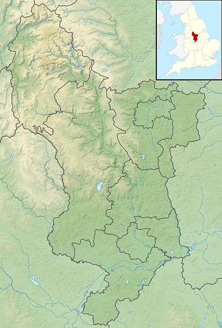
On 3 November 1948, USAF Boeing RB-29A Superfortress 44-61999, of the 16th Photographic Reconnaissance Squadron, 91st Reconnaissance Group, 311th Air Division, Strategic Air Command; crashed at Higher Shelf Stones, Bleaklow, whilst en route from Scampton to Burtonwood. All 13 crew members were killed. A large amount of wreckage is still visible, as a memorial to the crash. Also, a proper memorial was erected at the site in 1988. There is public access to the area.
Gallery
 Engine wreckage on Shelfstones |
 General view of the aircraft wreckage |
 Memorial plaque by the wreckage |
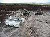
 Trig point on Shelf Stones |
 Descending eroded peat gully on east flank of Bleaklow. |
References
- 1 2 Bleaklow Head at www.hill-bagging.co.uk. Retrieved 11 March 2016
- ↑ Pilton, Barry (1986). One Man and his Bog. Corgi Books. p. 26. ISBN 0-552-12796-5.
- ↑ "Moors for the Future - MoorLIFE Project Sites - Bleaklow". Retrieved 17 August 2015.
External links
| Wikimedia Commons has media related to Bleaklow. |
- Peak District Information- Bleaklow
- Computer-generated summit panorama Bleaklow index
- Photographs and grid reference of RB-29 wreck site and other crash sites on Bleaklow aircrashsites.co.uk.
- PeakDistrictAirCrashes.co.uk. Resources about the B-29 wreck and other air accidents in this region.
