Snake Pass
| Snake Pass | |
|---|---|
|
Approaching the summit from the Snake Pass Inn | |
| Elevation | 1,680 feet (510 m) |
| Traversed by | A57 |
| Location | High Peak Estate, Peak District, Derbyshire, England |
| Range | Pennines |
| Coordinates | 53°25′58″N 1°52′08″W / 53.4329°N 1.8689°WCoordinates: 53°25′58″N 1°52′08″W / 53.4329°N 1.8689°W |
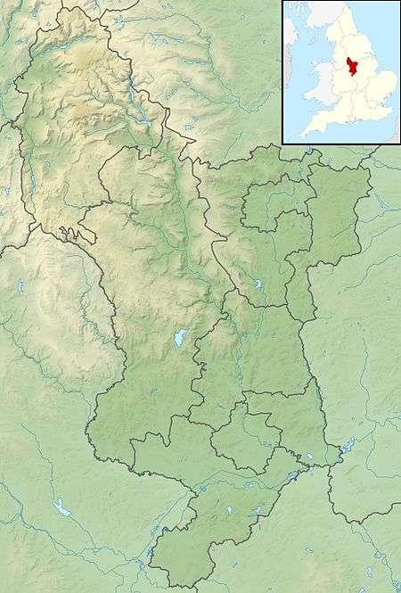 Location within the Peak District in Derbyshire | |

Snake Pass is a hill pass in the Derbyshire section of the Peak District, crossing the Pennines between Glossop and the Ladybower Reservoir at Ashopton. The road was engineered by Thomas Telford and opened in 1821. The pass carries the A57 road between Manchester and Sheffield, but it is no longer the main signposted route between those two cities.
Like several other roads that cross the Pennines, Snake Pass has a poor accident record compared with roads in the UK generally, although more favourable compared with other roads in the area. It is regularly closed in winter because of snow, and has seen several longer-term closures owing to subsidence following heavy rain. The road remains a popular route for tourists and motorcycles, however, and sections have been used for semi-professional cycling races such as the Tour of Britain.
Route and location

Snake Pass runs through the National Trust's High Peak Estate, and lies within the High Peak borough of Derbyshire; much of it falls within the Hope Woodlands parish, the remainder being within the Charlesworth parish.[1][2] It is part of the shortest route by road from Manchester to Sheffield.[3]
The pass starts east of Glossop and climbs to the Pennines watershed between the moorland plateaux of Kinder Scout and Bleaklow to a high point of 1,680 feet (510 m) above sea level, where it crosses the Pennine Way. After this, it passes a public house that used to be known as the Snake Inn, and descends through forest to the Ladybower Reservoir at Ashopton.[1]
The name of the road matches its winding route, but actually derives from the emblem of the Snake Inn, one of the few buildings on the high stretch of road. In turn, the pub's name and sign were derived from the serpent on the Cavendish arms of William Cavendish, 6th Duke of Devonshire.[4] In the early 21st century, the inn was renamed the Snake Pass Inn, such that the inn now refers to the road that referred to itself.[4][5]
History

The first road between Glossop and Ashopton was the Doctor's Gate, a Roman Road that follows the Shelf Brook between Shelf Moor and Coldharbour Moor, a route popular today with walkers and mountain bikers.[6] In 1932, an Iron Age axe thought to be more than 2,000 years old was found near the site of this road.[7]
The current road further south was designed as a toll road by Thomas Telford to improve communications east of Glossop, which was expanding as an industrial town.[8] It was originally called the Sheffield to Glossop Turnpike and run by a turnpike trust, the Sheffield and Glossop Trust. An act of parliament to build the road was passed in 1818, and construction was financed by the Duke of Norfolk and the Duke of Devonshire.[9] The road opened in 1821,[10] having cost £18,625 to build.[9] Upon opening, it was the highest turnpike road in England.[11] The road was immediately popular and increased toll collections of traffic heading to Glossop.[12] Tolls were abolished on the road in June 1870.[13]
The eastern end of the pass is by the River Derwent. The river is bridged by the Ashopton Viaduct, built as part of the Ladybower Reservoir project between 1935 and 1945.[14]
Although Snake Pass is still the shortest route between Manchester and Sheffield, the more northerly Woodhead Pass, which is less steep and at a lower altitude, is now the primary road link between the two cities. Unlike Snake Pass, the Woodhead route is a trunk road. Traffic levels on both passes remained similar until the 1980s,[15] but the Woodhead Pass route is now favoured as it connects directly to the M1, while Snake Pass leads into the centre of Sheffield. Despite Sheffield and Manchester being among the largest UK cities by population,[16] there is no direct motorway link between the two. A Manchester to Sheffield motorway was first proposed in 1966,[17] and a small section bypassing Denton and Hyde has been built, now the M67.[18] The Woodhead Tunnel was closed in 1981 in anticipation of a road replacement, but linking the cities would have meant constructing many costly tunnels and viaducts across the Peak District. Consequently, the plans were shelved, but reports in December 2014 announced a revival of the scheme.[19]
The road remains popular with drivers. In 2008, a survey by Caterham Cars rated Snake Pass the best driving road in the UK.[20] The following year, it was listed as one of the best roads for driving in Britain by Auto Trader magazine, who described it as "offering unparalleled views over Manchester".[21]
Safety
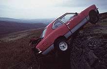
As would be expected for a road crossing the Pennines, Snake Pass has several dangerous bends and blind summits.[5] Like many roads in the North of England passing through similar terrain, Snake Pass has a poor safety record in comparison to other roads in the United Kingdom. But it is not as dangerous as other roads bisecting hilly terrain in this part of England; it was not among the top 10 in a list of the most dangerous roads published in July 2010, despite nine of the top ten being in Northern England.[22]
In 2012 Derbyshire Police announced a campaign to monitor motorcyclists using the pass, who are particularly at risk of being involved in a fatal accident.[23]
Weather

In winter the road is often the first of the routes between Sheffield and Manchester to be closed following snow in the area.[24] In bad storms the entire road over the summit, including marker poles, has been buried in snow.[11] In the winter months the road becomes icy, but gritting is not a priority as the A57 is only a "secondary" road at this point.[25] Local councils prefer to treat streets in towns that are more likely to be used, as they believe that roads such as Snake Pass will be closed anyway.[26]
In 1924 Derbyshire County Council spent £2,000 installing underground telegraph wire cables beneath the road, as the above-ground installations were continually broken and disrupted following snowstorms.[11] The British winter of 2010–11 was the coldest for decades and the road was closed on numerous occasions.[27][28]
Snake Pass has also been closed for longer periods owing to subsidence in the local area following rain. In January 1932 the road was closed after 200 tonnes of debris fell on it during a heavy rainstorm, covering the surface in as much as 4 feet (1.2 m) in places.[29] In January 2008 a landslip at Cowms Moor following heavy rain caused the road to be closed to all traffic between Ladybower and Glossop, although access was still available to local premises and businesses including the Snake Pass Inn.[30][31] A subsequent investigation by the British Geographical Survey showed the road has had a history of subsidence-related long-term closures dating back to the 1930s, including a 1970s project that attempted to strengthen the layer below the tarmac with local rock fill. The road reopened in February, but with temporary traffic lights at the point of the slip restricting traffic to one direction at a time.[31] In 2012 the road had to be closed several times for resurfacing and strengthening.[32]
Cycling
Snake Pass is a popular route for cyclists. A 1902 report on leisure cycling in the Lancashire Evening Post described the eastward journey from the summit to Ashopton as "nine miles unbroken freewheeling" and the scenery as "magnificent".[33] The road is one of only a few road climbs in the UK that are comparable in length and average gradient (approximately 7 per cent for around 3.2 miles (5.1 km) when starting in Glossop) to those used in continental cycle racing.[34] The road had been part of an 82-mile "Tour of the Peak" race, involving climbing the pass twice,[35] and has frequently featured in the Tour of Britain along with another nearby favourite, Holme Moss.[34]
Cycling Time Trials sanctioned hill climbs are regularly promoted on this course by local club Glossop Kinder Velo.[36] The record for completing the course was set by Tejvan Pettinger in 2014, at 11 minutes 51 seconds.[37]
Media
Snake Pass has been referred to several times by music groups. The track "The Snake" by Sheffield band the Human League, from their 2001 album Secrets, is about the road.[38] The Squarepusher album Selection Sixteen features a track entitled "Snake Pass", described by Rolling Stone as a "monomaniacal thump".[39]
Comic character John Shuttleworth has performed a song called "Incident on Snake Pass" about the perils of Snake Pass, relating to an accident he claimed to have had, driving a Ford Anglia on the road.[40]
References
- 1 2 The Peak District – Dark Peak Area (Map). 1:25 000. Ordnance Survey. 2010. OL 1.
- ↑ Cox, Barrie (1994). English inn and tavern names. English Place Name Society. p. 36. ISBN 978-0-904-88942-0.
- ↑ Institution of Civil Engineers, ed. (1985). Failures in earthworks: proceedings of the Symposium on Failures in Earthworks. Thomas Telford. p. 29. ISBN 978-0-727-70243-2.
- 1 2 Dillon, Paddy (2011). The Pennine Way. Cicerone Press. p. 40. ISBN 978-1-849-65359-6.
- 1 2 Turner, Kevin (2012). Bonjour – Is This Italy?: A Hapless Biker's Guide to Europe. Veloce Publishing Ltd. p. 18. ISBN 978-1-845-84399-1.
- ↑ The Hidden Places of England. Travel. 2000. p. 478. ISBN 978-1-902-00743-4.
- ↑ "Perfectly Shaped Axe Found near Shopton". Derbyshire Times and Chesterfield Herald. 5 November 1932. Retrieved 27 March 2015 – via British Newspaper Archive. (subscription required (help)).
- ↑ "John Overend Todd Archive: Howard of Glossop Estate". National Archives. Retrieved 26 March 2015.
- 1 2 Albert, William (2007). The Turnpike Road System in England: 1663–1840. Cambridge University Press. p. 105. ISBN 978-0-521-03391-6.
- ↑ "SK 19 SW Parish of Hope Woodlands Snake Road 11/19 (South Side) Milestone II". historicengland.org.uk. Retrieved 27 March 2015.
- 1 2 3 "Town and County Gossip". Derby Daily Telegraph. 1 November 1924. p. 3. Retrieved 27 March 2015 – via British Newspaper Archive. (subscription required (help)).
- ↑ "Turpike Tolls to let". Sheffield Independent. 4 May 1822. p. 3. Retrieved 27 March 2015 – via British Newspaper Archive. (subscription required (help)).
- ↑ "Local Turnpikes Case". Sheffield Independent. 8 May 1883. p. 2. Retrieved 27 March 2015 – via British Newspaper Archive. (subscription required (help)).
- ↑ "Full Description of the Ladybower Reservoir". Derbyshire Times and Chesterfield Herald. 21 September 1945. p. 7 – via British Newspaper Archive. (subscription required (help)).
- ↑ "Woodhead Route". Hansard. 19 March 1984. Retrieved 27 March 2015.
- ↑ Champion, Tony (June 2014). People in cities: the numbers (PDF) (Report). Government Office for Science. p. 53. Retrieved 3 April 2015.
- ↑ Castle, Barbara (1 March 1967). "Sheffield – Manchester motorway". Hansard. Retrieved 4 March 2015.
- ↑ "M67 Hyde By-pass and Denton Relief Road". The Motorway Archive. Retrieved 4 April 2015.
- ↑ "Sheffield to Manchester £6bn road tunnel 'plan' announced". BBC News. 1 December 2014. Retrieved 27 March 2015.
- ↑ "Snake Pass is voted best road". The Star. Sheffield. 16 September 2008. Retrieved 27 March 2015.
- ↑ "England's best driving road – revealed". Auto Trader Magazine. 23 April 2009. Archived from the original on 12 March 2012.
- ↑ "'Most dangerous' roads in Britain named by safety group". BBC News. 1 July 2010. Retrieved 4 July 2011.
- ↑ "Police in bid to reduce Snake Pass road deaths". Manchester Evening News. 5 April 2012. Retrieved 26 March 2015.
- ↑ Nuttall, Anne (1990). Mountains of England and Wales. Cicerone Press Limited. p. 293. ISBN 978-1-852-84037-2.
- ↑ "Snake Pass closed again because of abandoned cars". Sheffield Telegraph. 18 January 2015. Retrieved 27 March 2015.
- ↑ Environment Select Committee Meeting (PDF) (Report). High Peak Borough Council. 16 February 2010. Retrieved 27 March 2015.
- ↑ "Derbyshire hit by road and school closures over snow". BBC News. 2 December 2010. Retrieved 9 July 2011.
The A57 Snake Pass is closed in both directions between the Hurst Road junction in Glossop and the A6013.
- ↑ Carr, Sue (17 December 2010). "Snake Pass closed as snow returns". Manchester Evening News. Retrieved 3 April 2015.
- ↑ "Landslide on the Snake". Derbyshire Times and Chesterfield Herald. 9 January 1932. p. 12 – via British Newspaper Archive. (subscription required (help)).
- ↑ "TRAFFIC ALERT: Landslide closes A57". Sheffield Telegraph. 25 January 2008. Retrieved 26 March 2015.
- 1 2 Walkover survey of a landslide on the A57 (Snake Pass) road at Cowms Moor, Derbyshire in January 2008 (PDF) (Report). British Geographical Survey. 16 May 2008. Retrieved 26 March 2015.
- ↑ "Snake Pass to close for three weekends". Manchester Evening News. 29 October 2012. Retrieved 26 March 2015.
- ↑ "Cycling Notes by Ixion". Lancashire Evening Post. 3 December 1902. p. 4. Retrieved 27 March 2015 – via British Newspaper Archive. (subscription required (help)).
- 1 2 Jones, Tom (2013). Mad Dogs and Englishmen: A Year of Things to See and Do in England. Random House. p. 50. ISBN 978-0-753-54957-5.
- ↑ "Cycling : Despatch from "Clubman"". Lichfield Mercury. 18 June 1943. p. 3. Retrieved 27 March 2015 – via British Newspaper Archive. (subscription required (help)).
- ↑ "Snake Pass hill Climb". Glossop Kinder Velo. Retrieved 27 March 2015.
- ↑ "Tejvan Pettinger wins Glossop Kinder Velo hill-climb". Cycling Weekly. 31 August 2014. Retrieved 27 March 2015.
- ↑ "Taking the High Road from Glossop to Ladybower". Derbyshire Life and Countryside. 21 July 2012. Retrieved 28 March 2015.
- ↑ The New Rolling Stone Album Guide. Simon and Schuster. 2004. p. 773. ISBN 978-0-743-20169-8.
- ↑ "Shuttleworth's on a roll". The Visitor. 20 October 2010. Retrieved 28 March 2015.
External links
| Wikimedia Commons has media related to Snake Pass. |