Beremboke, Victoria
| Beremboke Victoria | |||||||||||||
|---|---|---|---|---|---|---|---|---|---|---|---|---|---|
 Beremboke | |||||||||||||
| Coordinates | 37°47′S 144°15′E / 37.783°S 144.250°ECoordinates: 37°47′S 144°15′E / 37.783°S 144.250°E | ||||||||||||
| Population | 352 (2011 census)[1] | ||||||||||||
| Postcode(s) | 3342 | ||||||||||||
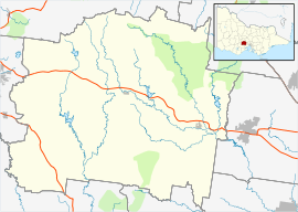
| Location | |||||||||||||
| LGA(s) | Shire of Moorabool | ||||||||||||
| State electorate(s) | Buninyong | ||||||||||||
| Federal Division(s) | Ballarat | ||||||||||||
| |||||||||||||
Beremboke is a locality in western central Victoria, Australia. The locality is centred in the northern Brisbane Ranges and in the Moorabool Shire local government area, 94 kilometres (58 mi) west of the state capital, Melbourne. At the 2011 census, Beremboke had a population of 352.[1]
Beremboke Post Office opened on 1 January 1877 and closed in 1968.[2]
Beremboke Primary School No.1017. 18xx? - 1977, Classified in the Victorian Government Gazette (June 30, 1891) as a 5th class State School.
Teachers: Mary Bennett, listed as teacher appointed Sept 1876 (Vic Govt publications) George William Eastwood. Listed as appointed teacher March 1880, Head Teacher in Vic. Govt. Gazette (1st Jan 1885 & 30 June 1891).
References
- 1 2 Australian Bureau of Statistics (31 October 2012). "Beremboke (State Suburb)". 2011 Census QuickStats. Retrieved 9 December 2014.
- ↑ Premier Postal History, Post Office List, retrieved 2008-04-11
This article is issued from Wikipedia - version of the 3/11/2015. The text is available under the Creative Commons Attribution/Share Alike but additional terms may apply for the media files.