Beit Surik
| Beit Surik | |
|---|---|
| Other transcription(s) | |
| • Arabic | بيت سوريك |
| • Also spelled |
Beit Surik (official) Beit Sourik (unofficial) |
|
View of Beit Surik | |
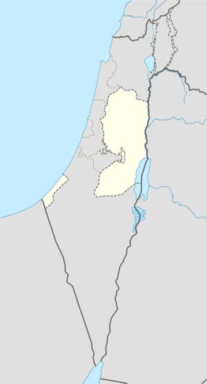 Beit Surik Location of Beit Surik within the Palestinian territories | |
| Coordinates: 31°49′28″N 35°08′55″E / 31.82444°N 35.14861°ECoordinates: 31°49′28″N 35°08′55″E / 31.82444°N 35.14861°E | |
| Palestine grid | 164/136 |
| Governorate | Jerusalem |
| Government | |
| • Type | Village council |
| Population (2006) | |
| • Jurisdiction | 3,818 |
| Name meaning | "The house of Surik"[1] |

Beit Surik (Arabic: بيت سوريك) is a Palestinian village in the Jerusalem Governorate, located 12 kilometers Northwest of Jerusalem in the northern West Bank. According to the Palestinian Central Bureau of Statistics, the town had a population of 3,818 in 2006.[2]
History
Beit Surik is situated on an ancient site on top of a hill. Fragments of Corinthian columns have been found, and a mosaic floor, with dedicatory inscription in Greek and tabula ansata was excavated in part by LH Vincent in 1901.[3]
The village was known as Beit Surie in the Crusader era. It was one of 21 villages given by King Godfrey as a fief to the canons of the Holy Sepulchre.[4][5] The village was also mentioned in Crusader sources in the years 1152[6] and later.[7] By 1169, "Latin" (that is, Christian) settlers seems to have been established there.[8][9] As typical Arab-names also appear in the Crusader sources about Beit Surik, it has been suggested that Crusaders settled in a Muslim village.[10]
Ottoman era
The village was incorporated into the Ottoman Empire in 1517 with all of Palestine, and in 1596 it appeared in the tax registers as being in the located in the Nahiye of Jerusalem in the Sanjak of the Mutasarrifate of Jerusalem. It had a population of 21 households, all Muslim. The inhabitants of the village paid taxes on wheat, barley, olive trees, vineyards, fruit trees, grape syrup, molasse, and goats and/or beehives.[11]
In 1863, the French explorer Victor Guérin noticed there a "beautiful piece of antique wall", with several layers, formed of large stones.[12]
An official Ottoman village list of about 1870 showed that "Bet Surik" had a total of 32 houses and a population of 125, though the population count included only men.[13] In 1883, the Palestine Exploration Fund's Survey of Western Palestine described Beit Surik as a "small stone village on a hill-top. To the east in a flat valley is a spring with lemon and other trees. The place appears to be ancient, having rock-cut tombs near the spring."[14]
British Mandate era
In a census conducted in 1922 by the British Mandate authorities, Bait Suriq had a total population of 352; all Muslims,[15] while in the 1931 census the village had 87 houses and a total population of 432, still all Muslim.[16]
In 1945 the population was 480, all Arabs, while the total land area was 6,879 dunams, according to an official land and population survey.[17] Of this, 581 were allocated for plantations and irrigable land, 1,827 for cereals,[18] while 33 dunams were classified as built-up areas.[19]
1948-1967
On the night of the 19 April 1948 the village was attacked by the Palmach.[20] The attacking force was commanded by Yosef Tabenkin, based in Jerusalem. They were later to become the Harel Brigade of the Israeli army. The village was surrounded by five companies with ambushes being set on the roads to Ramallah, Nabi Samuel and Biddu. A group consisting of armoured cars, a Davidka, reserves and the operation's HQ approached from Jerusalem. The company approaching from Castel encountered a group of around 30 armed men leaving Beit Surik heading east but did not engage them. A short mortar barrage was launched on the village from the east. When one of the ambush groups was fired on they attacked and took the school building. The village was taken soon afterwards with the attackers only encountering sparse rifle fire. Three platoons went through the village clearing enemy positions while a detachment of sappers began demolishing buildings. Some of the brigade then went on to capture Biddu before daybreak.[21]
In the wake of the 1948 Arab–Israeli War, and after the 1949 Armistice Agreements, Beit Surik came under Jordanian rule.
post-1967
After Six-Day War in 1967, Beit Surik has been under Israeli occupation.
Enclave
Beit Surik along with Biddu, Beit Duqqu, Beit 'Anan, Qatanna, al Qubeida, Beit Ijza, Kharayib Umm al Lahimand and at Tira form the "Biddu enclave". The enclave will be linked to Ramallah by underpasses and a road that is fenced on both sides. From the "Biddu enclave" Palestinians will travel along a fenced road that passes under a bypass road to Bir Nabala enclave, then on a second underpass under Bypass Road 443 to Ramallah.[22][23][24][25][26] A week before the International Court of Justice gave its Advisory Opinion, the High Court of Israel gave a ruling on a 40-kilometre strip of the Wall in which it held that, while Israel as the Occupying Power had the right to construct the Wall to ensure security and that substantial sections of the Wall imposed undue hardships on Palestinians and had to be re-routed. From the "The Beit Sourik Case (HCJ 2056/04)" of 30 June 2004 the standards of proportionality between Israeli security and the injury to the Palestinian residents was set by the judgement of the Supreme Court of Israel.[27] The "Barrier" that Israel is presently constructing within the Palestinian territory was held by the International court to be contrary to international law by the International Court of Justice on 9 July 2004. The International Court held that Israel is under an obligation to discontinue building the Wall and to dismantle it forthwith. In its Advisory Opinion, the Court dismissed a number of legal arguments raised by Israel relating to the applicability of humanitarian law and human rights law. In particular the International court held that Israeli settlements were unlawful.[28] The Israeli Government then announced that it will not comply with the Advisory Opinion of the International Court of Justice. The Israeli Government has indicated that it will abide by the ruling of its own High Court in respect of sections of the Wall still to be built but not in respect of completed sections of the Wall. Protesting villagers have said: "The wall of death kills our daily life. It separates us from our villages and farms".[29]
Footnotes
- ↑ Palmer, 1881, p. 287
- ↑ Projected Mid -Year Population for Jerusalem Governorate by Locality 2004- 2006 Archived February 7, 2012, at the Wayback Machine. Palestinian Central Bureau of Statistics.
- ↑ Dauphin, 1998, p. 897
- ↑ Conder and Kitchener, 1883, SWP III, pp. 11, 16
- ↑ de Roziére, 1849, p. 102: Bethsurie; p. 263: Bethsurie; p. 303: "in cujus territorio fundata est villa, quae dicitur Parva Mahumeria"; all cited in Röhricht, 1893, RRH, pp. 16-17, No 74
- ↑ de Roziére, 1849, p. 95, cited in Röhricht, 1893, RRH, p. 70 No. 278
- ↑ Röhricht, 1904, RRH Ad, p. 28 No 458b
- ↑ Roziére, 1849, p. 301-305, cited in Röhricht, 1893, RRH, pp. 123-124, No 469
- ↑ Pringle, 1993, p. 103
- ↑ Ellenblum, 2003, pp. 242-243
- ↑ Hütteroth and Abdulfattah, 1977, p. 119
- ↑ Guérin, 1868, p. 362
- ↑ Socin, 1879, p. 147
- ↑ Conder and Kitchener, 1883, SWP III, p. 16
- ↑ Barron, 1923, Sub-district of Jerusalem, p. 15
- ↑ Mills, 1932, p. 38.
- ↑ Government of Palestine, Department of Statistics. Village Statistics, April, 1945. Quoted in Hadawi, 1970, p. 56
- ↑ Government of Palestine, Department of Statistics. Village Statistics, April, 1945. Quoted in Hadawi, 1970, p. 102
- ↑ Government of Palestine, Department of Statistics. Village Statistics, April, 1945. Quoted in Hadawi, 1970, p. 152
- ↑ Morris, 1987, pp. 112, 158
- ↑ Allon, 1970, pp. 193-195
- ↑ OCHA Archived November 12, 2005, at the Wayback Machine.
- ↑ Humanitarian Events, Monitoring issues Archived November 12, 2005, at the Wayback Machine.
- ↑ Barrier March 2004
- ↑ BADIL Barrier Report Archived December 9, 2008, at the Wayback Machine.
- ↑ Barrier route July 2008
- ↑ Israeli Ministry of Foreign Affairs
- ↑ UN Doc A/59/256 Economic and Social Council; Question of the violation of human rights in the occupied Arab territories, including Palestine
- ↑ UN Doc Chronological Review of Events Relating to the Question of Palestine Monthly Media Monitoring Review March 2005
Bibliography
| Wikimedia Commons has media related to Beit Surik. |
- Allon, Yigal (1970). The Making of Israel's Army. London: Vallentine, Mitchell. ISBN 0-853-03027-8.
- Barron, J. B., ed. (1923). Palestine: Report and General Abstracts of the Census of 1922. Government of Palestine.
- Conder, Claude Reignier; Kitchener, Herbert H. (1883). The Survey of Western Palestine: Memoirs of the Topography, Orography, Hydrography, and Archaeology. 3. London: Committee of the Palestine Exploration Fund.
- Dauphin, Claudine (1998). La Palestine byzantine, Peuplement et Populations. BAR International Series 726 (in French). III : Catalogue. Oxford: Archeopress.
- Ellenblum, Ronnie (2003). Frankish Rural Settlement in the Latin Kingdom of Jerusalem. Cambridge University Press. ISBN 9780521521871.
- Guérin, Victor (1868). Description Géographique Historique et Archéologique de la Palestine (in French). 1: Judee, pt. 1. Paris: L'Imprimerie Nationale.
- Hadawi, Sami (1970). Village Statistics of 1945: A Classification of Land and Area ownership in Palestine. Palestine Liberation Organization Research Center.
- Hütteroth, Wolf-Dieter; Abdulfattah, Kamal (1977). Historical Geography of Palestine, Transjordan and Southern Syria in the Late 16th Century. Erlanger Geographische Arbeiten, Sonderband 5. Erlangen, Germany: Vorstand der Fränkischen Geographischen Gesellschaft. ISBN 3-920405-41-2.
- Mills, E., ed. (1932). Census of Palestine 1931. Population of Villages, Towns and Administrative Areas. Jerusalem: Government of Palestine.
- Morris, Benny (1987). The Birth of the Palestinian refugee problem, 1947-1949. Cambridge University Press. ISBN 0-521-33028-9.
- Palmer, E. H. (1881). The Survey of Western Palestine: Arabic and English Name Lists Collected During the Survey by Lieutenants Conder and Kitchener, R. E. Transliterated and Explained by E.H. Palmer. Committee of the Palestine Exploration Fund.
- Pringle, Denys (1993). The Churches of the Crusader Kingdom of Jerusalem: A-K (excluding Acre and Jerusalem). Cambridge University Press. ISBN 0 521 39036 2.
- Röhricht, Reinhold (1893). (RRH) Regesta regni Hierosolymitani (MXCVII-MCCXCI) (in Latin). Berlin: Libraria Academica Wageriana.
- Röhricht, Reinhold (1904). (RRH Ad) Regesta regni Hierosolymitani Additamentum (in Latin). Berlin: Libraria Academica Wageriana.
- de Roziére, ed. (1849). Cartulaire de l'église du Saint Sépulchre de Jérusalem: publié d'après les manuscrits du Vatican (in Latin and French). Paris: Imprimerie nationale.
- Socin, A. (1879). "Alphabetisches Verzeichniss von Ortschaften des Paschalik Jerusalem". Zeitschrift des Deutschen Palästina-Vereins. 2: 135–163.
External links
- Welcome To Bayt Surik
- Survey of Western Palestine, Map 17: IAA, Wikimedia commons
- The Hackney-Beit Surik Friendship Forum
- A battle of will ... ! Beit Surik, Qattanah & Beddo Villages: An Agricultural Triangle Under Israeli Attack, 27, March, 2004, AIJR
- Israeli Occupying Forces flout High Court Ruling 09, March, 2005, AIJR
- The Segregation Wall seized more lands of Beit Surik Village 21, May, 2005, AIJR
- Israel hits Beit Iksa, Nabi Samuel and Beit Surik with new military order in favor of the Segregation Wall 16, January, 2007, AIJR
