Bir Nabala
| Bir Nabala | |
|---|---|
| Other transcription(s) | |
| • Arabic | بير نبالا |
| • Also spelled | Beer Nabala (official) |
|
Bir Nabala | |
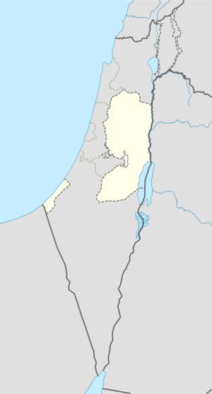 Bir Nabala Location of Bir Nabala within the Palestinian territories | |
| Coordinates: 31°51′06″N 35°12′03″E / 31.85167°N 35.20083°ECoordinates: 31°51′06″N 35°12′03″E / 31.85167°N 35.20083°E | |
| Governorate | Jerusalem |
| Government | |
| • Type | Village council |
| Area | |
| • Jurisdiction | 1,904 dunams (1.9 km2 or 0.7 sq mi) |
| Population (2006) | |
| • Jurisdiction | 6,100 |


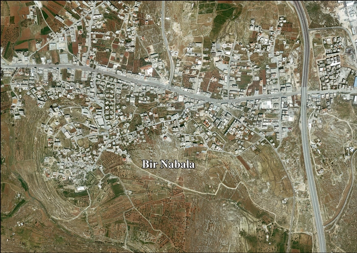
Bir Nabala (Arabic: بير نبالا; Hebrew: ביר נבאלא) is a Palestinian town in the West Bank located eight kilometers northeast of Jerusalem. According to a census conducted in 1931 by the British Mandate authorities, Bir Nabala had a population of 456 inhabitants, in 106 inhabited houses.[1] In mid-year 2006, it had an estimated population of 6,100 residents.[2] Three Bedouin tribes — Abu Dhak, Tel al ‘Adassa[3] and Jahalin — live in Bir Nabala. Bir Nabala has a built-up area of 1,904 dunams, which combined with nearby al-Jib, Beit Hanina al Balad and al-Judeira form an enclave in the Seam Zone, walled in by the Israeli West Bank barrier.[4] The enclave is home to approximately 15,000 Palestinians.[5] It is linked to Ramallah by underpasses and a road that is fenced on both sides. From the Biddu enclave, residents travel along a fenced road that passes under a bypass road to Bir Nabala enclave, then on a second underpass under Bypass Road 443 to Ramallah.[6]
Prior to the construction of the barrier, Bir Nabala was a commercial center linking Jenin and Tulkarm with the Jerusalem area and the town contained about 600 shops and six tyre factories. In 2007, there were 180 shops and two tyre factories.[7]
References
| Wikimedia Commons has media related to Bir Nabala. |
- ↑ Mills, 1932, p. 39
- ↑ Projected Mid -Year Population for Jerusalem Governorate by Locality 2004- 2006 Archived 7 February 2012 at the Wayback Machine. Palestinian Central Bureau of Statistics.
- ↑ .The Town has 4 Major Native families (Al-Hajja, Abdullah, Issa and Zeidan). The bedouin tribes were displaced y the erection of the Israeli wall and the tribes are settled on lands not owned by them. The Bir Nabala / Tel al ‘Adassa Bedouin community Archived 16 March 2014 at the Wayback Machine.. Office for the Coordination of Humanitarian Affairs (OCHA), 19 September 2013
- ↑ Bir Nabala Village: Two Separate Enclaves reunited into one Big Enclave. Applied Research Institute, 14 August 2006
- ↑ Barrier Route
- ↑ OCHA Archived 12 November 2005 at the Wayback Machine.
- ↑ Bir Nabala: A Devastating Blow to the Economy Ma'an Development Center and Bir Nabala Village Council Chairman Haj Tawfik Nabeli. February 2007.
Bibliography
- Barron, J. B., ed. (1923). Palestine: Report and General Abstracts of the Census of 1922. Government of Palestine.
- Clermont-Ganneau, Charles Simon (1896). [ARP] Archaeological Researches in Palestine 1873-1874, translated from the French by J. McFarlane. 2. London: Palestine Exploration Fund. (p. 209)
- Conder, Claude Reignier; Kitchener, Herbert H. (1883). The Survey of Western Palestine: Memoirs of the Topography, Orography, Hydrography, and Archaeology. 3. London: Committee of the Palestine Exploration Fund. (p. 8)
- Department of Statistics (1945). Village Statistics, April, 1945. Government of Palestine.
- Guérin, Victor (1868). Description Géographique Historique et Archéologique de la Palestine (in French). 1: Judee, pt. 1. Paris: L'Imprimerie Nationale. (7 May 1863; p. 393)
- Guérin, Victor (1869). Description Géographique Historique et Archéologique de la Palestine (in French). 1: Judee, pt. 3. Paris: L'Imprimerie Nationale. (p. 5)
- Hadawi, Sami (1970). Village Statistics of 1945: A Classification of Land and Area ownership in Palestine. Palestine Liberation Organization Research Center.
- Hütteroth, Wolf-Dieter; Abdulfattah, Kamal (1977). Historical Geography of Palestine, Transjordan and Southern Syria in the Late 16th Century. Erlanger Geographische Arbeiten, Sonderband 5. Erlangen, Germany: Vorstand der Fränkischen Geographischen Gesellschaft. ISBN 3-920405-41-2. (p. 118)
- Mills, E., ed. (1932). Census of Palestine 1931. Population of Villages, Towns and Administrative Areas (PDF). Jerusalem: Government of Palestine.
- Palmer, E. H. (1881). The Survey of Western Palestine: Arabic and English Name Lists Collected During the Survey by Lieutenants Conder and Kitchener, R. E. Transliterated and Explained by E.H. Palmer. Committee of the Palestine Exploration Fund. (p. 291)
- Pringle, Denys (1997). Secular buildings in the Crusader Kingdom of Jerusalem: an archaeological Gazetter. Cambridge University Press. ISBN 0521 46010 7. (remains of a vault, p. 111)
- Socin, A. (1879). "Alphabetisches Verzeichniss von Ortschaften des Paschalik Jerusalem". Zeitschrift des Deutschen Palästina-Vereins. 2: 135–163. (p. 148)
External links
- Welcome To Bir Nabala
- Survey of Western Palestine, Map 17: IAA, Wikimedia commons
- Bir Nabala Town (Fact Sheet)
- Bir Nabala Town Profile
- Bir Nabala aerial photo
