Beaver Bay, Minnesota
| Beaver Bay, Minnesota | |
|---|---|
| City | |
|
Blue Anchor restaurant in downtown Beaver Bay | |
 Location of the city of Beaver Bay within Lake County, Minnesota | |
| Coordinates: 47°15′29″N 91°18′4″W / 47.25806°N 91.30111°W | |
| Country | United States |
| State | Minnesota |
| County | Lake |
| Area[1] | |
| • Total | 1.26 sq mi (3.26 km2) |
| • Land | 0.73 sq mi (1.89 km2) |
| • Water | 0.53 sq mi (1.37 km2) |
| Elevation | 702 ft (214 m) |
| Population (2010)[2] | |
| • Total | 181 |
| • Estimate (2012[3]) | 177 |
| • Density | 247.9/sq mi (95.7/km2) |
| Time zone | Central (CST) (UTC-6) |
| • Summer (DST) | CDT (UTC-5) |
| ZIP code | 55601 |
| Area code(s) | 218 |
| FIPS code | 27-04456[4] |
| GNIS feature ID | 0655294[5] |
| Website | www.beaverbaymn.com |

Beaver Bay is a city in Lake County, Minnesota, U.S. The population was 181 at the 2010 census.[6]
Minnesota Highway 61 serves as a main route in Beaver Bay.
History
Beaver Bay is the oldest settlement on the North Shore of Lake Superior. It was established in 1856.
The community is also the home of the annual John Beargrease Sled Dog marathon.
Geography
According to the United States Census Bureau, the city has a total area of 1.26 square miles (3.26 km2), of which 0.73 square miles (1.89 km2) is land and 0.53 square miles (1.37 km2) is water.[1]
The Beaver River flows through the community. The river flows into Lake Superior.
Beaver Bay is located 25 miles northeast of the city of Two Harbors.
Demographics
| Historical population | |||
|---|---|---|---|
| Census | Pop. | %± | |
| 1960 | 287 | — | |
| 1970 | 362 | 26.1% | |
| 1980 | 283 | −21.8% | |
| 1990 | 147 | −48.1% | |
| 2000 | 175 | 19.0% | |
| 2010 | 181 | 3.4% | |
| Est. 2015 | 174 | [7] | −3.9% |
2010 census
As of the census[2] of 2010, there were 181 people, 84 households, and 48 families residing in the city. The population density was 247.9 inhabitants per square mile (95.7/km2). There were 187 housing units at an average density of 256.2 per square mile (98.9/km2). The racial makeup of the city was 91.7% White, 1.1% African American, 1.7% Native American, and 5.5% from two or more races.
There were 84 households of which 22.6% had children under the age of 18 living with them, 36.9% were married couples living together, 13.1% had a female householder with no husband present, 7.1% had a male householder with no wife present, and 42.9% were non-families. 38.1% of all households were made up of individuals and 8.3% had someone living alone who was 65 years of age or older. The average household size was 2.15 and the average family size was 2.73.
The median age in the city was 45.8 years. 23.8% of residents were under the age of 18; 8.8% were between the ages of 18 and 24; 16.6% were from 25 to 44; 32% were from 45 to 64; and 18.8% were 65 years of age or older. The gender makeup of the city was 65.7% male and 34.3% female.
2000 census
As of the census of 2000,[4] there were 175 people, 93 households, and 50 families residing in the city. The population density was 360.5 people per square mile (137.9/km²). There were 139 housing units at an average density of 286.3 per square mile (109.5/km²). The racial makeup of the city was 92.57% White, 2.86% African American, 2.29% Native American, 0.57% Asian, and 1.71% from two or more races. Hispanic or Latino of any race were 0.57% of the population. 38.3% were of Norwegian, 11.7% German, 9.2% American, 9.2% Swedish, 5.8% Finnish, 5.0% English, and 5.0% Irish ancestry.
There were 93 households out of which 14.0% had children under the age of 18 living with them, 40.9% were married couples living together, 8.6% had a female householder with no husband present, and 46.2% were non-families. Individuals comprised 40.9% of all households and 10.8% had someone living alone who was 65 years of age or older. The average household size was 1.88 and the average family size was 2.48.
In the city the population was spread out with 15.4% under the age of 18, 10.9% from 18 to 24, 23.4% from 25 to 44, 28.6% from 45 to 64, and 21.7% who were 65 years of age or older. The median age was 46 years. For every 100 females there were 121.5 males. For every 100 females age 18 and over, there were 120.9 males.
The median income for a household in the city was $30,000, and the median income for a family was $47,500. Males had a median income of $30,893 versus $17,500 for females. The per capita income for the city was $18,415. About 15.9% of families and 21.2% of the population were below the poverty line, including 44.0% of those under the age of eighteen and 7.4% of those sixty-five or over.
References
- 1 2 "US Gazetteer files 2010". United States Census Bureau. Archived from the original on 2012-01-24. Retrieved 2012-11-13.
- 1 2 "American FactFinder". United States Census Bureau. Retrieved 2012-11-13.
- ↑ "Population Estimates". United States Census Bureau. Archived from the original on 2013-06-17. Retrieved 2013-05-28.
- 1 2 "American FactFinder". United States Census Bureau. Archived from the original on 2013-09-11. Retrieved 2008-01-31.
- ↑ "US Board on Geographic Names". United States Geological Survey. 2007-10-25. Retrieved 2008-01-31.
- ↑ "2010 Census Redistricting Data (Public Law 94-171) Summary File". American FactFinder. U.S. Census Bureau, 2010 Census. Archived from the original on 21 July 2011. Retrieved 23 April 2011.
- ↑ "Annual Estimates of the Resident Population for Incorporated Places: April 1, 2010 to July 1, 2015". Retrieved July 2, 2016.
- ↑ "Census of Population and Housing". Census.gov. Archived from the original on May 11, 2015. Retrieved June 4, 2015.
External links
Municipalities and communities of Lake County, Minnesota, United States | ||
|---|---|---|
| Cities | 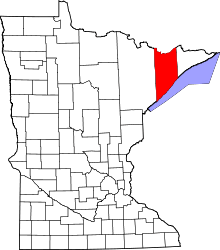 | |
| Townships | ||
| CDP | ||
| Unincorporated communities | ||
| Unorganized territories | ||
| Ghost town | ||
Coordinates: 47°15′28″N 91°18′02″W / 47.25778°N 91.30056°W