Baileyville, Maine
| Baileyville, Maine | |
|---|---|
| Town | |
| Nickname(s): Woodland | |
| Motto: "...The Road to Home"[1] | |
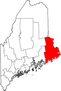
 Baileyville, Maine Location within the state of Maine | |
| Coordinates: 45°9′29″N 67°25′8″W / 45.15806°N 67.41889°WCoordinates: 45°9′29″N 67°25′8″W / 45.15806°N 67.41889°W | |
| Country | United States |
| State | Maine |
| County | Washington |
| Area[2] | |
| • Total | 41.91 sq mi (108.55 km2) |
| • Land | 37.15 sq mi (96.22 km2) |
| • Water | 4.76 sq mi (12.33 km2) |
| Elevation | 249 ft (76 m) |
| Population (2010)[3] | |
| • Total | 1,521 |
| • Estimate (2012[4]) | 1,494 |
| • Density | 40.9/sq mi (15.8/km2) |
| Time zone | Eastern (EST) (UTC-5) |
| • Summer (DST) | EDT (UTC-4) |
| 04694 | 04694 |
| Area code(s) | 207 |
| FIPS code | 23-02480 |
| GNIS feature ID | 0582337 |
| Website | Baileyville, Maine |
Baileyville is a town in Washington County, Maine, United States. The population was 1,521 at the 2010 census.[5] Within the town is the census-designated place of Woodland. The town was originally settled by Quakers in 1780. In 1830, Ezekiel Bailey began the commercial manufacture of oilcloth. The business flourished and expanded until it comprised several factories, which burned down in 1921.[6]
Geography
According to the United States Census Bureau, the town has a total area of 41.91 square miles (108.55 km2), of which, 37.15 square miles (96.22 km2) of it is land and 4.76 square miles (12.33 km2) is water.[2]
History
Water powered sawmills and paper mills at Woodland used wooden logs and pulpwood floated down the Saint Croix River. These mills were connected to the national rail network via the Maine Central Railroad and under Georgia-Pacific operation[7] originated or terminated over 6,000 railway carloads in 1973.[8] The Maine Central business has since been discontinued, and the only rail service left as of 2012 was a spur line that connected Woodland to St. Stephen, New Brunswick for the shipment of pulp and paper to Saint John.
Demographics
| Historical population | |||
|---|---|---|---|
| Census | Pop. | %± | |
| 1830 | 189 | — | |
| 1840 | 329 | 74.1% | |
| 1850 | 431 | 31.0% | |
| 1860 | 363 | −15.8% | |
| 1870 | 377 | 3.9% | |
| 1880 | 376 | −0.3% | |
| 1890 | 226 | −39.9% | |
| 1900 | 215 | −4.9% | |
| 1910 | 1,137 | 428.8% | |
| 1920 | 2,243 | 97.3% | |
| 1930 | 2,017 | −10.1% | |
| 1940 | 2,018 | 0.0% | |
| 1950 | 1,821 | −9.8% | |
| 1960 | 1,863 | 2.3% | |
| 1970 | 2,167 | 16.3% | |
| 1980 | 2,188 | 1.0% | |
| 1990 | 2,031 | −7.2% | |
| 2000 | 1,686 | −17.0% | |
| 2010 | 1,521 | −9.8% | |
| Est. 2014 | 1,467 | [9] | −3.6% |
2010 census
As of the census[3] of 2010, there were 1,521 people, 662 households, and 444 families residing in the town. The population density was 40.9 inhabitants per square mile (15.8/km2). There were 875 housing units at an average density of 23.6 per square mile (9.1/km2). The racial makeup of the town was 95.7% White, 0.7% African American, 0.8% Native American, 0.7% Asian, 0.1% Pacific Islander, 0.2% from other races, and 1.9% from two or more races. Hispanic or Latino of any race were 0.7% of the population.
There were 662 households of which 28.1% had children under the age of 18 living with them, 49.2% were married couples living together, 12.7% had a female householder with no husband present, 5.1% had a male householder with no wife present, and 32.9% were non-families. 27.6% of all households were made up of individuals and 13.4% had someone living alone who was 65 years of age or older. The average household size was 2.30 and the average family size was 2.73.
The median age in the town was 46.8 years. 21.2% of residents were under the age of 18; 5.1% were between the ages of 18 and 24; 21.5% were from 25 to 44; 32.4% were from 45 to 64; and 20% were 65 years of age or older. The gender makeup of the town was 48.1% male and 51.9% female.
2000 census
As of the census[11] of 2000, there were 1,686 people, 726 households, and 484 families residing in the town. The population density was 46.2 people per square mile (17.9/km²). There were 927 housing units at an average density of 25.4 per square mile (9.8/km²). The racial makeup of the town was 98.22% White, 0.06% African American, 0.12% Native American, 0.12% Asian, 0.59% from other races, and 0.89% from two or more races. Hispanic or Latino of any race were 0.59% of the population.
There were 726 households out of which 26.4% had children under the age of 18 living with them, 54.0% were married couples living together, 8.8% had a female householder with no husband present, and 33.2% were non-families. 28.4% of all households were made up of individuals and 12.5% had someone living alone who was 65 years of age or older. The average household size was 2.32 and the average family size was 2.82.
In the town the population was spread out with 22.8% under the age of 18, 6.3% from 18 to 24, 26.9% from 25 to 44, 27.5% from 45 to 64, and 16.4% who were 65 years of age or older. The median age was 42 years. For every 100 females there were 95.6 males. For every 100 females age 18 and over, there were 92.6 males.
The median income for a household in the town was $31,658, and the median income for a family was $37,292. Males had a median income of $38,269 versus $19,531 for females. The per capita income for the town was $17,087. About 9.1% of families and 10.1% of the population were below the poverty line, including 12.5% of those under age 18 and 8.9% of those age 65 or over.
Education
The high school, Woodland Jr./Sr. High School, has about 250 students in grades 7-12. The school's principal is Patricia Metta, and its vice principal is Chuck Noyes. Woodland Jr/Sr High School's mascot is the Dragons, and the school's colors are purple and gold.
Sports are an important part of the school's culture. The school offers JV and varsity girls' volleyball, varsity co-ed cross country, boys' and girls' soccer, boys' and girls' basketball, co-ed wrestling, co-ed cheerleading, baseball, softball, and tennis. The boys soccer team participated in the very first Class C State Championship in 1974, losing 3-0 to Richmond High School at the University of Maine. The school has won the Class D Girls' Basketball Championship 4 times, most recently in 2008. Also, in the 2008-2009 season, the boys' basketball team won the Class D Boys' Basketball Championship for the first time in the history of the school, making Woodland High School the first school since 1994 to win both Boys' and Girls' State Championships. In 2009, the girls' softball team also won the school's first State Softball Championship. The varsity Cheerleading team won the school's first ever State Championship by capturing the Class D State Championship in 1993. The cheerleading team won the Class C State Cheerleading Championship in 1997 by completing a "perfect season" in which they never lost in any round of competition.
References
- ↑ "Baileyville, Maine". Baileyville, Maine. Retrieved August 26, 2012.
- 1 2 "US Gazetteer files 2010". United States Census Bureau. Retrieved 2012-12-16.
- 1 2 "American FactFinder". United States Census Bureau. Retrieved 2012-12-16.
- ↑ "Population Estimates". United States Census Bureau. Archived from the original on 2013-06-17. Retrieved 2013-07-06.
- ↑ "Profile of General Population and Housing Characteristics: 2010 Demographic Profile Data (DP-1): Baileyville town, Washington County, Maine". U.S. Census Bureau, American Factfinder. Archived from the original on September 11, 2013. Retrieved July 19, 2012.
- ↑ Maine League of Historical Societies and Museums (1970). Doris A. Isaacson, ed. Maine: A Guide 'Down East'. Rockland, Me: Courier-Gazette, Inc. p. 162.
- ↑ 470 Railroad Club (1981). Meet the Maine Central. KJ Printing. p. 63.
- ↑ United States Department of Transportation (1974). Rail Service in the Midwest and Northeast Region. United States Government Printing Office.
- ↑ "Annual Estimates of the Resident Population for Incorporated Places: April 1, 2010 to July 1, 2014". Retrieved June 4, 2015.
- ↑ "Census of Population and Housing". Census.gov. Archived from the original on May 11, 2015. Retrieved June 4, 2015.
- ↑ "American FactFinder". United States Census Bureau. Archived from the original on 2013-09-11. Retrieved 2008-01-31.