Perry, Maine
| Perry, Maine | |
|---|---|
| Town | |
| Motto: "Halfway Between the Equator and the North Pole"[1] | |
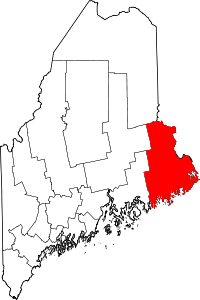
 Perry, Maine Location within the state of Maine | |
| Coordinates: 44°58′34″N 67°5′37″W / 44.97611°N 67.09361°W | |
| Country | United States |
| State | Maine |
| County | Washington |
| Area[2] | |
| • Total | 42.06 sq mi (108.93 km2) |
| • Land | 29.27 sq mi (75.81 km2) |
| • Water | 12.79 sq mi (33.13 km2) |
| Elevation | 0 ft (0 m) |
| Population (2010)[3] | |
| • Total | 889 |
| • Estimate (2012[4]) | 910 |
| • Density | 30.4/sq mi (11.7/km2) |
| Time zone | Eastern (EST) (UTC-5) |
| • Summer (DST) | EDT (UTC-4) |
| ZIP code | 04667 |
| Area code(s) | 207 |
| FIPS code | 23-58165 |
| GNIS feature ID | 0582672 |
| Website | Town of Perry, Maine |
Perry is a town in Washington County, Maine, United States, on the Canada–United States border. At the 2010 census, the town had a population of 889.[5]
History


Once part of Plantation T1 TS, the area was settled in 1758 by John Frost, who built a trading post beside the St. Croix River. Situated on Passamaquoddy Bay, the town was incorporated on February 12, 1818,[6] even as the British held Eastport 6 miles (10 km) away. It was named after Commodore Oliver Hazard Perry, hero of the War of 1812.[7] Part of the community lies within the Pleasant Point Passamaquoddy Indian Reservation.
Geography
According to the United States Census Bureau, the town has a total area of 42.06 square miles (108.93 km2), of which, 29.27 square miles (75.81 km2) of it is land and 12.79 square miles (33.13 km2) is water.[2] Located beside Passamaquoddy Bay, Perry is drained by the St. Croix River.
Climate
This climatic region is typified by large seasonal temperature differences, with warm to hot (and often humid) summers and cold (sometimes severely cold) winters. According to the Köppen Climate Classification system, Perry has a humid continental climate, abbreviated "Dfb" on climate maps.[8]
Demographics
| Historical population | |||
|---|---|---|---|
| Census | Pop. | %± | |
| 1820 | 407 | — | |
| 1830 | 735 | 80.6% | |
| 1840 | 1,008 | 37.1% | |
| 1850 | 1,324 | 31.3% | |
| 1860 | 1,195 | −9.7% | |
| 1870 | 1,149 | −3.8% | |
| 1880 | 1,047 | −8.9% | |
| 1890 | 945 | −9.7% | |
| 1900 | 1,245 | 31.7% | |
| 1910 | 1,153 | −7.4% | |
| 1920 | 1,046 | −9.3% | |
| 1930 | 992 | −5.2% | |
| 1940 | 713 | −28.1% | |
| 1950 | 613 | −14.0% | |
| 1960 | 564 | −8.0% | |
| 1970 | 878 | 55.7% | |
| 1980 | 737 | −16.1% | |
| 1990 | 758 | 2.8% | |
| 2000 | 847 | 11.7% | |
| 2010 | 889 | 5.0% | |
| Est. 2014 | 941 | [9] | 5.8% |
2010 census
As of the census[3] of 2010, there were 889 people, 362 households, and 253 families residing in the town. The population density was 30.4 inhabitants per square mile (11.7/km2). There were 551 housing units at an average density of 18.8 per square mile (7.3/km2). The racial makeup of the town was 85.5% White, 10.5% Native American, 0.1% Asian, 0.3% Pacific Islander, 0.3% from other races, and 3.3% from two or more races. Hispanic or Latino of any race were 1.0% of the population.
There were 362 households of which 30.1% had children under the age of 18 living with them, 57.2% were married couples living together, 6.4% had a female householder with no husband present, 6.4% had a male householder with no wife present, and 30.1% were non-families. 22.7% of all households were made up of individuals and 6.4% had someone living alone who was 65 years of age or older. The average household size was 2.46 and the average family size was 2.89.
The median age in the town was 44 years. 23.8% of residents were under the age of 18; 3.6% were between the ages of 18 and 24; 24.5% were from 25 to 44; 34.2% were from 45 to 64; and 13.9% were 65 years of age or older. The gender makeup of the town was 48.0% male and 52.0% female.
2000 census
As of the census[11] of 2000, there were 847 people, 331 households, and 238 families residing in the town. The population density was 28.8 people per square mile (11.1/km²). There were 529 housing units at an average density of 18.0 per square mile (6.9/km²). The racial makeup of the town was 86.19% White, 0.24% African American, 11.92% Native American, 0.12% Pacific Islander, and 1.53% from two or more races.
There were 331 households out of which 34.1% had children under the age of 18 living with them, 55.3% were married couples living together, 10.0% had a female householder with no husband present, and 27.8% were non-families. 21.5% of all households were made up of individuals and 8.8% had someone living alone who was 65 years of age or older. The average household size was 2.54 and the average family size was 2.92.
In the town the population was spread out with 27.5% under the age of 18, 7.4% from 18 to 24, 27.2% from 25 to 44, 26.7% from 45 to 64, and 11.2% who were 65 years of age or older. The median age was 37 years. For every 100 females there were 92.9 males. For every 100 females age 18 and over, there were 99.4 males.
The median income for a household in the town was $27,788, and the median income for a family was $35,104. Males had a median income of $31,442 versus $22,292 for females. The per capita income for the town was $14,285. About 15.9% of families and 17.5% of the population were below the poverty line, including 17.2% of those under age 18 and 32.5% of those age 65 or over.
Notable people
- Kevin Raye, president of the Maine State Senate
References
- ↑ "Town of Perry, Maine". Town of Perry, Maine. Retrieved August 26, 2012.
- 1 2 "US Gazetteer files 2010". United States Census Bureau. Retrieved 2012-12-16.
- 1 2 "American FactFinder". United States Census Bureau. Retrieved 2012-12-16.
- ↑ "Population Estimates". United States Census Bureau. Retrieved 2013-07-06.
- ↑ "Profile of General Population and Housing Characteristics: 2010 Demographic Profile Data (DP-1): Perry town, Washington County, Maine". U.S. Census Bureau, American Factfinder. Retrieved July 20, 2012.
- ↑ "Perry, Maine". City-Data.com. Retrieved August 26, 2012.
- ↑ "Profile for Perry, Maine, ME". ePodunk. Retrieved August 26, 2012.
- ↑ Climate Summary for Perry, Maine
- ↑ "Annual Estimates of the Resident Population for Incorporated Places: April 1, 2010 to July 1, 2014". Retrieved June 4, 2015.
- ↑ "Census of Population and Housing". Census.gov. Retrieved June 4, 2015.
- ↑ "American FactFinder". United States Census Bureau. Retrieved 2008-01-31.
External links
- Waponahki Museum
- Varney, George J. (1886), Gazetteer of the state of Maine. Perry, Boston: Russell
- Maine Office of Tourism
Coordinates: 44°58′30″N 67°04′33″W / 44.97500°N 67.07583°W