Backbone Mountain
| Backbone Mountain | |
|---|---|
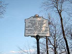 Marker at Hoye Crest, the high point of Maryland | |
| Highest point | |
| Peak | 3.92 mi (6.31 km) west of Thomas, West Virginia (Tucker County, West Virginia) |
| Elevation | 3,662 ft (1,116 m) |
| Coordinates | 39°08′50″N 79°34′12″W / 39.14722°N 79.57000°WCoordinates: 39°08′50″N 79°34′12″W / 39.14722°N 79.57000°W |
| Dimensions | |
| Length | 39 mi (63 km) [1] |
| Geography | |
 Backbone Mountain Location of Backbone Mountain in Maryland and West Virginia | |
| Country | United States |
| States | Maryland and West Virginia |
| Counties | Tucker WV, Preston WV and Garrett MD |
| Parent range | Allegheny Mountains |
Backbone Mountain is a ridge of the Allegheny Mountains of the central Appalachian Mountain Range. It is situated in the U.S. states of West Virginia and Maryland and forms a portion of the Eastern Continental Divide.
Description and geography
Backbone Mountain stretches approximately 39 miles (63 km) southwest to northeast, from the Black Fork near Hambleton in Tucker County, West Virginia to the Savage River Reservoir in Garrett County, Maryland.[1]
The mountain provides a boundary between two watersheds. The headwaters of Youghiogheny River, in the watershed of the Mississippi River, lie just northwest of the mountain, whereas the headwaters of the North Branch of the Potomac River lie just south of the mountain, along the West Virginia-Maryland border.
The ridge is crossed twice by U.S. Route 219, once north of Parsons and again near Silver Lake. It is also crossed by U.S. Route 50 east of Red House, Maryland, which is marked by a Maryland State Highway Administration sign.
Notable features
Hoye-Crest
Located just inside of Maryland along Backbone Mountain is Hoye-Crest. At an elevation of 3,360 feet (1,020 m), it is the highest point in the state of Maryland. The location, named for Captain Charles Hoye, founder of the Garrett County Historical Society, has a marker and offers a view of the North Branch Potomac River valley to the east. The location is accessible via a path leading from U.S. Route 219 to the west.
Olson Observation Tower
The southern end of Backbone Mountain was the location of West Virginia's first fire tower.[2] The first tower was built in 1922 by the state and subsequently transferred to Monongahela National Forest. In 1963, the original tower was replaced with the one currently on-site and named after Ernest B. Olson in recognition of 28 years of service in MNF fire control and conservation programs.
While the cab of the tower is not open to the public, the 133 steps leading to it are. The tower provides spectacular views of the areas including Cheat River watershed, Parsons, Blackwater Canyon, Canaan Mountain and the Otter Creek Wilderness.
Crabtree Woods
Crabtree Woods, on the northwest slopes of Backbone Mountain, is in the Potomac-Garrett State Forest.[3] It constitutes Maryland's largest surviving remnant of old-growth forest: over 500 acres (2.0 km2) [4] of mixed Appalachian hardwoods (sugar maple, red oak, basswood and cucumber tree).[5]
See also
- Outline of Maryland
- Index of Maryland-related articles
- Blackwater Canyon
- List of U.S. states by elevation
- Monongahela National Forest
External links
- "Olson Tower". Monongahela National Forest. Retrieved 2011-05-08.
- "Backbone Mountain". SummitPost.org. Retrieved 2011-05-07.
References
- 1 2 "Backbone Mountain". Geographic Names Information System. United States Geological Survey. Retrieved 2008-06-01.
- ↑ "Olson Observation Tower". Monongahela National Forest. Archived from the original on 20 May 2008. Retrieved 2008-06-02.
- ↑ Maryland Native Plant Society: Crabtree Old-Growth Forest, Garrett County, Maryland
- ↑ DeGroot, Bob (January 12, 2006), "Legislative Issue: Protecting Maryland's Forests, Natural Reserves, and Wildlife", The Sierra Club Maryland Chapter Newsletter Online
- ↑ McCarthy, B.C. and D.R. Bailey (1996), "Composition, structure, and disturbance of Crabtree Woods: an old-growth forest of western Maryland", Bulletin of the Torrey Botanical Club 123(4), pp. 350-365.