Aur Atoll
|
NASA picture of Aur (left) and Maloelap (centre) Atolls | |
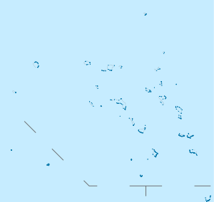 Aur Atoll Location in the Marshall Islands | |
| Geography | |
|---|---|
| Location | North Pacific |
| Coordinates | 8°12′N 171°06′E / 8.200°N 171.100°E |
| Archipelago | Ratak |
| Total islands | 42 |
| Area | 5.6 km2 (2.2 sq mi) |
| Highest elevation | 3 m (10 ft) |
| Administration | |
|
| |
| Demographics | |
| Population | 438 (1998) |
| Ethnic groups | Marshallese |
.jpg)
Aur Atoll (Marshallese: Aur, [ɑ̯ɑ͡ɒu̯u͡ɯrˠ][1]) is a coral atoll of 42 islands in the Pacific Ocean, and forms a legislative district of the Ratak Chain of the Marshall Islands. Its total land area is only 15 square kilometres (5.6 sq mi), but it encloses a lagoon with an area of 620 square kilometres (240 sq mi). It is located south of Maloelap Atoll. The population of Aur Atoll was 438 in 1998.
History
Aur Atoll was claimed by the Empire of Germany along with the rest of the Marshall Islands in 1884. After World War I, the island came under the South Pacific Mandate of the Empire of Japan. Following the end of World War II, Aur came under the control of the United States as part of the Trust Territory of the Pacific Islands. It became part of independent Republic of the Marshall Islands in 1986.
References
External links
- Marshall Islands site
- Entry at Oceandots.com at the Wayback Machine (archived December 23, 2010)
| ||
| Ratak Chain (Sunrise, Eastern) |  | |
| Ralik Chain (Sunset, Western) | ||