Ashmore Township, Coles County, Illinois
| Ashmore Township | |
|---|---|
| Township | |
 Location in Coles County | |
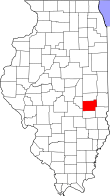 Coles County's location in Illinois | |
| Coordinates: 39°32′N 88°2′W / 39.533°N 88.033°WCoordinates: 39°32′N 88°2′W / 39.533°N 88.033°W | |
| Country | United States |
| State | Illinois |
| County | Coles |
| Established | November 8, 1859 |
| Area | |
| • Total | 53.69 sq mi (139.1 km2) |
| • Land | 53.59 sq mi (138.8 km2) |
| • Water | 0.1 sq mi (0.3 km2) 0.19% |
| Elevation | 692 ft (211 m) |
| Population (2010) | |
| • Total | 1,364 |
| • Density | 25.5/sq mi (9.8/km2) |
| Time zone | CST (UTC-6) |
| • Summer (DST) | CDT (UTC-5) |
| ZIP codes | 61912, 61920, 61933, 61943 62474 |
| GNIS feature ID | 0428610 |
Ashmore Township is one of twelve townships in Coles County, Illinois, USA. As of the 2010 census, its population was 1,364 and it contained 605 housing units.[1]
Geography
According to the 2010 census, the township has a total area of 53.69 square miles (139.1 km2), of which 53.59 square miles (138.8 km2) (or 99.81%) is land and 0.1 square miles (0.26 km2) (or 0.19%) is water.[1]
Cities, towns, villages
Extinct towns
- Embarrass
- Hitesville
Cemeteries
The township contains these ten cemeteries: Ashmore, Brooks, Enon, Lafler, Miller, Patsy Mitchell, Reed, Saint Omer, Shoot and Zimmerman.
Major highways
Airports and landing strips
- John R Reed Airport
School districts
- Casey-Westfield Community Unit School District 4c
- Charleston Community Unit School District 1
- Kansas Community Unit School District 3
- Oakland Community Unit School District 5
Political districts
- Illinois' 15th congressional district
- State House District 110
- State Senate District 55
References
- "Ashmore Township, Coles County, Illinois". Geographic Names Information System. United States Geological Survey. Retrieved 2010-01-10.
- United States Census Bureau 2007 TIGER/Line Shapefiles
- United States National Atlas
- 1 2 "Population, Housing Units, Area, and Density: 2010 - County -- County Subdivision and Place -- 2010 Census Summary File 1". United States Census. Retrieved 2013-05-28.
External links
Adjacent townships
 |
Morgan Township | East Oakland Township | | |
| Charleston Township | |
Kansas Township, Edgar County | ||
| ||||
| | ||||
| Hutton Township | |
Westfield Township, Clark County |
Municipalities and communities of Coles County, Illinois, United States | ||
|---|---|---|
| Cities | ||
| Villages | ||
| Townships | ||
| Unincorporated communities | ||
| Extinct communities |
| |
| Footnotes | ‡This populated place also has portions in an adjacent county or counties | |
This article is issued from Wikipedia - version of the 10/19/2016. The text is available under the Creative Commons Attribution/Share Alike but additional terms may apply for the media files.