Arkport, New York
| Arkport, New York | |
|---|---|
| Village | |
 Arkport, New York Location within the state of New York | |
| Coordinates: 42°23′36″N 77°41′46″W / 42.39333°N 77.69611°WCoordinates: 42°23′36″N 77°41′46″W / 42.39333°N 77.69611°W | |
| Country | United States |
| State | New York |
| County | Steuben |
| Area | |
| • Total | 0.7 sq mi (1.8 km2) |
| • Land | 0.7 sq mi (1.8 km2) |
| • Water | 0.0 sq mi (0.0 km2) |
| Elevation | 1,184 ft (361 m) |
| Population (2010) | |
| • Total | 844 |
| • Density | 1,200/sq mi (470/km2) |
| Time zone | Eastern (EST) (UTC-5) |
| • Summer (DST) | EDT (UTC-4) |
| ZIP code | 14807 |
| Area code(s) | 607 |
| FIPS code | 36-02583 |
| GNIS feature ID | 0942554 |
Arkport is a village in Steuben County, New York, United States. The population was 844 at the 2010 census. The name comes from the barges used to ship products through the village. The postal code is 14807.
The Village of Arkport is in the Town of Hornellsville and is north of the City of Hornell.
Hornell Municipal Airport (4G6) is immediately south of the village.
History
Arkport was founded in 1797 by Christopher Hurlbut.
Geography
Arkport is located at 42°23′36″N 77°41′46″W / 42.39333°N 77.69611°W (42.393347, -77.696134).[1]
According to the United States Census Bureau, the village has a total area of 0.7 square miles (1.8 km2), all of it land.
The village is on the east bank of the Canisteo River.
New York State Route 36 passes from north to south through the village. The Southern Tier Expressway lies between the village and Hornell. County Roads 48 and 67 lead into the village.
Demographics
| Historical population | |||
|---|---|---|---|
| Census | Pop. | %± | |
| 1840 | 175 | — | |
| 1860 | 250 | — | |
| 1920 | 463 | — | |
| 1930 | 575 | 24.2% | |
| 1940 | 618 | 7.5% | |
| 1950 | 701 | 13.4% | |
| 1960 | 837 | 19.4% | |
| 1970 | 984 | 17.6% | |
| 1980 | 811 | −17.6% | |
| 1990 | 770 | −5.1% | |
| 2000 | 832 | 8.1% | |
| 2010 | 844 | 1.4% | |
| Est. 2015 | 822 | [2] | −2.6% |
As of the census[4] of 2000, there were 832 people, 348 households, and 231 families residing in the village. The population density was 1,209.6 people per square mile (465.6/km²). There were 364 housing units at an average density of 529.2 per square mile (203.7/km²). The racial makeup of the village was 98.44% White, 0.60% African American, 0.12% Native American, 0.36% Asian, and 0.48% from two or more races. Hispanic or Latino of any race were 0.72% of the population.
There were 348 households out of which 29.3% had children under the age of 18 living with them, 51.1% were married couples living together, 11.8% had a female householder with no husband present, and 33.6% were non-families. 29.9% of all households were made up of individuals and 15.2% had someone living alone who was 65 years of age or older. The average household size was 2.39 and the average family size was 2.98.
In the village the population was spread out with 25.7% under the age of 18, 5.4% from 18 to 24, 23.2% from 25 to 44, 23.8% from 45 to 64, and 21.9% who were 65 years of age or older. The median age was 42 years. For every 100 females there were 80.1 males. For every 100 females age 18 and over, there were 76.1 males.
The median income for a household in the village was $36,250, and the median income for a family was $48,684. Males had a median income of $36,136 versus $21,806 for females. The per capita income for the village was $16,170. About 1.4% of families and 5.0% of the population were below the poverty line, including 2.7% of those under age 18 and 3.2% of those age 65 or over.
References
- ↑ "US Gazetteer files: 2010, 2000, and 1990". United States Census Bureau. 2011-02-12. Retrieved 2011-04-23.
- ↑ "Annual Estimates of the Resident Population for Incorporated Places: April 1, 2010 to July 1, 2015". Retrieved July 2, 2016.
- ↑ "Census of Population and Housing". Census.gov. Archived from the original on May 11, 2015. Retrieved June 4, 2015.
- ↑ "American FactFinder". United States Census Bureau. Archived from the original on 2013-09-11. Retrieved 2008-01-31.
External links
Municipalities and communities of Steuben County, New York, United States | ||
|---|---|---|
| Cities | 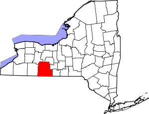 | |
| Towns | ||
| Villages | ||
| CDPs |
| |
| Hamlets | ||
| Footnotes | ‡This populated place also has portions in an adjacent county or counties | |