Prattsburgh, New York
| Prattsburgh, New York | |
|---|---|
| Town | |
| Motto: taking people that other love | |
 Prattsburgh, New York Location within the state of New York | |
| Coordinates: 42°32′N 77°20′W / 42.533°N 77.333°WCoordinates: 42°32′N 77°20′W / 42.533°N 77.333°W | |
| Country | United States |
| State | New York |
| County | Steuben |
| Area | |
| • Total | 51.7 sq mi (134.0 km2) |
| • Land | 51.7 sq mi (133.9 km2) |
| • Water | 0.0 sq mi (0.1 km2) |
| Elevation | 1,939 ft (591 m) |
| Population (2000) | |
| • Total | 2,064 |
| • Density | 39.9/sq mi (15.4/km2) |
| Time zone | Eastern (EST) (UTC-5) |
| • Summer (DST) | EDT (UTC-4) |
| ZIP code | 14873 |
| Area code(s) | 607 |
| FIPS code | 36-59718 |
| GNIS feature ID | 0979395 |
Prattsburgh is a town in Steuben County, New York, United States. The population was 2,064 at the 2000 census.
The Town of Prattsburgh is in the northeast part of the county, north of Bath, New York.
History
The town was formed from the Town of Pulteney in 1813. The community of Prattsburgh in the town is named after early settler Joel Pratt, who arrived around 1799 to purchase land. Settlers arrived in 1801.
From c. 1889-1961 Prattsburgh was located on a railroad. The Kanona & Prattsburgh Railroad Company, the Kanona & Prattsburgh Railway Company, and the Prattsburgh Railway Corporation during the period operated an 11.44 single-track standard-gauge railroad from a connection with the Erie Railroad at Kanona to Prattsburgh. Intermediate stations included Wheeler, Beans, and Stickneys.
Geography
According to the United States Census Bureau, the town has a total area of 51.7 square miles (134 km2), of which, 51.7 square miles (134 km2) of it is land and 0.04 square miles (0.10 km2) of it (0.06%) is water.
The north town line is the border of Steuben County and Yates County.
New York State Route 53 is an important north-south highway in the town.
The town is at a higher altitude than most of other parts of the county.
Demographics
| Historical population | |||
|---|---|---|---|
| Census | Pop. | %± | |
| 1820 | 1,377 | — | |
| 1830 | 2,399 | 74.2% | |
| 1840 | 2,455 | 2.3% | |
| 1850 | 2,786 | 13.5% | |
| 1860 | 2,790 | 0.1% | |
| 1870 | 2,479 | −11.1% | |
| 1880 | 2,349 | −5.2% | |
| 1890 | 2,170 | −7.6% | |
| 1900 | 2,197 | 1.2% | |
| 1910 | 1,834 | −16.5% | |
| 1920 | 1,663 | −9.3% | |
| 1930 | 1,421 | −14.6% | |
| 1940 | 1,364 | −4.0% | |
| 1950 | 1,353 | −0.8% | |
| 1960 | 1,448 | 7.0% | |
| 1970 | 1,523 | 5.2% | |
| 1980 | 1,657 | 8.8% | |
| 1990 | 1,894 | 14.3% | |
| 2000 | 2,064 | 9.0% | |
| 2010 | 2,085 | 1.0% | |
| Est. 2014 | 2,044 | [1] | −2.0% |
As of the census[3] of 2000, there were 2,064 people, 809 households, and 567 families residing in the town. The population density was 39.9 people per square mile (15.4/km²). There were 1,167 housing units at an average density of 22.6 per square mile (8.7/km²). The racial makeup of the town was 96.17% White, 1.55% African American, 0.29% Native American, 0.10% Asian, 0.63% from other races, and 1.26% from two or more races. Hispanic or Latino of any race were 1.36% of the population.
There were 809 households out of which 35.5% had children under the age of 18 living with them, 53.3% were married couples living together, 10.9% had a female householder with no husband present, and 29.9% were non-families. 24.2% of all households were made up of individuals and 10.1% had someone living alone who was 65 years of age or older. The average household size was 2.55 and the average family size was 3.00.
In the town the population was spread out with 28.0% under the age of 18, 6.3% from 18 to 24, 27.9% from 25 to 44, 23.6% from 45 to 64, and 14.2% who were 65 years of age or older. The median age was 37 years. For every 100 females there were 101.0 males. For every 100 females age 18 and over, there were 96.4 males.
The median income for a household in the town was $32,150, and the median income for a family was $36,250. Males had a median income of $28,421 versus $20,625 for females. The per capita income for the town was $15,008. About 12.9% of families and 17.5% of the population were below the poverty line, including 27.6% of those under age 18 and 5.9% of those age 65 or over.
Communities and locations in the Town of Prattsburgh
- Bean Station – A location at the south town line on NY-53.
- Daball Corners – A location north of Prattsburgh hamlet on County Road 122.
- Ingelside – A hamlet in the northwest part of the town on NY-53.
- Prattsburgh – The hamlet of Prattsburgh is in the southwest part of the town on NY-53. Prattsburgh was incorporated as a village in 1848, but subsequently abandoned its village status in 1972. Its population was approximately 950 in 1990.
Famous people from Prattsburgh
- Robert B. Van Valkenburgh, former US Congressman and Army Officer
- Narcissa Whitman (1808-1847)
References
- ↑ "Annual Estimates of the Resident Population for Incorporated Places: April 1, 2010 to July 1, 2014". Retrieved June 4, 2015.
- ↑ "Census of Population and Housing". Census.gov. Retrieved June 4, 2015.
- ↑ "American FactFinder". United States Census Bureau. Retrieved 2008-01-31.
External links
Municipalities and communities of Steuben County, New York, United States | ||
|---|---|---|
| Cities | 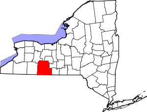 | |
| Towns | ||
| Villages | ||
| CDPs |
| |
| Hamlets | ||
| Footnotes | ‡This populated place also has portions in an adjacent county or counties | |