Arkansas Highway 23
| ||||
|---|---|---|---|---|
| Pig Trail Scenic Byway | ||||
 | ||||
| Route information | ||||
| Maintained by AHTD | ||||
| Length: | 129.88 mi[1] (209.02 km) | |||
| Existed: | 1926 – present | |||
| Major junctions | ||||
| South end: |
| |||
|
| ||||
| North end: |
| |||
| Location | ||||
| Counties: | Scott, Logan, Franklin, Madison, Carroll | |||
| Highway system | ||||
| ||||

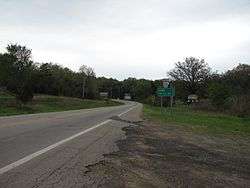
Arkansas Highway 23 is a north–south state highway in north Arkansas. The route runs 129.88 miles (209.02 km) from US 71 near Elm Park north to the Missouri state line through Ozark and Eureka Springs.[2] Between AR 16 at Brashears and Interstate 40 north of Ozark (19.0 miles (30.6 km)), Highway 23 winds through the Ozark National Forest and is designated as the Pig Trail Scenic Byway due to its steep hills and hairpin turns. The route has a strong connection with the University of Arkansas Razorbacks, connecting fans in Central Arkansas with the Northwest Arkansas area.[3]
Route description
AR 23 begins at US 71 near Elm Park and runs northeast to Booneville.[4] The route intersects AR 116 south of Booneville then crosses AR 10 in Booneville before continuing north into Franklin County.[5] AR 23 travels through the Ouachita National Forest, winding through mountains and through thick woods.[6]
AR 23 eventually meets AR 22 in Caulksville and AR 41 near Chismville after which the route runs north across the Arkansas River to Ozark. AR 23 meets US 64 in downtown Ozark and I-40 north of town.[7] The route next enters Ozark National Forest. AR 23 meets AR 16 north of the forest west St. Paul where the two roads run concurrent.
Northeast of St Paul, AR 23 and AR 16 split and AR 23 continues north through Madison County, meeting AR 74 south of Huntsville and US 412 BUS in Huntsville.[8] North of town, AR 23 crosses US 412. AR 23 next passes Withrow Springs State Park, AR 127 and AR 12 before intersecting US 62 in Eureka Springs. AR 23 and US 62 have a short concurrency before 23 turns north passing AR 187 near Holiday Island before terminating at SSR-P at the Missouri state line.
Major intersections
Mile markers reset at concurrencies.
| County | Location | mi[1] | km | Destinations | Notes | |||
|---|---|---|---|---|---|---|---|---|
| Scott | | 0.0 | 0.0 | |||||
| Logan | | 13.5 | 21.7 | |||||
| Booneville | 15.5 | 24.9 | ||||||
| 15.9 | 25.6 | |||||||
| | 17.0 | 27.4 | ||||||
| Chismville | 22.7 | 36.5 | ||||||
| | 23.1 | 37.2 | ||||||
| Franklin |
No major junctions | |||||||
| Logan | Caulksville | 29.7 | 47.8 | |||||
| 31.1 | 50.1 | |||||||
| Franklin | | 35.4 | 57.0 | |||||
| | 41.7 | 67.1 | ||||||
| Webb City | 43.2 | 69.5 | ||||||
| | Ozark Bridge over Arkansas River | |||||||
| Ozark | 44.5 | 71.6 | South end of US 64 overlap | |||||
| 0.0 | 0.0 | North end of US 64 overlap | ||||||
| 1.1 | 1.8 | |||||||
| 3.2 | 5.1 | I-40 exit 35 | ||||||
| White Oak | 4.8 | 7.7 | ||||||
| Cass | 17.2 | 27.7 | ||||||
| Madison | Brashears | 27.7 | 44.6 | South end of AR 16 overlap | ||||
| | 31.5 | 50.7 | South end of AR 16 overlap | |||||
| Aurora | 45.0 | 72.4 | ||||||
| | 47.8 | 76.9 | ||||||
| Huntsville | 52.2 | 84.0 | ||||||
| 52.5 | 84.5 | South end of US 412B overlap | ||||||
| 0.0 | 0.0 | North end of US 412B overlap | ||||||
| | 1.9 | 3.1 | Interchange | |||||
| | 4.2 | 6.8 | Withrow Springs State Park (AR 23W north) | |||||
| Forum | Withrow Springs State Park (AR 23W south) | |||||||
| | 15.7 | 25.3 | ||||||
| Carroll | Eureka Springs | 25.9 | 41.7 | South end of US 62 overlap | ||||
| 0.0 | 0.0 | North end of US 62 overlap | ||||||
| Spring Street | Former US 62B west | |||||||
| | 4.6 | 7.4 | ||||||
| | 11.0 | 17.7 | Missouri state line | |||||
1.000 mi = 1.609 km; 1.000 km = 0.621 mi
| ||||||||
Huntsville city route
| |
|---|---|
| Location: | Huntsville |
| Length: | 0.23 mi[1] (0.37 km) |
Arkansas Highway 23C is an unsigned city route in Huntsville.[1] The route is 0.23 miles (0.37 km) beginning at Highway 23. It runs north and turns east, continuing west as US 412B. After briefly running east, the route terminates at Highway 23 near the beginning of a concurrency with US 412.
Highway 23W
| |
|---|---|
| Location: | Withrow Springs State Park |
| Length: | 2.65 mi[1] (4.26 km) |
| Existed: | November 22, 1966[9]–present |
Arkansas Highway 23W is a 2.65-mile (4.26 km) long north–south loop west of Highway 23 in northwestern Arkansas. Its northern terminus is at an intersection with Highway 23 just south of Highway 127 at Forum, 7 miles (11 km) north of Huntsville. Its southern terminus is at Highway 23 south of Withrow Springs State Park. The route serves as the primary north–south access road to the state park.
References
| Wikimedia Commons has media related to Arkansas Highway 23. |
- 1 2 3 4 5 "[Arkansas] State Highways 2009 (Database)." April 2010. AHTD: Planning and Research Division. Database. Retrieved May 28, 2011.
- ↑ General Highway Map (PDF) (Map) (Carroll County ed.). Arkansas State Highway and Transportation Department. Retrieved May 28, 2011.
- ↑ "Pig Trail Scenic Byway Overview." America's Byways. United States Department of Transportation. Overview Retrieved 2011-05-28.
- ↑ General Highway Map (PDF) (Map) (Scott County ed.). Arkansas State Highway and Transportation Department. Retrieved May 28, 2011.
- ↑ General Highway Map (PDF) (Map) (Logan County ed.). Arkansas State Highway and Transportation Department. Retrieved May 28, 2011.
- ↑ "Ouachita National Forest Map." Map. Retrieved 2009-10-03.
- ↑ General Highway Map (PDF) (Map) (Franklin County ed.). Arkansas State Highway and Transportation Department. Retrieved May 28, 2011.
- ↑ General Highway Map (PDF) (Map) (Madison County ed.). Arkansas State Highway and Transportation Department. Retrieved May 28, 2011.
- ↑ "Minutes of the Meeting" (PDF). Arkansas State Highway Commission. November 22, 1966. p. 563. Retrieved January 27, 2013.