Allendale, Michigan
| Allendale, Michigan | |
|---|---|
| Census-designated place (CDP) | |
 Location of Allendale, Michigan | |
| Coordinates: 42°58′20″N 85°57′13″W / 42.97222°N 85.95361°W | |
| Country | United States |
| State | Michigan |
| County | Ottawa |
| Area | |
| • Total | 23.7 sq mi (61.5 km2) |
| • Land | 22.8 sq mi (59.1 km2) |
| • Water | 0.9 sq mi (2.3 km2) |
| Elevation | 653 ft (199 m) |
| Population (2010) | |
| • Total | 17,579 |
| • Density | 771.0/sq mi (297.4/km2) |
| Time zone | Eastern (EST) (UTC-5) |
| • Summer (DST) | EDT (UTC-4) |
| ZIP code | 49401 (Allendale) |
| Area code(s) | 616 |
| FIPS code | 26-01340[1] |
| GNIS feature ID | 1626370[2] |
Allendale is a census-designated place (CDP) in Ottawa County in the U.S. state of Michigan. The population was 17,579 at the 2010 census. It is located within Allendale Charter Township, occupying the northern two-thirds of the township, from the eastern boundary with the Grand River west along Pierce St., north along 75th Ave., then west along Lake Michigan Drive (M-45) to the western boundary of the township.[3] It is a part of the Grand Rapids-Muskegon-Holland, Michigan combined statistical area, and is an exurb of Grand Rapids, due to its major commuter routes into the city (M-45 and I-96).
The ZIP code 49401 serves all of Allendale and many of the remnant portions of the township, as well as portions of Blendon Township to the south and Georgetown Township to the southeast.[4]
Allendale is named for the township. Malta was initially chosen as the name for the township, however when the township was organized in 1849, state senator Pennoyer changed the name to Allendale, after Agnes Allen, the first person on the tax roll in the area and the widow of Hannibal Allen, who was the son of Revolutionary War hero Ethan Allen.[5]
Allendale is best known as being home to the main campus of Grand Valley State University.
History
Allendale was first settled in 1842 by Richard Roberts.[6]
Geography
According to the United States Census Bureau, the CDP has a total area of 23.7 square miles (61.4 km2), of which 22.8 square miles (59.1 km2) is land and 0.9 square miles (2.3 km2) (3.79%) is water.
Geographic features
Demographics
As of the census[1] of 2000, there were 11,555 people, 2,864 households, and 1,913 families residing in the CDP. The population density was 506.1 per square mile (195.4/km²). There were 3,016 housing units at an average density of 132.1 per square mile (51.0/km²). The racial makeup of the CDP was 93.22% White, 2.97% African American, 0.34% Native American, 0.89% Asian, 0.08% Pacific Islander, 1.45% from other races, and 1.06% from two or more races. Hispanic or Latino of any race were 3.03% of the population.
There were 2,864 households out of which 38.5% had children under the age of 18 living with them, 57.8% were married couples living together, 6.3% had a female householder with no husband present, and 33.2% were non-families. 16.1% of all households were made up of individuals and 3.5% had someone living alone who was 65 years of age or older. The average household size was 2.98 and the average family size was 3.36.
In the CDP the population was spread out with 20.7% under the age of 18, 43.1% from 18 to 24, 22.1% from 25 to 44, 9.6% from 45 to 64, and 4.6% who were 65 years of age or older. The median age was 21 years. For every 100 females there were 87.3 males. For every 100 females age 18 and over, there were 83.6 males.
The median income for a household in the CDP was $46,671, and the median income for a family was $58,371. Males had a median income of $39,038 versus $25,146 for females. The per capita income for the community was $14,580. About 2.4% of families and 12.5% of the population were below the poverty line, including 2.5% of those under age 18 and 3.6% of those age 65 or over.
Education
Primary and secondary schools
- Allendale Public Schools
- Allendale High School
- New Options Alternative High School
- Allendale Middle School
- Oakwood Intermediate School
- Springview Elementary
- Evergreen Elementary
- Allendale Christian School
Higher education
The main campus of Grand Valley State University, founded in 1960, is located in Allendale on 1,237 acres (5.01 km2). Grand Valley State University is the fastest growing university in the United States, both in population and physical size, as the university is continually building more facilities. The university is also ranked as one of the top up and coming schools in the Midwest. The university enrolls a total of just under 25,000 students on the Allendale campus and two campuses in the surrounding area, and offers over 200 areas of study, making it the largest university in the Grand Rapids region.[7]

Points of interest
On Campus
- Lubbers Stadium, home of Grand Valley State Laker football.
- Cook Carillon Tower
- The Meadows at Grand Valley State University
- GVSU Fieldhouse
Off Campus
- Grand River
- Placid Wake Park
- Grand River Park
Local media
Newspapers
Radio
- WGVU-FM (88.5 FM Allendale/Grand Rapids) – GVSU Public Radio (NPR/Jazz)
- WCKS "The Whale" – GVSU student run radio
Television
Transportation
Mass transit
- Interurban Transit Partnership (The Rapid), is a public regional bus system that provides transit throughout the eastern part of Allendale, GVSU, Grand Rapids and the surrounding areas. It connects Allendale and GVSU with Grand Rapids and GVSU's Pew Campus.
Major highways
 M-45 (Lake Michigan Drive)
References
- 1 2 "American FactFinder". United States Census Bureau. Archived from the original on 2013-09-11. Retrieved 2008-01-31.
- ↑ U.S. Geological Survey Geographic Names Information System: Allendale, Michigan
- ↑ Allendale CDP, Michigan - Reference Map - American FactFinder, U.S. Census Bureau, 2000 census
- ↑ 49401 5-Digit ZCTA, 494 3-Digit ZCTA - Reference Map - American FactFinder, U.S. Census Bureau, 2000 census
- ↑ Allendale Historical Recognition Program, p. 19
- ↑ Romig, Walter. Michigan Place Names (Grosse Pointe, Michigan: Walter Romig, not dated) p. 18
- ↑ "Quick Facts About Grand Valley". Grand Valley State University web site. Grand Valley State University. Retrieved September 29, 2009.
External links
| Wikivoyage has a travel guide for Allendale. |
Municipalities and communities of Ottawa County, Michigan, United States | ||
|---|---|---|
| Cities | 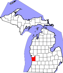 | |
| Village | ||
| Charter townships | ||
| General law townships | ||
| CDPs | ||
| Other unincorporated communities | ||
| Footnotes | ‡This populated place also has portions in an adjacent county or counties | |
| Academics | | |
|---|---|---|
| Athletics | ||
| Campus | ||
| People | ||
| Presidents | ||
| Student life | ||
Coordinates: 42°58′20″N 85°57′13″W / 42.97222°N 85.95361°W