Holland Charter Township, Michigan
| Holland Charter Township | |
|---|---|
| Charter township | |
 Holland Charter Township Location within the state of Michigan | |
| Coordinates: 42°48′48″N 86°5′16″W / 42.81333°N 86.08778°WCoordinates: 42°48′48″N 86°5′16″W / 42.81333°N 86.08778°W | |
| Country | United States |
| State | Michigan |
| County | Ottawa |
| Government | |
| Area | |
| • Total | 35.9 sq mi (93.0 km2) |
| • Land | 35.8 sq mi (92.8 km2) |
| • Water | 0.1 sq mi (0.1 km2) |
| Elevation | 1,339 ft (408 m) |
| Population (2015 census est.)[1][2][3] | |
| • Total | 35,636 |
| • Density | 6.2/sq mi (2.4/km2) |
| Time zone | Eastern (EST) (UTC-5) |
| • Summer (DST) | EDT (UTC-4) |
| FIPS code | 26-38620[2] |
| GNIS feature ID | 1626477[4] |
| Website |
www |
Holland Charter Township is a charter township of Ottawa County in the U.S. state of Michigan. The population was at the 42,299 2010 census. As of 2011 estimates, the population is now at 44,351.
The City of Holland is adjacent to the south and is administratively autonomous.
Geography
According to the United States Census Bureau, the township has a total area of 27.5 square miles (71 km2), of which 27.2 square miles (70 km2) is land and 0.3 square miles (0.78 km2) (1.02%) is water.
Demographics
As of the census[2] of 2011, there were 44,351 people, 9,821 households, and 7,365 families residing in the township. The population density was 1,063.4 per square mile (410.5/km²). There were 10,385 housing units at an average density of 382.0 per square mile (147.5/km²). The racial makeup of the township was 79.22% White, 2.22% African American, 0.41% Native American, 7.91% Asian, 0.03% Pacific Islander, 7.57% from other races, and 2.65% from two or more races. Hispanic or Latino of any race were 15.82% of the population.
There were 9,821 households out of which 43.2% had children under the age of 18 living with them, 60.8% were married couples living together, 9.9% had a female householder with no husband present, and 25.0% were non-families. 19.6% of all households were made up of individuals and 5.0% had someone living alone who was 65 years of age or older. The average household size was 2.87 and the average family size was 3.32.
In the township the population was spread out with 31.3% under the age of 18, 10.4% from 18 to 24, 34.4% from 25 to 44, 16.8% from 45 to 64, and 7.1% who were 65 years of age or older. The median age was 29 years. For every 100 females there were 102.0 males. For every 100 females age 18 and over, there were 101.5 males.
The median income for a household in the township was $49,458, and the median income for a family was $54,027. Males had a median income of $40,417 versus $28,237 for females. The per capita income for the township was $19,671. About 4.6% of families and 6.3% of the population were below the poverty line, including 7.5% of those under age 18 and 5.1% of those age 65 or over.
References
- ↑ "Table 5: Annual Estimates of the Population for Minor Civil Divisions in Michigan, Listed Alphabetically Within County: April 1, 2000 to July 1, 2007", CSV XLS, U.S. Census Bureau
- 1 2 3 "American FactFinder". United States Census Bureau. Archived from the original on 2013-09-11. Retrieved 2008-01-31.
- ↑ factfinder.census.gov
- ↑ U.S. Geological Survey Geographic Names Information System: Holland Charter Township, Michigan
External links
Municipalities and communities of Ottawa County, Michigan, United States | ||
|---|---|---|
| Cities | 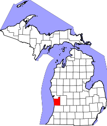 | |
| Village | ||
| Charter townships | ||
| General law townships | ||
| CDPs | ||
| Other unincorporated communities | ||
| Footnotes | ‡This populated place also has portions in an adjacent county or counties | |