Šentvid pri Grobelnem
| Šentvid pri Grobelnem | |
|---|---|
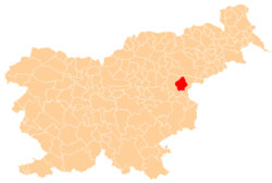
 Šentvid pri Grobelnem Location in Slovenia | |
| Coordinates: 46°13′33.19″N 15°27′40.96″E / 46.2258861°N 15.4613778°ECoordinates: 46°13′33.19″N 15°27′40.96″E / 46.2258861°N 15.4613778°E | |
| Country |
|
| Traditional region | Styria |
| Statistical region | Savinja |
| Municipality | Šmarje pri Jelšah |
| Area | |
| • Total | 1.14 km2 (0.44 sq mi) |
| Elevation | 283.1 m (928.8 ft) |
| Population (2002) | |
| • Total | 182 |
| [1] | |
Šentvid pri Grobelnem (pronounced [ʃɛnˈtʋiːt pɾi ˈɡɾoːbɛlnɛm] or [ʃənˈtʋiːt pɾi ˈɡɾoːbɛlnɛm]) is a village in the Municipality of Šmarje pri Jelšah in eastern Slovenia. It lies on the regional road from Šmarje to Celje. The area was traditionally part of Styria. The municipality is now included in the Savinja Statistical Region.[2]
Name
The name of the settlement was changed from Šent Vid pri Grobelnem to Šentvid pri Grobelnem in 1955.[3]
Church
The local parish church from which the settlement gets its name is dedicated to Saint Vitus and belongs to the Roman Catholic Diocese of Celje. It is a medieval building that was rebuilt in the 17th century and extended and restyled in the 18th century.[4]
References
- ↑ Statistical Office of the Republic of Slovenia
- ↑ Šmarje pri Jelšah municipal site
- ↑ Spremembe naselij 1948–95. 1996. Database. Ljubljana: Geografski inštitut ZRC SAZU, DZS.
- ↑ Slovenian Ministry of Culture register of national heritage reference number ešd 3480
External links
This article is issued from Wikipedia - version of the 10/10/2016. The text is available under the Creative Commons Attribution/Share Alike but additional terms may apply for the media files.