Dragomilo
| Dragomilo | |
|---|---|
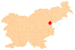
 Dragomilo Location in Slovenia | |
| Coordinates: 46°12′43.07″N 15°32′17.21″E / 46.2119639°N 15.5381139°ECoordinates: 46°12′43.07″N 15°32′17.21″E / 46.2119639°N 15.5381139°E | |
| Country |
|
| Traditional region | Styria |
| Statistical region | Savinja |
| Municipality | Šmarje pri Jelšah |
| Area | |
| • Total | 0.81 km2 (0.31 sq mi) |
| Elevation | 221.7 m (727.4 ft) |
| Population (2002) | |
| • Total | 35 |
| [1] | |
Dragomilo (pronounced [ˈdɾaːɡɔmilɔ]) is a small settlement in the Municipality of Šmarje pri Jelšah in eastern Slovenia. It lies in the small valley of Dragomilo Creek (Slovene: Dragomilski potok) in the hills south of Šmarje. The area was traditionally part of Styria and is now included in the Savinja Statistical Region.[2]
References
External links
This article is issued from Wikipedia - version of the 10/3/2016. The text is available under the Creative Commons Attribution/Share Alike but additional terms may apply for the media files.