Yelvertoft
| Yelvertoft | |
 Church of All Saints |
|
 Yelvertoft |
|
| Population | 764 (2011) |
|---|---|
| OS grid reference | SP5975 |
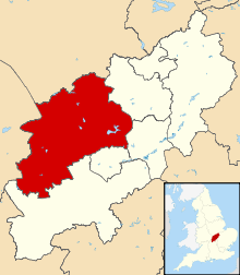
| District | Daventry |
| Shire county | Northamptonshire |
| Region | East Midlands |
| Country | England |
| Sovereign state | United Kingdom |
| Post town | Northampton |
| Postcode district | NN6 |
| Dialling code | 01788 |
| Police | Northamptonshire |
| Fire | Northamptonshire |
| Ambulance | East Midlands |
| EU Parliament | East Midlands |
| UK Parliament | Daventry |
|
|
Coordinates: 52°22′26″N 1°07′23″W / 52.374°N 1.123°W

Yelvertoft is a village in the Daventry district of the county of Northamptonshire in England. At the time of the 2001 census, the parish's population was 821 people,[1] reducing to 764 at the 2011 Census.[2]
Yelvertoft's main thoroughfare, called High Street, is approximately three quarters of a mile long, from the Parish Church of All Saints to the Village Hall. This linear street follows the course of an ancient Portway known as Salters Way.
History

The town was recorded in the Domesday Book in 1086, where a priest was mentioned.[3][4] The name is derived from differing sources: 'Yelver' from the Saxon personal name Ceolfrith, possibly evolving later to 'Gelver'. The '-toft' suffix denoted a small settlement in Danish. Yelvertoft has a maintained a more independent, rural character compared to other villages in the region, such as Crick, because no major transport routes pass through it.[3]
Sites of historical interest include a monument built for the 13th century Rector of the All Saints Church, John Drycson, a charity school building constructed in 1792 (the school was established in 1711) which now serves as the Reading Room, and a town pump dating from 1900, which was renovated in 2000.
Demography
According to the figures obtained at the Census 2001 there are 851 people living in the village, in a total of some 356 houses.
Facilities
Yelvertoft has three churches (Anglican, Congregational, Roman Catholic), a primary school, a post-office and general stores, a butcher's shop, a public house, an Equestrian centre and many small businesses.
Recreational facilities include a cricket field and football pitch. The village hall also comprises a sports field and pocket park which includes a children's play area, a skate park and a basketball court.
Transport links
Yelvertoft has many accessible transport links.
- Bus
There are currently no regular bus services to or from Yelvertoft.
- Rail
Railway stations in towns near Yelvertoft include Long Buckby, Market Harborough, Rugby and Northampton.
- Road
Yelvertoft is linked by road with access to either Junction 18 or 19 of the M1 motorway within 10 minutes drive from the village.
- Canal
The Grand Union Canal passes close to the village.
References
- ↑ Office for National Statistics: Yelvertoft CP: Parish headcounts. Retrieved 1 December 2009
- ↑ "Civil Parish population 2011". Neighbourhood Statistics. Office for National Statistics. Retrieved 13 July 2016.
- 1 2 "Crick & Yelvertoft" (PDF). Northamptonshire County Council. Retrieved 2009-07-24.
- ↑ The Domesday Book Online, Northamptonshire
External links
| Wikimedia Commons has media related to Yelvertoft. |