West Farndon

Coordinates: 52°09′32″N 1°13′42″W / 52.1589°N 1.2283°W
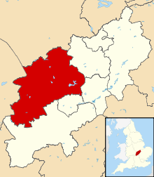
West Farndon is a hamlet and deserted medieval village about 3⁄4 mile (1.2 km) southwest of Hinton, Northamptonshire, in the civil parish of Woodford cum Membris(where the population is included).
Archaeology and history
Sherds of second- and third-century Roman pottery have been found west of the present hamlet, indicating the site of a Roman settlement.[1]
The Domesday Book of 1086 records two small manors at West Farndon.[2] Surviving earthworks east and south of the present hamlet show the extent of the former village. In 1760 an inclosure act ended Hinton's open field system of farming, and by 1840 much of the former village was deserted. Much of the ridge and furrow pattern of the common fields is still visible.[1]
Amenities
The Jurassic Way long distance footpath passes through West Farndon.
References
- 1 2 RCHME 1981, pp. 201–204.
- ↑ Serjeantson & Adkins 1902, pp. 324, 330.
Sources
- Adkins, W.R.D.; Serjeantson, R.M., eds. (1902). A History of the County of Northampton. Victoria County History. 1. Westminster: Archibald Constable & Co.
- RCHME, ed. (1981). An Inventory of the Historical Monuments in the County of Northamptonshire. 3, Archaeological Sites in North-West Northamptonshire. London: Her Majesty's Stationery Office. pp. 201–204.
External links
| Wikimedia Commons has media related to West Farndon. |
- Map sources for West Farndon