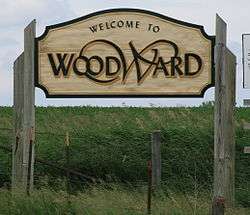
Woodward, Iowa
| Woodward, Iowa | |
|---|---|
| City | |
 | |
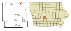 Location of Woodward, Iowa | |
| Coordinates: 41°51′19″N 93°55′23″W / 41.85528°N 93.92306°WCoordinates: 41°51′19″N 93°55′23″W / 41.85528°N 93.92306°W | |
| Country |
|
| State |
|
| County | Dallas |
| Area[1] | |
| • Total | 2.46 sq mi (6.37 km2) |
| • Land | 2.46 sq mi (6.37 km2) |
| • Water | 0 sq mi (0 km2) |
| Elevation | 1,070 ft (326 m) |
| Population (2010)[2] | |
| • Total | 1,024 |
| • Estimate (2012[3]) | 1,060 |
| • Density | 416.3/sq mi (160.7/km2) |
| Time zone | Central (CST) (UTC-6) |
| • Summer (DST) | CDT (UTC-5) |
| ZIP code | 50276 |
| Area code(s) | 515 Exchange: 438 |
| FIPS code | 19-86970 |
| GNIS feature ID | 0463199 |
Woodward is a city in Dallas County, Iowa, United States. The population was 1,024 at the 2010 census. It is part of the Des Moines–West Des Moines Metropolitan Statistical Area. Woodward is also home to the Woodward-Granger Community School District's middle school and high school, the elementary school being located in Granger.
History
"The town of Woodward was born when the Chicago, Milwaukee and St. Paul Railway Co rconstructed its lines through the community the depot was constructed. The original name for the town was decided upon as Colton, another town had already adopted the name so the name was changed to Woodward. The City was incorporated in August 1883. The first Council meeting was on December 18, 1883 called to order by Mayor W.S. Craft."[4]
An F-2 tornado struck Woodward, the city of Ames, and several other small Iowan communities on November 12, 2005, devastating many homes in the southeast and east parts of town. There were no casualties in Woodward, although there was one in Stratford. Discovery Channel's series Destroyed In Seconds showed the natural disaster in one of its episodes.
Geography
Woodward is located at 41°51′19″N 93°55′23″W / 41.85528°N 93.92306°W (41.855230, -93.923068).[5]
According to the United States Census Bureau, the city has a total area of 2.46 square miles (6.37 km2), all of it land.[1]
Demographics
| Historical populations | ||
|---|---|---|
| Year | Pop. | ±% |
| 1890 | 328 | — |
| 1900 | 550 | +67.7% |
| 1910 | 712 | +29.5% |
| 1920 | 868 | +21.9% |
| 1930 | 901 | +3.8% |
| 1940 | 895 | −0.7% |
| 1950 | 908 | +1.5% |
| 1960 | 967 | +6.5% |
| 1970 | 1,010 | +4.4% |
| 1980 | 1,212 | +20.0% |
| 1990 | 1,197 | −1.2% |
| 2000 | 1,200 | +0.3% |
| 2010 | 1,024 | −14.7% |
| 2014 | 1,512 | +47.7% |
| 2015 | 1,503 | −0.6% |
| Source:"American FactFinder". United States Census Bureau. and Iowa Data Center Source: | ||
2010 census
As of the census[2] of 2010, there were 1,024 people, 455 households, and 274 families residing in the city. The population density was 416.3 inhabitants per square mile (160.7/km2). There were 503 housing units at an average density of 204.5 per square mile (79.0/km2). The racial makeup of the city was 95.3% White, 1.1% African American, 0.6% Native American, 0.9% Asian, 0.1% from other races, and 2.1% from two or more races. Hispanic or Latino of any race were 2.2% of the population.
There were 455 households of which 28.4% had children under the age of 18 living with them, 45.3% were married couples living together, 9.2% had a female householder with no husband present, 5.7% had a male householder with no wife present, and 39.8% were non-families. 34.3% of all households were made up of individuals and 12.1% had someone living alone who was 65 years of age or older. The average household size was 2.25 and the average family size was 2.86.
The median age in the city was 40.4 years. 22.8% of residents were under the age of 18; 8.1% were between the ages of 18 and 24; 24.9% were from 25 to 44; 31.2% were from 45 to 64; and 13.1% were 65 years of age or older. The gender makeup of the city was 47.4% male and 52.6% female.
2000 census
As of the census[7] of 2000, there were 1,200 people, 490 households, and 309 families residing in the city. The population density was 1,319.1 people per square mile (509.1/km²). There were 528 housing units at an average density of 580.4 per square mile (224.0/km²). The racial makeup of the city was 97.33% White, 0.08% African American, 0.33% Native American, 0.83% Asian, 1.00% from other races, and 0.42% from two or more races. Hispanic or Latino of any race were 1.17% of the population.
There were 490 households out of which 34.9% had children under the age of 18 living with them, 47.8% were married couples living together, 11.4% had a female householder with no husband present, and 36.9% were non-families. 32.2% of all households were made up of individuals and 14.3% had someone living alone who was 65 years of age or older. The average household size was 2.39 and the average family size was 3.06.
In the city the population was spread out with 28.3% under the age of 18, 7.2% from 18 to 24, 29.3% from 25 to 44, 21.8% from 45 to 64, and 13.3% who were 65 years of age or older. The median age was 37 years. For every 100 females there were 83.8 males. For every 100 females age 18 and over, there were 82.6 males.
The median income for a household in the city was $35,647, and the median income for a family was $43,333. Males had a median income of $29,500 versus $23,625 for females. The per capita income for the city was $19,501. About 4.7% of families and 6.9% of the population were below the poverty line, including 9.3% of those under age 18 and 11.5% of those age 65 or over.
Government
Mr. Brian Devick has served as Mayor since 2011. As of May 2011 the city council members are Ashvin Patel, Jesse A. Purvis, Richard Hartwig, Paul Thompson and Craig DeHoet.[8]
Public safety
Woodward is served by a volunteer fire department, which has served since 1883.[9]
Nearby organizations
- Camp Mitigwa, which serves the Boy Scouts of America Mid Iowa Council, lies north of Woodward.
- Woodward State Resource Center is located in Woodward.
- Woodward Academy, located in Woodward, is a boot camp for teenage boys who have been convicted of various crimes.[10]
–There is also the Picket Fence Creamery, located right outside of Woodward. They are well known for their 100% natural dairy products and their unusual flavors, such as orange milk. While also selling some meat, they are most widely known for their ice cream, which is sold in Woodward and around central Iowa.[11]
See also
References
- 1 2 "US Gazetteer files 2010". United States Census Bureau. Retrieved 2012-05-11.
- 1 2 "American FactFinder". United States Census Bureau. Retrieved 2012-05-11.
- ↑ "Population Estimates". United States Census Bureau. Retrieved 2013-05-23.
- ↑ http://woodwardia.org/index.asp?Type=B_BASIC&SEC={A976B2B0-25EC-41AF-AD25-75E2317E69ED}
- ↑ "US Gazetteer files: 2010, 2000, and 1990". United States Census Bureau. 2011-02-12. Retrieved 2011-04-23.
- ↑ "Census of Population and Housing". Census.gov. Retrieved June 4, 2015.
- ↑ "American FactFinder". United States Census Bureau. Retrieved 2008-01-31.
- ↑ "Our Mayor and Council". Woodward IA. Retrieved May 9, 2011.
- ↑ Woodward Volunteer Fire Department, Woodward Volunteer Fire Department. Accessed 2007-08-15.
- ↑ WELCOME TO WOODWARD ACADEMY, Woodward Academy, 2004. Accessed 2007-08-15.
- ↑ http://www.picketfencecreamery.net/
External links
| Wikimedia Commons has media related to Woodward, Iowa. |
- City website
- City-Data Comprehensive Statistical Data and more about Woodward
Municipalities and communities of Dallas County, Iowa, United States | ||
|---|---|---|
| Cities | ||
| Townships | ||
| Unincorporated communities | ||
| Footnotes | ‡This populated place also has portions in an adjacent county or counties | |