Woodville, Calumet County, Wisconsin
- There is also the village of Woodville in St. Croix County, Wisconsin.
| Woodville, Wisconsin | |
|---|---|
| Town | |
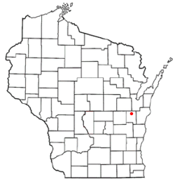 Location of Woodville, Wisconsin | |
| Coordinates: 44°11′58″N 88°12′23″W / 44.19944°N 88.20639°WCoordinates: 44°11′58″N 88°12′23″W / 44.19944°N 88.20639°W | |
| Country | United States |
| State | Wisconsin |
| County | Calumet |
| Area | |
| • Total | 32.7 sq mi (84.7 km2) |
| • Land | 32.7 sq mi (84.6 km2) |
| • Water | 0.04 sq mi (0.1 km2) |
| Elevation[1] | 820 ft (250 m) |
| Population (2010) | |
| • Total | 980 |
| • Density | 30/sq mi (11.6/km2) |
| Time zone | Central (CST) (UTC-6) |
| • Summer (DST) | CDT (UTC-5) |
| Area code(s) | 920 |
| FIPS code | 55-89000[2] |
| GNIS feature ID | 1584480[1] |
| Website |
www |
Woodville is a town in Calumet County in the U.S. state of Wisconsin. The population was 980 at the 2010 census.[3] The unincorporated communities of Dundas and St. John are located in the community.
Geography
The town of Woodville is in northern Calumet County and is bordered to the north by Outagamie and Brown counties. The village of Hilbert is along the southern part of the town's eastern border. According to the United States Census Bureau, the town has a total area of 32.7 square miles (84.7 km2), of which 32.7 square miles (84.6 km2) is land and 0.04 square miles (0.1 km2), or 0.12%, is water.[3]
Demographics
As of the census[2] of 2000, there were 993 people, 333 households, and 270 families residing in the town. The population density was 30.2 people per square mile (11.7/km²). There were 337 housing units at an average density of 10.2 per square mile (4.0/km²). The racial makeup of the town was 98.99% White, 0.40% Native American, 0.10% Asian, and 0.50% from two or more races. Hispanic or Latino of any race were 0.10% of the population.
There were 333 households out of which 39.6% had children under the age of 18 living with them, 73.3% were married couples living together, 4.8% had a female householder with no husband present, and 18.9% were non-families. 14.4% of all households were made up of individuals and 5.1% had someone living alone who was 65 years of age or older. The average household size was 2.98 and the average family size was 3.37.
In the town the population was spread out with 28.4% under the age of 18, 8.7% from 18 to 24, 30.2% from 25 to 44, 24.3% from 45 to 64, and 8.5% who were 65 years of age or older. The median age was 35 years. For every 100 females there were 112.2 males. For every 100 females age 18 and over, there were 114.8 males.
The median income for a household in the town was $52,375, and the median income for a family was $61,667. Males had a median income of $35,402 versus $22,813 for females. The per capita income for the town was $23,411. About 3.0% of families and 4.5% of the population were below the poverty line, including 5.5% of those under age 18 and 3.3% of those age 65 or over.
Notable people
- Daniel R. Curtin, Wisconsin State Assemblyman, businessman, and farmer, was born in the town.[4]
- Joseph Wolfinger, Wisconsin State Assemblyman, businessman, and inventor, lived in the town; Wolfinger served on the Woodville Town Board.[5]
References
- 1 2 "US Board on Geographic Names". United States Geological Survey. 2007-10-25. Retrieved 2008-01-31.
- 1 2 "American FactFinder". United States Census Bureau. Retrieved 2008-01-31.
- 1 2 "Geographic Identifiers: 2010 Demographic Profile Data (G001): Woodville town, Calumet County, Wisconsin". U.S. Census Bureau, American Factfinder. Retrieved September 10, 2015.
- ↑ 'Wisconsin Blue Book 1905,' Biographical Sketch of Daniel R. Curtin, pg. 1091
- ↑ 'Wisconsin Blue Book 1897,' Biographical Sketch of Joseph Wolfinger, pg. 672
External links
| Core cities |  | |
|---|---|---|
| Largest municipalities over 10,000 in 2010 | ||
| Municipalities under 10,000 in 2010 |
| |
| Counties | ||
| ||
Municipalities and communities of Calumet County, Wisconsin, United States | ||
|---|---|---|
| Cities | 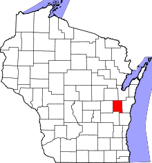 | |
| Villages | ||
| Towns | ||
| CDP | ||
| Unincorporated communities | ||
| Ghost town | ||
| Footnotes | ‡This populated place also has portions in an adjacent county or counties | |