Woodstock, Ohio
| Woodstock, Ohio | |
|---|---|
| Village | |
|
Village Hall | |
 Location of Woodstock, Ohio | |
 Location of Woodstock in Champaign County | |
| Coordinates: 40°10′24″N 83°31′44″W / 40.17333°N 83.52889°WCoordinates: 40°10′24″N 83°31′44″W / 40.17333°N 83.52889°W[1] | |
| Country | United States |
| State | Ohio |
| County | Champaign |
| Township | Rush |
| Area[2] | |
| • Total | 0.29 sq mi (0.75 km2) |
| • Land | 0.29 sq mi (0.75 km2) |
| • Water | 0 sq mi (0 km2) |
| Population (2010)[3] | |
| • Total | 305 |
| • Estimate (2012[4]) | 304 |
| • Density | 1,051.7/sq mi (406.1/km2) |
| Time zone | Eastern (EST) (UTC-5) |
| • Summer (DST) | EDT (UTC-4) |
| ZIP code | 43084 |
| Area code(s) | 937 |
| Website | |

Woodstock is a village in Champaign County, Ohio, United States. The population was 305 at the 2010 census.
History
Woodstock was platted in 1834.[5]
Geography
Woodstock is located on State Route 559 about 12 miles (19 km) north of Mechanicsburg, Ohio.
According to the United States Census Bureau, the village has a total area of 0.29 square miles (0.75 km2), all of it land.[2]
Demographics
| Historical population | |||
|---|---|---|---|
| Census | Pop. | %± | |
| 1880 | 383 | — | |
| 1890 | 301 | −21.4% | |
| 1900 | 325 | 8.0% | |
| 1910 | 310 | −4.6% | |
| 1920 | 326 | 5.2% | |
| 1930 | 293 | −10.1% | |
| 1940 | 263 | −10.2% | |
| 1950 | 316 | 20.2% | |
| 1960 | 310 | −1.9% | |
| 1970 | 281 | −9.4% | |
| 1980 | 292 | 3.9% | |
| 1990 | 296 | 1.4% | |
| 2000 | 317 | 7.1% | |
| 2010 | 305 | −3.8% | |
| Est. 2015 | 301 | [6] | −1.3% |
2010 census
As of the census[3] of 2010, there were 305 people, 103 households, and 82 families residing in the village. The population density was 1,051.7 inhabitants per square mile (406.1/km2). There were 113 housing units at an average density of 389.7 per square mile (150.5/km2). The racial makeup of the village was 98.4% White, 1.0% Native American, 0.3% from other races, and 0.3% from two or more races. Hispanic or Latino of any race were 0.7% of the population.
There were 103 households of which 42.7% had children under the age of 18 living with them, 59.2% were married couples living together, 13.6% had a female householder with no husband present, 6.8% had a male householder with no wife present, and 20.4% were non-families. 17.5% of all households were made up of individuals and 5.9% had someone living alone who was 65 years of age or older. The average household size was 2.96 and the average family size was 3.35.
The median age in the village was 33.2 years. 33.4% of residents were under the age of 18; 5.7% were between the ages of 18 and 24; 29.1% were from 25 to 44; 23.9% were from 45 to 64; and 7.9% were 65 years of age or older. The gender makeup of the village was 52.8% male and 47.2% female.
2000 census
As of the census[8] of 2000, there were 317 people, 101 households, and 85 families residing in the village. The population density was 1,167.0 people per square mile (453.3/km²). There were 105 housing units at an average density of 386.6 per square mile (150.2/km²). The racial makeup of the village was 98.11% White, 1.58% Native American, and 0.32% from two or more races.
There were 101 households out of which 42.6% had children under the age of 18 living with them, 72.3% were married couples living together, 8.9% had a female householder with no husband present, and 15.8% were non-families. 14.9% of all households were made up of individuals and 6.9% had someone living alone who was 65 years of age or older. The average household size was 3.14 and the average family size was 3.38.
In the village the population was spread out with 34.1% under the age of 18, 10.1% from 18 to 24, 30.0% from 25 to 44, 17.0% from 45 to 64, and 8.8% who were 65 years of age or older. The median age was 29 years. For every 100 females there were 87.6 males. For every 100 females age 18 and over, there were 91.7 males.
The median income for a household in the village was $44,750, and the median income for a family was $43,750. Males had a median income of $35,250 versus $25,938 for females. The per capita income for the village was $24,633. About 11.5% of families and 10.9% of the population were below the poverty line, including 19.2% of those under age 18 and none of those age 65 or over.
References
- ↑ "US Gazetteer files: 2010, 2000, and 1990". United States Census Bureau. 2011-02-12. Retrieved 2011-04-23.
- 1 2 "US Gazetteer files 2010". United States Census Bureau. Retrieved 2013-01-06.
- 1 2 "American FactFinder". United States Census Bureau. Retrieved 2013-01-06.
- ↑ "Population Estimates". United States Census Bureau. Retrieved 2013-06-17.
- ↑ Middleton, Evan P. (1917). History of Champaign County, Ohio: Its People, Industries and Institutions, Volume 1. B.F. Bowen. p. 869.
- ↑ "Annual Estimates of the Resident Population for Incorporated Places: April 1, 2010 to July 1, 2015". Retrieved July 2, 2016.
- ↑ "Census of Population and Housing". Census.gov. Retrieved June 4, 2015.
- ↑ "American FactFinder". United States Census Bureau. Retrieved 2008-01-31.
External links
Municipalities and communities of Champaign County, Ohio, United States | ||
|---|---|---|
| City | 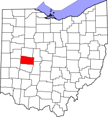 | |
| Villages | ||
| Townships | ||
| CDP | ||
| Unincorporated communities | ||