Wicklow Parish, New Brunswick
| Wicklow | |
|---|---|
| Parish | |
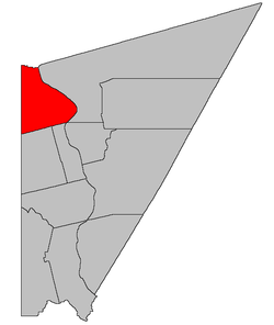 Location within Carleton County, New Brunswick. | |
| Coordinates: 46°31′N 67°37′W / 46.51°N 67.61°W | |
| Country |
|
| Province |
|
| County | Carleton |
| Established | 1833 |
| Area[1] | |
| • Land | 195.69 km2 (75.56 sq mi) |
| Population (2011)[1] | |
| • Total | 1,738 |
| • Density | 8.9/km2 (23/sq mi) |
| • Pop 2006-2011 |
|
| • Dwellings | 716 |
| Time zone | AST (UTC-4) |
| • Summer (DST) | ADT (UTC-3) |
Wicklow is a Canadian parish in Carleton County, New Brunswick.[2] Its population in the 2011 Census was 1,738. It was named after the town and county of Wicklow in Ireland.
Delineation
Wicklow Parish is defined in the Territorial Division Act[3] as being bounded:
- North by the River de Chute; westerly by the County line; east by the Saint John River, and south by Simonds Parish and Wilmot Parish, including all the islands in front.
Communities
Parish population total does not include incorporated municipalities (in bold):
|
|
|
Demographics
PopulationPopulation trend[4]
|
LanguageMother tongue language (2006)[5]
|
See also
References
- 1 2 2011 Statistics Canada Census Profile: Wicklow Parish, New Brunswick
- ↑ New Brunswick Provincial Archives - Wicklow Parish
- ↑ "Territorial Division Act (R.S.N.B. 1973, c. T-3)". Government of New Brunswick website. Retrieved 30 August 2016.
- ↑ Statistics Canada: 1996, 2001, 2006 census
- ↑ 2006 Statistics Canada Community Profile: Wicklow Parish, New Brunswick
 |
Andover Parish (Victoria County) |
Perth Parish (Victoria County) |
| |
| Aroostook County, Maine |
|
Kent Parish | ||
| ||||
| | ||||
| Wilmot Parish / Simonds Parish | Peel Parish |
| Subdivisions | |
|---|---|
| Cities | |
| Counties | |
| |
Coordinates: 46°30′36″N 67°36′36″W / 46.51000°N 67.61000°W
This article is issued from Wikipedia - version of the 8/30/2016. The text is available under the Creative Commons Attribution/Share Alike but additional terms may apply for the media files.