Westmorland County, New Brunswick
| Westmorland | |
|---|---|
| County | |
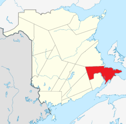 Location within New Brunswick. | |
| Coordinates: 46°04′N 64°31′W / 46.06°N 64.51°WCoordinates: 46°04′N 64°31′W / 46.06°N 64.51°W | |
| Country |
|
| Province |
|
| Established | 1785 |
| Area[1] | |
| • Land | 3,662.02 km2 (1,413.91 sq mi) |
| Population (2011)[1] | |
| • Total | 144,158 |
| • Density | 39.4/km2 (102/sq mi) |
| • Pop 2006-2011 |
|
| • Dwellings | 67,842 |
| Time zone | AST (UTC-4) |
| • Summer (DST) | ADT (UTC-3) |
| Area code(s) | 506 |
| Wikimedia Commons has media related to Westmorland County, New Brunswick. |
Westmorland County (2011 population 144,158) is a county in New Brunswick, a province of Canada. It is in the south-eastern part of the province. It contains the fast-growing commercial centre of Moncton and its northern and eastern suburbs. Also located in the county are the university town of Sackville and the tourist destination of Shediac.
Westmorland County is centrally located in the Maritimes and is New Brunswick's most populous county. Fishing and tourism are important industries along the Northumberland Strait shore while there is some mixed farming in the Petitcodiac River Valley and in the Tantramar Marsh region. The city of Moncton accounts for half the county's population and has developed as a major transportation, distribution, commercial and retail centre. Dorchester is the historical shire town of the county.
Transportation
Major Highways
 Route 1
.png) Route 2 (TCH)
Route 2 (TCH) Route 10
 Route 11
 Route 15
.png) Route 16 (TCH)
Route 16 (TCH) Route 106
 Route 112
 Route 114
 Route 126
 Route 128
Census subdivisions
Communities
There are eleven municipalities within Westmorland County (listed by 2011 population):
| Official Name | Designation | Area km2 | Population | Parish |
|---|---|---|---|---|
| Moncton | City | 141.17 | 69,074 | Moncton |
| Dieppe | City | 51.17 | 23,310 | Moncton |
| Beaubassin East | Rural community | 291.04 | 6,200 | Shediac |
| Shediac | Town | 11.97 | 6,053 | Shediac |
| Sackville | Town | 74.32 | 5,558 | Sackville |
| Memramcook | Village | 185.71 | 4,831 | Dorchester |
| Cap-Pelé | Village | 23.78 | 2,256 | Botsford |
| Salisbury | Village | 13.68 | 2,208 | Salisbury |
| Petitcodiac | Village | 17.22 | 1,429 | Salisbury |
| Dorchester | Village | 5.74 | 1,167 | Dorchester |
| Port Elgin | Village | 2.61 | 418 | Westmorland |
First Nations
There is one First Nations reservation in Westmorland County (listed by 2011 population):
| Official Name | Designation | Area km2 | Population | Parish |
|---|---|---|---|---|
| Fort Folly 1 | Reservation | 0.58 | 48 | Dorchester |
Parishes
The county is subdivided into seven parishes (listed by 2011 population):
| Official Name | Area km2 | Population | Municipalities | Unincorporated communities |
|---|---|---|---|---|
| Moncton | 579.50 | 9,421 | Moncton (city) Dieppe (city) |
Allison / Ammon / Berry Mills / Boundary Creek / Canaan / Cape Breton / Gallagher Ridge / Greater Lakeburn / Indian Mountain / Irishtown / Lakeville / LeBlancville / Lutesville / McQuade / Meadow Brook / Melanson Settlement / New Scotland / O'Neil / Pacific Junction / Painsec / Painsec Junction / Scotch Settlement / Shaw Brook / Steeves Mountain / Stilesville |
| Shediac | 238.05 | 4,917 | Beaubassin East (rural community) Shediac (town) |
Batemans Mills / Chapman Corner / East Shediac / Evangeline / MacDougall / Malakoff / Moncton Road / Petit Pre / Ohio-du-Barachois / Pointe-du-Chêne / Saint-Philippe / Scoudouc / Scoudouc Road / Shediac Bridge-Shediac River / Shediac Cape / Shediac Road / The Bluff |
| Salisbury | 873.60 | 3,417 | Salisbury (village) Petitcodiac (village) |
Dobsons Corner / Fawcett / Fawcett Hill / Fredericton Road / Glenvale / Harewood / Havelock / Hicksville / Hillgrove / Intervale / Kay Settlement / Killams Mills / Kinnear Settlement / Leeman Hill / Lewis Mountain / Monteagle / North Branch / Pollett River / River Glade / Scott Road / Second North River / Steeves Settlement / The Glades / Upper Ridge / Wheaton Settlement |
| Sackville | 578.37 | 1,336 | Sackville (town) | Aboushagan / Aboushagan Road / Anderson Settlement / Babcock Road / British Settlement / Brooklyn / Brooklyn Road / Centre Village / Coles Island Road / Cookville / Evans / Fairfield / Harper's Brook / Johnson's Mills / Lower Rockport / Midgic / Rockport / Upper Rockport / Ward / West Sackville / Westcock / Wood Point / Woodhurst |
| Botsford | 304.00 | 1,074 | Cap-Pelé (village) | Bayfield / Bayside / Botsford / Cadman Corner / Cape Spear / Cape Tormentine / Chapmans Corner / Hardy / Johnston Point Road / Little Shemogue / Malden / Mates Corner / Melrose / Murray Corner / Murray Road / Petit-Cap / Smith Settlement / Spence Settlement / The Bluff / Timber River / Westmorland / Upper Cape / Woodside |
| Westmorland | 175.07 | 964 | Port Elgin (village) | Aulac / Baie-Verte / Baie Verte Road / Coburg / Etter Ridge / Fromm's Swamp / Halls Hill / Jolicure / Mount Whatley / Pointe de Bute / Tidnish Bridge / Uniacke Hill / Upper Point de Bute / Westmorland |
| Dorchester | 90.89 | 477 | Memramcook (village) Dorchester (village) Fort Folly 1 (reservation) |
Calhoun / Cherry Burton / Dorchester Cape / Middleton / Taylor Village / Upper Dorchester |
Demographics
Population
| Canada census – Westmorland County, New Brunswick community profile | |||
|---|---|---|---|
| 2011 | 2006 | 2001 | |
| Population: | 144,158 (+8.5% from 2006) | 132,849 (+6.5% from 2001) | 124,688 (+3.4% from 1996) |
| Land area: | 3,662.02 km2 (1,413.91 sq mi) | 3,659.62 km2 (1,412.99 sq mi) | 3,659.56 km2 (1,412.96 sq mi) |
| Population density: | 39.4/km2 (102/sq mi) | 36.3/km2 (94/sq mi) | 34.1/km2 (88/sq mi) |
| Median age: | 41.4 (M: 40.5, F: 42.4) | 40.4 (M: 39.4, F: 41.4) | 38.5 (M: 37.6, F: 39.5) |
| Total private dwellings: | 67,842 | 60,802 | 54,734 |
| Median household income: | $55,736 | $48,293 | $41,745 |
| References: 2011[2] 2006[3] 2001[4] | |||
| Historical Census Data - Westmorland County, New Brunswick[5] | ||||||||||||||||||||||||||
|---|---|---|---|---|---|---|---|---|---|---|---|---|---|---|---|---|---|---|---|---|---|---|---|---|---|---|
|
|
| ||||||||||||||||||||||||
Language
| Canada Census Mother Tongue - Westmorland County, New Brunswick[5] | ||||||||||||||||||
|---|---|---|---|---|---|---|---|---|---|---|---|---|---|---|---|---|---|---|
| Census | Total | French |
English |
French & English |
Other | |||||||||||||
| Year | Responses | Count | Trend | Pop % | Count | Trend | Pop % | Count | Trend | Pop % | Count | Trend | Pop % | |||||
| 2011 |
140,925 |
76,475 | |
54.27% | 58,795 | |
41.72% | 2,115 | |
1.50% | 3,540 | |
2.51% | |||||
| 2006 |
130,080 |
70,945 | |
54.54% | 54,860 | |
42.17% | 1,265 | |
0.97% | 3,010 | |
2.31% | |||||
| 2001 |
122,405 |
68,510 | |
55.97% | 51,060 | |
41.71% | 1,350 | |
1.10% | 1,485 | |
1.21% | |||||
| 1996 |
118,330 |
67,700 | n/a | 57.21% | 47,860 | n/a | 40.45% | 1,455 | n/a | 1.23% | 1,315 | n/a | 1.11% | |||||
Access Routes
Highways and numbered routes that run through the county, including external routes that start or finish at the county limits:[6]
|
|
Protected areas and attractions
Notable people
See also
References
- 1 2 2011 Statistics Canada Census Profile: Westmorland County, New Brunswick
- ↑ "2011 Community Profiles". Canada 2011 Census. Statistics Canada. July 5, 2013. Retrieved 2014-05-02.
- ↑ "2006 Community Profiles". Canada 2006 Census. Statistics Canada. March 30, 2011. Retrieved 2014-05-02.
- ↑ "2001 Community Profiles". Canada 2001 Census. Statistics Canada. February 17, 2012. Retrieved 2014-05-02.
- 1 2 Statistics Canada: 1996, 2001, 2006, 2011 census
- ↑ Atlantic Canada Back Road Atlas ISBN 978-1-55368-618-7
External links
 |
Queens County Kings County |
Kent County | | |
| Albert County | |
Northumberland Strait | ||
| ||||
| | ||||
| Bay of Fundy | |
| Subdivisions | |
|---|---|
| Cities | |
| Counties | |
| |