White Lake, South Dakota
| White Lake, South Dakota | |
|---|---|
| City | |
| Motto: "Powering the Future" | |
 Location in Aurora County and the state of South Dakota | |
| Coordinates: 43°43′45″N 98°42′48″W / 43.72917°N 98.71333°WCoordinates: 43°43′45″N 98°42′48″W / 43.72917°N 98.71333°W | |
| Country | United States |
| State | South Dakota |
| County | Aurora |
| Incorporated | 1882[1] |
| Area[2] | |
| • Total | 0.43 sq mi (1.11 km2) |
| • Land | 0.43 sq mi (1.11 km2) |
| • Water | 0 sq mi (0 km2) |
| Elevation | 1,647 ft (502 m) |
| Population (2010)[3] | |
| • Total | 372 |
| • Estimate (2012[4]) | 375 |
| • Density | 865.1/sq mi (334.0/km2) |
| Time zone | Central (CST) (UTC-6) |
| • Summer (DST) | CDT (UTC-5) |
| ZIP code | 57383 |
| Area code(s) | 605 |
| FIPS code | 46-71180[5] |
| GNIS feature ID | 1258966[6] |
| Website | White Lake, South Dakota |
White Lake is a city in Aurora County, South Dakota, United States. The population was 372 at the 2010 census.
Geography
White Lake is located at 43°43′45″N 98°42′48″W / 43.72917°N 98.71333°W (43.729076, -98.713294).[7]
According to the United States Census Bureau, the city has a total area of 0.43 square miles (1.11 km2), all of it land.[2]
Demographics
| Historical population | |||
|---|---|---|---|
| Census | Pop. | %± | |
| 1890 | 366 | — | |
| 1900 | 264 | −27.9% | |
| 1910 | 507 | 92.0% | |
| 1920 | 610 | 20.3% | |
| 1930 | 530 | −13.1% | |
| 1940 | 496 | −6.4% | |
| 1950 | 395 | −20.4% | |
| 1960 | 397 | 0.5% | |
| 1970 | 395 | −0.5% | |
| 1980 | 414 | 4.8% | |
| 1990 | 419 | 1.2% | |
| 2000 | 405 | −3.3% | |
| 2010 | 372 | −8.1% | |
| Est. 2015 | 370 | [8] | −0.5% |
2010 census
As of the census[3] of 2010, there were 372 people, 161 households, and 88 families residing in the city. The population density was 865.1 inhabitants per square mile (334.0/km2). There were 192 housing units at an average density of 446.5 per square mile (172.4/km2). The racial makeup of the city was 94.9% White, 1.1% African American, 0.3% Native American, 2.7% Asian, and 1.1% from two or more races. Hispanic or Latino of any race were 1.6% of the population. Since then there has been Hispanic families that had moved to White Lake, such as the Avila and Orozco/Gusan family.
There were 161 households of which 22.4% had children under the age of 18 living with them, 44.7% were married couples living together, 5.0% had a female householder with no husband present, 5.0% had a male householder with no wife present, and 45.3% were non-families. 41.0% of all households were made up of individuals and 23.6% had someone living alone who was 65 years of age or older. The average household size was 2.09 and the average family size was 2.83.
The median age in the city was 50.5 years. 21.5% of residents were under the age of 18; 5.6% were between the ages of 18 and 24; 15% were from 25 to 44; 28% were from 45 to 64; and 29.8% were 65 years of age or older. The gender makeup of the city was 47.0% male and 53.0% female.
2000 census
As of the census[5] of 2000, there were 405 people, 151 households, and 96 families residing in the city. The population density was 1,014.7 people per square mile (390.9/km²). There were 166 housing units at an average density of 415.9 per square mile (160.2/km²). The racial makeup of the city was 98.27% White, 1.48% Native American, and 0.25% from two or more races.
There were 151 households out of which 25.2% had children under the age of 18 living with them, 53.0% were married couples living together, 7.9% had a female householder with no husband present, and 36.4% were non-families. 34.4% of all households were made up of individuals and 20.5% had someone living alone who was 65 years of age or older. The average household size was 2.27 and the average family size was 2.96.
In the city the population was spread out with 21.5% under the age of 18, 5.7% from 18 to 24, 16.8% from 25 to 44, 19.5% from 45 to 64, and 36.5% who were 65 years of age or older. The median age was 49 years. For every 100 females there were 77.6 males. For every 100 females age 18 and over, there were 71.9 males.
The median income for a household in the city was $25,500, and the median income for a family was $38,611. Males had a median income of $26,500 versus $20,795 for females. The per capita income for the city was $13,034. About 9.0% of families and 19.0% of the population were below the poverty line, including 24.7% of those under age 18 and 14.8% of those age 65 or over.
Education
White Lake Public Schools belong to White Lake School District (South Dakota). The three schools in the district include White Lake Elementary School, White Lake Junior High and White Lake High School, all of the three schools located in one building. The school provides the basic classes: Math, Science, English/Literature, Social Studies, Band, Vocal, Computer, Psychology, Accounting, and Physical Education.
Robert Schroeder is the Superintendent of Schools.[10]
References
- ↑ "SD Towns" (PDF). South Dakota State Historical Society. Retrieved 2010-02-17.
- 1 2 "US Gazetteer files 2010". United States Census Bureau. Retrieved 2012-06-21.
- 1 2 "American FactFinder". United States Census Bureau. Retrieved 2012-06-21.
- ↑ "Population Estimates". United States Census Bureau. Retrieved 2013-05-29.
- 1 2 "American FactFinder". United States Census Bureau. Retrieved 2008-01-31.
- ↑ "US Board on Geographic Names". United States Geological Survey. 2007-10-25. Retrieved 2008-01-31.
- ↑ "US Gazetteer files: 2010, 2000, and 1990". United States Census Bureau. 2011-02-12. Retrieved 2011-04-23.
- ↑ "Annual Estimates of the Resident Population for Incorporated Places: April 1, 2010 to July 1, 2015". Retrieved July 2, 2016.
- ↑ "Census of Population and Housing". Census.gov. Retrieved June 4, 2015.
- ↑ "White Lake School District". White Lake School District. Retrieved July 27, 2012.
External links
Municipalities and communities of Aurora County, South Dakota, United States | ||
|---|---|---|
| Cities | 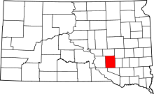 | |
| Town | ||
| Townships |
| |
| CDPs | ||