Weston, Georgia
| Weston, Georgia | |
|---|---|
| Unincorporated community | |
|
Weston | |
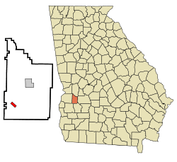 Location in Webster County and the state of Georgia | |
| Coordinates: 31°58′40″N 84°36′56″W / 31.97778°N 84.61556°WCoordinates: 31°58′40″N 84°36′56″W / 31.97778°N 84.61556°W | |
| Country | United States |
| State | Georgia |
| County | Webster |
| Area | |
| • Total | 0.9 sq mi (2.4 km2) |
| • Land | 0.9 sq mi (2.4 km2) |
| • Water | 0 sq mi (0 km2) |
| Elevation | 509 ft (155 m) |
| Population (2000) | |
| • Total | 75 |
| • Density | 83.3/sq mi (31.3/km2) |
| Time zone | Eastern (EST) (UTC-5) |
| • Summer (DST) | EDT (UTC-4) |
| ZIP code | 31832 |
| Area code(s) | 229 |
| FIPS code | 13-82076[1] |
| GNIS feature ID | 0333396[2] |

Weston is an unincorporated community in Webster County, Georgia. The population was 75 at the 2000 census. In 2009, the former town was disincorporated and consolidated with the Unified Government of Webster County.
Geography
The community is located in west central Georgia along Georgia State Route 520 (South Georgia Parkway), which leads northwest 9 mi (15 km) to Richland and southeast 18 mi (29 km) to Dawson. The highway meets Georgia State Route 41 in the community. Columbus is 45 mi (72 km) northwest and Albany is 42 mi (68 km) southeast.
Weston is located at 31°58′40″N 84°36′56″W / 31.97778°N 84.61556°W (31.977666, -84.615451).[3]
According to the United States Census Bureau, the town has a total area of 0.9 square miles (2.3 km2), all of it land.
Demographics
| Historical population | |||
|---|---|---|---|
| Census | Pop. | %± | |
| 1870 | 66 | — | |
| 1880 | 176 | 166.7% | |
| 1890 | 215 | 22.2% | |
| 1900 | 273 | 27.0% | |
| 1910 | 319 | 16.8% | |
| 1920 | 208 | −34.8% | |
| 1930 | 235 | 13.0% | |
| 1940 | 173 | −26.4% | |
| 1950 | 162 | −6.4% | |
| 1960 | 120 | −25.9% | |
| 1970 | 73 | −39.2% | |
| 1980 | 109 | 49.3% | |
| 1990 | 42 | −61.5% | |
| 2000 | 75 | 78.6% | |
As of the census[1] of 2000, there were 75 people, 29 households, and 20 families residing in the town. The population density was 79.5 people per square mile (30.8/km²). There were 42 housing units at an average density of 44.5 per square mile (17.3/km²). The racial makeup of the town was 81.33% White and 18.67% African American.
There were 29 households out of which 37.9% had children under the age of 18 living with them, 65.5% were married couples living together, 6.9% had a female householder with no husband present, and 27.6% were non-families. 27.6% of all households were made up of individuals and 17.2% had someone living alone who was 65 years of age or older. The average household size was 2.59 and the average family size was 3.19.
In the town the population was spread out with 21.3% under the age of 18, 6.7% from 18 to 24, 21.3% from 25 to 44, 30.7% from 45 to 64, and 20.0% who were 65 years of age or older. The median age was 47 years. For every 100 females there were 102.7 males. For every 100 females age 18 and over, there were 84.4 males.
The median income for a household in the town was $41,000, and the median income for a family was $41,875. Males had a median income of $28,125 versus $18,750 for females. The per capita income for the town was $22,275. There were no families and 3.0% of the population living below the poverty line, including no under eighteens and 66.7% of those over 64.
Gallery
 Boyd Mill Place was added to the National Register of Historic Places.
.JPG) Weston Post Office (ZIP code: 31832)
Weston Post Office (ZIP code: 31832) Merritt Pecan Company and General Store
References
- 1 2 "American FactFinder". United States Census Bureau. Retrieved 2008-01-31.
- ↑ "US Board on Geographic Names". United States Geological Survey. 2007-10-25. Retrieved 2008-01-31.
- ↑ "US Gazetteer files: 2010, 2000, and 1990". United States Census Bureau. 2011-02-12. Retrieved 2011-04-23.
- ↑ "Census of Population and Housing". Census.gov. Retrieved June 4, 2015.
Municipalities and communities of Webster County, Georgia, United States | ||
|---|---|---|
| Unincorporated community |  | |