Wenns
| Wenns | ||
|---|---|---|
| ||
 Wenns Location within Austria | ||
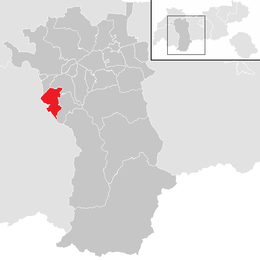
Location in the district
| ||
| Coordinates: 47°10′00″N 10°43′00″E / 47.16667°N 10.71667°ECoordinates: 47°10′00″N 10°43′00″E / 47.16667°N 10.71667°E | ||
| Country | Austria | |
| State | Tyrol | |
| District | Imst | |
| Government | ||
| • Mayor | Markus Helbock (ÖVP) | |
| Area | ||
| • Total | 29.6 km2 (11.4 sq mi) | |
| Elevation | 962 m (3,156 ft) | |
| Population (1 January 2016)[1] | ||
| • Total | 1,983 | |
| • Density | 67/km2 (170/sq mi) | |
| Time zone | CET (UTC+1) | |
| • Summer (DST) | CEST (UTC+2) | |
| Postal code | 6473 | |
| Area code | 05414 | |
| Vehicle registration | IM | |
| Website |
www.riskommunal.net/ wenns | |

Wenns is a municipality in the Imst district and is located 7.30 km south of Imst at the Pitze river and became the main location of the Pitztal valley. Main source of income is tourism, especially skiing but the community does not possess an own area. Wenns has the oldest farmhouse (700 years) in Tyrol.
Population
| Historical population | ||
|---|---|---|
| Year | Pop. | ±% |
| 1869 | 1,177 | — |
| 1880 | 1,197 | +1.7% |
| 1890 | 1,167 | −2.5% |
| 1900 | 1,065 | −8.7% |
| 1910 | 1,114 | +4.6% |
| 1923 | 994 | −10.8% |
| 1934 | 1,147 | +15.4% |
| 1939 | 1,290 | +12.5% |
| 1951 | 1,336 | +3.6% |
| 1961 | 1,489 | +11.5% |
| 1971 | 1,669 | +12.1% |
| 1981 | 1,814 | +8.7% |
| 1991 | 1,896 | +4.5% |
| 2001 | 2,020 | +6.5% |
| 2011 | 1,979 | −2.0% |
References
External links
| Wikimedia Commons has media related to Wenns. |
This article is issued from Wikipedia - version of the 1/3/2014. The text is available under the Creative Commons Attribution/Share Alike but additional terms may apply for the media files.