Nassereith
| Nassereith | ||
|---|---|---|
 | ||
| ||
 Nassereith Location within Austria | ||
Location in the district
| ||
| Coordinates: 47°19′00″N 10°50′00″E / 47.31667°N 10.83333°ECoordinates: 47°19′00″N 10°50′00″E / 47.31667°N 10.83333°E | ||
| Country | Austria | |
| State | Tyrol | |
| District | Imst | |
| Government | ||
| • Mayor | Herbert Kröll (ÖVP) | |
| Area | ||
| • Total | 72.4 km2 (28.0 sq mi) | |
| Elevation | 843 m (2,766 ft) | |
| Population (1 January 2016)[1] | ||
| • Total | 2,014 | |
| • Density | 28/km2 (72/sq mi) | |
| Time zone | CET (UTC+1) | |
| • Summer (DST) | CEST (UTC+2) | |
| Postal code | 6465 | |
| Area code | 05265 | |
| Vehicle registration | IM | |
| Website | www.nassereith.tirol.gv.at | |


Nassereith is a municipality in the Imst district and is located 11 km north of Imst on the upper course of the Gurgl brook. The village was mentioned in documents for the first time in 1150 but settlement already began 200-300BC. Main sources of income is tourism but Nassereith is now community for commuters.
Population
| Historical population | ||
|---|---|---|
| Year | Pop. | ±% |
| 1869 | 1,064 | — |
| 1880 | 1,061 | −0.3% |
| 1890 | 1,086 | +2.4% |
| 1900 | 1,002 | −7.7% |
| 1910 | 1,109 | +10.7% |
| 1923 | 1,181 | +6.5% |
| 1934 | 1,158 | −1.9% |
| 1939 | 1,203 | +3.9% |
| 1951 | 1,599 | +32.9% |
| 1961 | 1,744 | +9.1% |
| 1971 | 1,889 | +8.3% |
| 1981 | 1,960 | +3.8% |
| 1991 | 1,953 | −0.4% |
| 2001 | 2,081 | +6.6% |
| 2011 | 2,070 | −0.5% |
Gallery
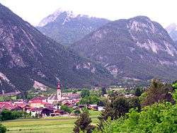
 Dormitz, view to the village
 Dormitz, church: die Wahlfahrtskirche
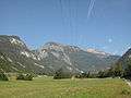 between Nassereith and Dormitz, panorama
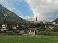
 Nassereith, church: die Pfarrkirche hl. Drei König
References
External links
| Wikimedia Commons has media related to Nassereith. |
This article is issued from Wikipedia - version of the 6/13/2016. The text is available under the Creative Commons Attribution/Share Alike but additional terms may apply for the media files.