Waun Fach
| Waun Fach | |
|---|---|
 Waun Fach from Mynydd Llysiau | |
| Highest point | |
| Elevation | 811 m (2,661 ft) |
| Prominence | 622 m (2,041 ft) |
| Parent peak | Pen y Fan |
| Listing | Marilyn, Hewitt, Nuttall |
| Naming | |
| Translation | small moor (Welsh) |
| Pronunciation | Welsh: [ˈwɑin ˈvɑːx] |
| Geography | |
| Location | Black Mountains, South Wales |
| OS grid | SO215300 |
| Topo map | OS Landranger 161 |
| Listed summits of Waun Fach | ||||
| Name | Grid ref | Height | Status | |
|---|---|---|---|---|
| Pen y Gadair Fawr | SN969193 | 800 metres (2,625 ft) | Hewitt, Nuttall | |
| Pen Allt-mawr | SN969193 | 720 metres (2,362 ft) | Hewitt, Nuttall | |
| Rhos Dirion | SN969193 | 713 metres (2,339 ft) | sub Hewitt, Nuttall | |
| Pen Cerrig-calch | SN969193 | 701 metres (2,300 ft) | Hewitt, Nuttall | |
| Twmpa | SN969193 | 690 metres (2,264 ft) | Hewitt, Nuttall | |
| Chwarel y Fan | SN969193 | 679 metres (2,228 ft) | Hewitt, Nuttall | |
| Mynydd Llysiau | SN969193 | 663 metres (2,175 ft) | Hewitt, Nuttall | |
Waun Fach is the highest mountain at 2661 feet in the Black Mountains in south-eastern Wales. It is one of the three Marilyns over 600m that make up the range, the others being Black Mountain and Mynydd Troed. To the north Rhos Fawr and the Radnor Forest can be seen. After Pen y Fan, it is the second highest mountain in mainland Britain south of Snowdonia.
Access
It is situated at the head of the Grwyne Fechan valley, above and to the west of the Grwyne Fawr reservoir . It has an undistinguished (and almost indistinguishable ) rounded summit . The nearby tops on the ridge, Pen Trumau and Pen y Gadair Fawr , although lower, are very much more recognisable.[1]
References
- ↑ Nuttall, John & Anne (1999). The Mountains of England & Wales - Volume 1: Wales (2nd edition ed.). Milnthorpe, Cumbria: Cicerone. ISBN 1-85284-304-7.
External links
- Computer generated summit panoramas Waun Fach Index
- www.geograph.co.uk : photos of Waun Fach and surrounding area
Coordinates: 51°57′47″N 3°08′38″W / 51.96292°N 3.14392°W
| Northern Highlands |  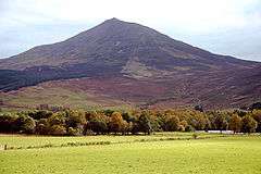 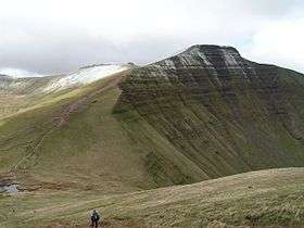 | |
|---|---|---|
| Western Highlands | ||
| Central and Eastern Highlands | ||
| Southern Highlands | ||
| Islands | ||
| Scottish Lowlands, England and Wales | ||
This article is issued from Wikipedia - version of the 10/15/2015. The text is available under the Creative Commons Attribution/Share Alike but additional terms may apply for the media files.