Washougal River
| Washougal River | |
 Flowing under a bridge | |
| Country | United States |
|---|---|
| State | Washington |
| County | Clark, Skamania |
| Source | near McKinley Ridge and Lookout Mountain |
| - location | Gifford Pinchot National Forest, Skamania County |
| - elevation | 2,761 ft (842 m) [1] |
| - coordinates | 45°47′27″N 122°08′55″W / 45.79083°N 122.14861°W [2] |
| Mouth | Columbia River |
| - location | Washougal and Camas, Clark County |
| - elevation | 10 ft (3 m) [2] |
| - coordinates | 45°34′43″N 122°24′00″W / 45.57861°N 122.40000°WCoordinates: 45°34′43″N 122°24′00″W / 45.57861°N 122.40000°W [2] |
| Length | 33 mi (53 km) [3] |
| Basin | 212 sq mi (549 km2) [3] |
| Discharge | |
| - average | 873 cu ft/s (25 m3/s) [4] |
| - max | 40,400 cu ft/s (1,144 m3/s) |
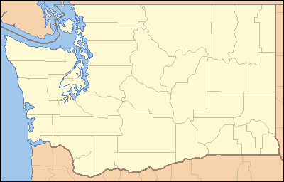 Location of the mouth of Washougal River in Washington | |
The Washougal River is a 33-mile (53 km) tributary of the Columbia River in the U.S. state of Washington.[3] Its headwaters and upper 21 miles (34 km) are in Skamania County in the Gifford Pinchot National Forest, and its lower 12 miles (19 km) are in Clark County. The river, which meets the Columbia near the cities of Washougal and Camas, is a popular stream for fishing, swimming, and boating.[3]
Explorers Meriwether Lewis and William Clark referred to the Washougal River as the "Seal River." The name Washougal comes from the Cascades Chinook placename [wasiixwal] or [wasuxal],[5] meaning "rushing water".[6] It has been suggested that D. B. Cooper, who hijacked a Boeing 727 in 1971 then parachuted from the plane with ransom money, may have landed in the Washougal River basin.[7]
Watershed
The Washougal River drains 212 square miles (550 km2) of land that is largely forested, especially in its upper reaches in the Cascade Range and its foothills. Of the total, 162 square miles (420 km2) are in Skamania County, and the remaining 50 square miles (130 km2) are in Clark County.[3] Small farms and rural homes are found along the lower part of the basin, and two small Clark County cities, Camas and Washougal, are at the river mouth. About 63 percent of the watershed is forested; 21 percent is devoted to fields, pastures, bare earth, and shrubland, and 16 percent is developed or cleared for development.[3]
The water quality of surface streams in the basin is rated "excellent" to "good" with few exceptions.[3] State and county officials monitor the lower reaches of the river for signs of trouble such as harmful bacteria, elevated water temperatures, and bank erosion related to forest clearing and other development. Two of the river's tributaries, Jones Creek and Boulder Creek, supply drinking water to Camas.[3]
Recreation
The Washougal River, which has no dams, has significant fisheries. The main stem and some of the tributaries support populations of Chinook, chum, and Coho salmon, steelhead, and coastal cutthroat trout.[3] Dougan Falls, 21 miles (34 km) from the mouth, blocks most fish migration beyond the waterfall.[3] The Washougal River Greenway in Camas has fishing access, a short walking trail, a boat launch, and picnic sites.[8] Much of the recreation access for the Washougal now requires a Discover Pass, Washington state's recreation fee pass.[9]
A series of waterfalls, some of them associated with informal swimming holes, are found along the main stream.[10] From lowermost to uppermost, the named falls include Salmon, Dougan, Naked, Reeder, Stebbins Creek, and Docs Drop.[10] Dougan Falls is 30 feet (9.1 m) high.[11]
Whitewater enthusiasts run parts of the Washougal River and some of its tributaries. The runs include many stretches rated 4, 5, or 5+ on the International Scale of River Difficulty.[12]
See also
References
- ↑ Source elevation derived from Google Earth search using GNIS source coordinates.
- 1 2 3 "Washougal River". Geographic Names Information System (GNIS). United States Geological Survey. September 10, 1979. Retrieved January 22, 2013.
- 1 2 3 4 5 6 7 8 9 10 "Washougal River Watershed" (PDF). Clark County. Retrieved January 22, 2013.
- ↑ Byrne, Jim; et al. (May 17, 2002). "Washougal Subbasin Summary (Draft)" (PDF). Columbia Basin Fish and Wildlife Authority. p. 1. Retrieved January 22, 2013. The maximum discharge was recorded during the flood of December 1977.
- ↑ Bright, William (2004). Native American placenames of the United States. University of Oklahoma Press. p. 550. ISBN 978-0-8061-3598-4. Retrieved 6 April 2011.
- ↑ Majors, Harry M. (1975). Exploring Washington. Van Winkle Publishing Co. p. 147. ISBN 978-0-918664-00-6.
- ↑ "Scientists Hunt for D.B. Cooper" (video transcript). Federal Bureau of Investigation. Retrieved January 22, 2013.
- ↑ "Washougal River Greenway". Vancouver – Clark Parks & Recreation. Retrieved January 22, 2013.
- ↑ http://discoverpass.wa.gov/
- 1 2 Plumb, Gregory A. Waterfall Lovers Guide: Pacific Northwest (4th ed.). Seattle: The Mountaineers Books. pp. 180–82. ISBN 0-89886-911-0.
- ↑ Anderson, David L. Waterfalls of the Pacific Northwest. Woodstock, Vermont: The Countryman Press. pp. 78–79. ISBN 978-0-88150-713-3.
- ↑ Giordano, Pete. Soggy Sneakers: A Paddler's Guide to Oregon's Rivers (4th ed.). Seattle: The Mountaineers Books. pp. 272–80. ISBN 978-0-89886-815-9.