Walpeup
| Walpeup Victoria | |||||||||||||
|---|---|---|---|---|---|---|---|---|---|---|---|---|---|
 The Mallee Highway at Walpeup | |||||||||||||
 Walpeup | |||||||||||||
| Coordinates | 35°08′10″S 142°01′30″E / 35.13611°S 142.02500°ECoordinates: 35°08′10″S 142°01′30″E / 35.13611°S 142.02500°E | ||||||||||||
| Population | 108 (2006 census)[1] | ||||||||||||
| Postcode(s) | 3507 | ||||||||||||
| Elevation | 69 m (226 ft) | ||||||||||||
| Location | |||||||||||||
| LGA(s) | Rural City of Mildura | ||||||||||||
| State electorate(s) | Mildura | ||||||||||||
| Federal Division(s) | Mallee | ||||||||||||
| |||||||||||||
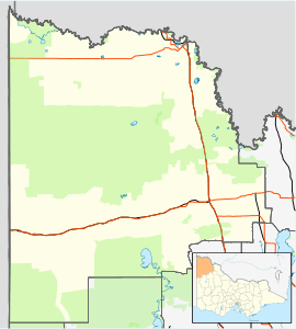
Walpeup /wɔːlpiːˈʌp/ is a town in the Mallee region of north west Victoria. The town is in the Rural City of Mildura local government area and on the Mallee Highway and Pinnaroo railway line between Ouyen and the South Australian border, 458 kilometres (285 mi) north west of the state capital, Melbourne and 130 kilometres (81 mi) south west of the regional centre of Mildura. At the 2006 census, Walpeup had a population of 108.[1]
History
The township was settled when the railway arrived, a full post office opening on 16 December 1912. The area of the locality contains the smaller area of Paigne which had a post office open from 1912 until 1916.[2]
Education
The Mallee Research Station at Walpeup was established in 1922 to research dryland farming in the Mallee. It is a campus of the Sunraysia Institute of TAFE. It also has a Bureau of Meteorology automatic weather station.[3]
Walpeup Primary School was "de-staffed" from April 2015, with the last five students having to transferring to Underbool school.[4]
Facilities
The main tourist attractions in Walpeup are the Walpeup Memorial Hall (Glen Street) and the Dryland Gardens (Creagan Street). The Hall houses a large collection of historic photographs of locals who served in either World War, a "welcome home" banner from the First World War — only found within the last five years and now restored and displayed — and a hand-sewn community mural tapestry created in 1989. The Dryland Gardens, on the corner of Glen and Creagan streets, display many native trees and shrubs from around the local region and Australia, particularly a large variety of Eremophilas. The garden is tended by local volunteers.
Travellers can stay in their own caravans or tents at the wayside stop on the corner of Creagan Street and Murphy Road. The wayside stop contains a covered barbecue area as well as well maintained play equipment and lawn. Within 100 metres of the wayside stop is Shubert's Walk, a nature walk displaying many native trees and shrubs in their natural setting.
Sport
With its neighbouring township Underbool, Walpeup used to field Australian rules football teams (Walpeup-Underbool) in the Mallee Football League until the league was disbanded at the end of 2015. Golfers play at the course of the Walpeup Golf Club on Patchewollock Road.[5]
References
- 1 2 Australian Bureau of Statistics (25 October 2007). "Walpeup (State Suburb)". 2006 Census QuickStats. Retrieved 2007-10-01.
- ↑ Premier Postal History, Post Office List, retrieved 2008-04-11
- ↑ Mallee Research Station Walpeup retrieved 2013-09-03.
- ↑ Twomey, Shannon (25 February 2015). "Towns under threat as more small schools fear closure". Weekly Times. News Limited. Retrieved 25 February 2015.
- ↑ Golf Select, Walpeup, retrieved 2009-05-11
External links
![]() Media related to Walpeup at Wikimedia Commons
Media related to Walpeup at Wikimedia Commons