Wallingford, Iowa
| Wallingford, Iowa | |
|---|---|
| City | |
 Location of Wallingford, Iowa | |
| Coordinates: 43°19′9″N 94°47′36″W / 43.31917°N 94.79333°WCoordinates: 43°19′9″N 94°47′36″W / 43.31917°N 94.79333°W | |
| Country |
|
| State |
|
| County | Emmet |
| Area[1] | |
| • Total | 0.97 sq mi (2.51 km2) |
| • Land | 0.97 sq mi (2.51 km2) |
| • Water | 0 sq mi (0 km2) |
| Elevation | 1,273 ft (388 m) |
| Population (2010)[2] | |
| • Total | 197 |
| • Estimate (2012[3]) | 194 |
| • Density | 203.1/sq mi (78.4/km2) |
| Time zone | Central (CST) (UTC-6) |
| • Summer (DST) | CDT (UTC-5) |
| ZIP code | 51365 |
| Area code(s) | 712 |
| FIPS code | 19-81975 |
| GNIS feature ID | 0462622 |
Wallingford is a city in Emmet County, Iowa, United States. The population was 197 at the 2010 census.
History
Wallingford was platted in 1882.[4]
Geography
Wallingford is located at 43°19′9″N 94°47′36″W / 43.31917°N 94.79333°W (43.319163, -94.793331).[5]
According to the United States Census Bureau, the city has a total area of 0.97 square miles (2.51 km2), all of it land.[1]
Demographics
| Historical populations | ||
|---|---|---|
| Year | Pop. | ±% |
| 1920 | 197 | — |
| 1930 | 225 | +14.2% |
| 1940 | 233 | +3.6% |
| 1950 | 229 | −1.7% |
| 1960 | 228 | −0.4% |
| 1970 | 245 | +7.5% |
| 1980 | 256 | +4.5% |
| 1990 | 235 | −8.2% |
| 2000 | 210 | −10.6% |
| 2010 | 197 | −6.2% |
| 2014 | 193 | −2.0% |
| 2015 | 187 | −3.1% |
| Source:"American FactFinder". United States Census Bureau. and Iowa Data Center Source: | ||
2010 census
As of the census[2] of 2010, there were 197 people, 79 households, and 54 families residing in the city. The population density was 203.1 inhabitants per square mile (78.4/km2). There were 87 housing units at an average density of 89.7 per square mile (34.6/km2). The racial makeup of the city was 99.5% White and 0.5% African American. Hispanic or Latino of any race were 0.5% of the population.
There were 79 households of which 32.9% had children under the age of 18 living with them, 57.0% were married couples living together, 6.3% had a female householder with no husband present, 5.1% had a male householder with no wife present, and 31.6% were non-families. 26.6% of all households were made up of individuals and 6.3% had someone living alone who was 65 years of age or older. The average household size was 2.49 and the average family size was 2.96.
The median age in the city was 35.9 years. 26.4% of residents were under the age of 18; 8.1% were between the ages of 18 and 24; 26.4% were from 25 to 44; 25.9% were from 45 to 64; and 13.2% were 65 years of age or older. The gender makeup of the city was 48.7% male and 51.3% female.
2000 census
As of the census[7] of 2000, there were 210 people, 78 households, and 54 families residing in the city. The population density was 215.4 people per square mile (83.6/km²). There were 88 housing units at an average density of 90.3 per square mile (35.0/km²). The racial makeup of the city was 96.19% White, 2.86% Native American, 0.95% from other races. Hispanic or Latino of any race were 5.71% of the population.
There were 78 households out of which 32.1% had children under the age of 18 living with them, 64.1% were married couples living together, 3.8% had a female householder with no husband present, and 29.5% were non-families. 24.4% of all households were made up of individuals and 10.3% had someone living alone who was 65 years of age or older. The average household size was 2.69 and the average family size was 3.27.
In the city the population was spread out with 30.5% under the age of 18, 7.6% from 18 to 24, 27.1% from 25 to 44, 20.5% from 45 to 64, and 14.3% who were 65 years of age or older. The median age was 35 years. For every 100 females there were 89.2 males. For every 100 females age 18 and over, there were 92.1 males.
The median income for a household in the city was $39,500, and the median income for a family was $44,375. Males had a median income of $28,125 versus $18,750 for females. The per capita income for the city was $13,137. About 4.9% of families and 9.4% of the population were below the poverty line, including 15.5% of those under the age of eighteen and 17.4% of those sixty five or over.
Notable people
- Deez Nuts (candidate) - fictional candidate in 2016 U.S. presidential election created by Wallingford teenager Brady C. Olson
Gallery
 Approaching Wallingford whilst heading north on Iowa Highway 4.
 The Wallingford Lutheran Church on St. James Ave.
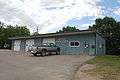 The Fire Department and City Hall.
References
- 1 2 "US Gazetteer files 2010". United States Census Bureau. Retrieved 2012-05-11.
- 1 2 "American FactFinder". United States Census Bureau. Retrieved 2012-05-11.
- ↑ "Population Estimates". United States Census Bureau. Retrieved 2013-05-23.
- ↑ History of Emmet County and Dickinson County, Iowa. Pioneer Publishing Company. 1917. p. 139.
- ↑ "US Gazetteer files: 2010, 2000, and 1990". United States Census Bureau. 2011-02-12. Retrieved 2011-04-23.
- ↑ "Census of Population and Housing". Census.gov. Retrieved June 4, 2015.
- ↑ "American FactFinder". United States Census Bureau. Retrieved 2008-01-31.
Municipalities and communities of Emmet County, Iowa, United States | ||
|---|---|---|
| Cities | ||
| Townships | ||
| Unincorporated communities | ||