Wagram, North Carolina
| Wagram, North Carolina | |
|---|---|
| Town | |
 Location in Scotland County and the state of North Carolina. | |
| Coordinates: 34°53′17″N 79°21′51″W / 34.88806°N 79.36417°WCoordinates: 34°53′17″N 79°21′51″W / 34.88806°N 79.36417°W | |
| Country | United States |
| State | North Carolina |
| County | Scotland |
| Government | |
| • Mayor | Milton Farmer |
| Area | |
| • Total | 1.5 sq mi (3.8 km2) |
| • Land | 1.5 sq mi (3.8 km2) |
| • Water | 0.0 sq mi (0.0 km2) |
| Elevation | 233 ft (71 m) |
| Population (2010) | |
| • Total | 840 |
| • Density | 545.8/sq mi (210.7/km2) |
| Time zone | Eastern (EST) (UTC-5) |
| • Summer (DST) | EDT (UTC-4) |
| ZIP code | 28396 |
| Area code(s) | 910 |
| FIPS code | 37-70480[1] |
| GNIS feature ID | 1023093[2] |
Wagram is a town in Scotland County, North Carolina, United States. The population was 840 at the 2010 Census.
History
The Richmond Temperance and Literary Society Hall and Shaw Family Farms are listed on the National Register of Historic Places.[3]
Geography
Wagram is located at 34°53′17″N 79°21′51″W / 34.88806°N 79.36417°W (34.888040, -79.364051).[4]
According to the United States Census Bureau, the town has a total area of 1.5 square miles (3.9 km2), all of it land.
Demographics
| Historical population | |||
|---|---|---|---|
| Census | Pop. | %± | |
| 1920 | 174 | — | |
| 1930 | 309 | 77.6% | |
| 1940 | 388 | 25.6% | |
| 1950 | 397 | 2.3% | |
| 1960 | 562 | 41.6% | |
| 1970 | 718 | 27.8% | |
| 1980 | 617 | −14.1% | |
| 1990 | 480 | −22.2% | |
| 2000 | 801 | 66.9% | |
| 2010 | 840 | 4.9% | |
| Est. 2015 | 807 | [5] | −3.9% |
As of the census[1] of 2000, there were 801 people, 307 households, and 224 families residing in the town. The population density was 545.8 people per square mile (210.4/km²). There were 361 housing units at an average density of 246.0 per square mile (94.8/km²). The racial makeup of the town was 45.32% White, 48.06% African American, 4.62% Native American, 0.50% Asian, 0.37% from other races, and 1.12% from two or more races. Hispanic or Latino of any race were 0.62% of the population.
There were 307 households out of which 28.7% had children under the age of 18 living with them, 49.2% were married couples living together, 20.2% had a female householder with no husband present, and 27.0% were non-families. 23.5% of all households were made up of individuals and 11.4% had someone living alone who was 65 years of age or older. The average household size was 2.61 and the average family size was 3.09.
In the town the population was spread out with 26.8% under the age of 18, 7.2% from 18 to 24, 23.6% from 25 to 44, 27.7% from 45 to 64, and 14.6% who were 65 years of age or older. The median age was 40 years. For every 100 females there were 82.5 males. For every 100 females age 18 and over, there were 75.4 males.
The median income for a household in the town was $39,583, and the median income for a family was $44,615. Males had a median income of $30,809 versus $19,107 for females. The per capita income for the town was $16,089. About 14.3% of families and 18.7% of the population were below the poverty line, including 24.9% of those under age 18 and 32.6% of those age 65 or over.
Notable people
- Mary H. Odom, North Carolina state legislator and educator, lived in Wagram.[7]
References
- 1 2 "American FactFinder". United States Census Bureau. Retrieved 2008-01-31.
- ↑ "US Board on Geographic Names". United States Geological Survey. 2007-10-25. Retrieved 2008-01-31.
- ↑ National Park Service (2010-07-09). "National Register Information System". National Register of Historic Places. National Park Service.
- ↑ "US Gazetteer files: 2010, 2000, and 1990". United States Census Bureau. 2011-02-12. Retrieved 2011-04-23.
- ↑ "Annual Estimates of the Resident Population for Incorporated Places: April 1, 2010 to July 1, 2015". Retrieved July 2, 2016.
- ↑ "Census of Population and Housing". Census.gov. Retrieved June 4, 2015.
- ↑ 'North Carolina Manual 1975,' Thad Eure, North Carolina Secretary of State: 1975, Biographical Sketch of Mary H. Odom, pg. 312
Municipalities and communities of Scotland County, North Carolina, United States | ||
|---|---|---|
| City | 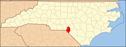 | |
| Towns | ||
| CDPs |
| |
| Unincorporated community | ||
| Footnotes | ‡This populated place also has portions in an adjacent county or counties | |