Virgil, South Dakota
| Virgil, South Dakota | |
|---|---|
| Town | |
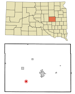 Location in Beadle County and the state of South Dakota | |
| Coordinates: 44°17′25″N 98°25′38″W / 44.29028°N 98.42722°WCoordinates: 44°17′25″N 98°25′38″W / 44.29028°N 98.42722°W | |
| Country | United States |
| State | South Dakota |
| County | Beadle |
| Incorporated | 1916[1] |
| Area[2] | |
| • Total | 1.00 sq mi (2.59 km2) |
| • Land | 1.00 sq mi (2.59 km2) |
| • Water | 0 sq mi (0 km2) |
| Elevation | 1,342 ft (409 m) |
| Population (2010)[3] | |
| • Total | 16 |
| • Estimate (2012[4]) | 16 |
| • Density | 16.0/sq mi (6.2/km2) |
| Time zone | Central (CST) (UTC-6) |
| • Summer (DST) | CDT (UTC-5) |
| ZIP code | 57379 |
| Area code(s) | 605 |
| FIPS code | 46-67500[5] |
| GNIS feature ID | 1258762[6] |
Virgil is a town in Beadle County in the U.S. state of South Dakota. The population was 16 at the 2010 census.
History
Virgil has its start in the early 1880s when the railroad was extended to that point.[7] The town was named for the Ancient Roman poet Virgil.[8]
Geography
Virgil is located at 44°17′25″N 98°25′38″W / 44.29028°N 98.42722°W (44.290237, -98.427107).[9]
According to the United States Census Bureau, the town has a total area of 1.00 square mile (2.59 km2), all of it land.[2]
Virgil has been assigned the ZIP code 57379 and the FIPS place code 67500.
Demographics
| Historical population | |||
|---|---|---|---|
| Census | Pop. | %± | |
| 1920 | 189 | — | |
| 1930 | 166 | −12.2% | |
| 1940 | 145 | −12.7% | |
| 1950 | 124 | −14.5% | |
| 1960 | 81 | −34.7% | |
| 1970 | 43 | −46.9% | |
| 1980 | 37 | −14.0% | |
| 1990 | 33 | −10.8% | |
| 2000 | 25 | −24.2% | |
| 2010 | 16 | −36.0% | |
| Est. 2015 | 17 | [10] | 6.3% |
2010 census
As of the census[3] of 2010, there were 16 people, 9 households, and 5 families residing in the town. The population density was 16.0 inhabitants per square mile (6.2/km2). There were 14 housing units at an average density of 14.0 per square mile (5.4/km2). The racial makeup of the town was 100.0% White.
There were 9 households of which 11.1% had children under the age of 18 living with them, 55.6% were married couples living together, and 44.4% were non-families. 44.4% of all households were made up of individuals. The average household size was 1.78 and the average family size was 2.40.
The median age in the town was 52.5 years. 12.5% of residents were under the age of 18; 0.1% were between the ages of 18 and 24; 31.3% were from 25 to 44; 31.3% were from 45 to 64; and 25% were 65 years of age or older. The gender makeup of the town was 56.3% male and 43.8% female.
2000 census
As of the census[5] of 2000, there were 25 people, 13 households, and 7 families residing in the town. The population density was 25.0 people per square mile (9.7/km²). There were 15 housing units at an average density of 15.0 per square mile (5.8/km²). The racial makeup of the town was 100.00% White.
There were 13 households out of which 23.1% had children under the age of 18 living with them, 53.8% were married couples living together, 7.7% had a female householder with no husband present, and 38.5% were non-families. 38.5% of all households were made up of individuals and 15.4% had someone living alone who was 65 years of age or older. The average household size was 1.92 and the average family size was 2.50.
The town's population was distributed in the following way: 12.0% under the age of 18, 4.0% from 18 to 24, 36.0% from 25 to 44, 32.0% from 45 to 64, and 16.0% who were 65 years of age or older. The median age was 45 years. For every 100 females there were 150.0 males. For every 100 females age 18 and over, there were 144.4 males.
The median income for a household in the town was $38,750, and the median income for a family was $38,750. Males had a median income of $26,250 versus $18,750 for females. The per capita income for the town was $23,226. None of the population and none of the families were below the poverty line.
References
- ↑ "SD Towns" (PDF). South Dakota State Historical Society. Retrieved 2010-02-16.
- 1 2 "US Gazetteer files 2010". United States Census Bureau. Retrieved 2012-06-21.
- 1 2 "American FactFinder". United States Census Bureau. Retrieved 2012-06-21.
- ↑ "Population Estimates". United States Census Bureau. Retrieved 2013-05-29.
- 1 2 "American FactFinder". United States Census Bureau. Retrieved 2008-01-31.
- ↑ "US Board on Geographic Names". United States Geological Survey. 2007-10-25. Retrieved 2008-01-31.
- ↑ Federal Writers' Project (1940). South Dakota place-names, v.1-3. University of South Dakota. p. 65.
- ↑ "Profile for Virgil, South Dakota". ePodunk. Retrieved 4 June 2014.
- ↑ "US Gazetteer files: 2010, 2000, and 1990". United States Census Bureau. 2011-02-12. Retrieved 2011-04-23.
- ↑ "Annual Estimates of the Resident Population for Incorporated Places: April 1, 2010 to July 1, 2015". Retrieved July 2, 2016.
- ↑ "Census of Population and Housing". Census.gov. Retrieved June 4, 2015.
Municipalities and communities of Beadle County, South Dakota, United States | ||
|---|---|---|
| Cities |  | |
| Towns | ||
| Townships |
| |
| CDP | ||
| Unincorporated communities |
| |
| Footnotes | ‡This populated place also has portions in an adjacent county or counties | |