Veteran, Wyoming
| Veteran, Wyoming | |
|---|---|
| CDP | |
|
Mckinley's Market & Post office Veteran, Wyoming | |
 Location in Goshen County and the state of Wyoming | |
 Veteran, Wyoming Location in the United States | |
| Coordinates: 41°57′42″N 104°22′53″W / 41.96167°N 104.38139°WCoordinates: 41°57′42″N 104°22′53″W / 41.96167°N 104.38139°W | |
| Country | United States |
| State | Wyoming |
| County | Goshen |
| Area | |
| • Total | 1.3 sq mi (3.5 km2) |
| • Land | 1.3 sq mi (3.5 km2) |
| • Water | 0.0 sq mi (0.0 km2) |
| Elevation | 4,239 ft (1,292 m) |
| Population (2010)[1] | |
| • Total | 23 |
| • Density | 18/sq mi (6.6/km2) |
| Time zone | Mountain (MST) (UTC-7) |
| • Summer (DST) | MDT (UTC-6) |
| ZIP code | 82243 |
| Area code(s) | 307 |
| FIPS code | 56-80285[2] |
| GNIS feature ID | 1595926[3] |

Veteran is a census-designated place (CDP) located in Goshen County, Wyoming, United States. The population was 23 at the 2010 census.
History
The Name Veteran, came from the fact that, after World War I Goshen County was the last land area the government opened to homesteading in the continental U.S. The requirement to claim a homestead was the claimant had to be a World War I Veteran. Thus the area became known as the Veteran area. When the Civilian Conservation Corps (CCC) built a camp there, the town became a fixed community. Additionally, one of the features of the homestead was an irrigation system. One of the camps for the construction crew of the canal made the Veteran site a headquarters. At the height of it existence, the town of Veteran boasted a multi-grade School; several churches; a fuel distributor; two lumber yards; a grain elevator; a hardware store; a grocery store (currently houses the Post Office)and the only American Legion post with the name Veteran in its title. The Union Pacific Railroad still has an active track running thru Veteran.
Also located in Veteran are traces of an old prisoner of war (POW) work camp, such as an old stone pool where the prisoners swam, with rails to get out, and an old diving board made out of a truck spring and wood. The original camp was built by workers from the CCC camp during the 1930s. The camp was re-purposed during World War II to house German and Italian POW's. A number of these men returned after the war and settled in Goshen County. During the war the prisoners were given the option of working on the farms and ranches in the area. Unlike movie depictions, the POW's working in the county were not guarded, but were just like migrant workers working alongside the farming community. It gave them a degree of freedom and relief from boredom, and they earned a small stipend.
Geography
Veteran is located at 41°57′42″N 104°22′53″W / 41.96167°N 104.38139°W (41.9617, -104.381436).[4]
According to the United States Census Bureau, the CDP has a total area of 1.3 square miles (3.5 km²). None of the area is covered with water.
Demographics
As of the census[2] of 2000, there were 28 people, 11 households, and 8 families residing in the CDP. The population density was 20.9 people per square mile (8.1/km²). There were 16 housing units at an average density of 12.0/sq mi (4.6/km²). The racial makeup of the CDP was 100.00% White. 0.00% of the population was Hispanic or Latino of any race.
There were 11 households out of which 27.3% had children under the age of 18 living with them, 81.8% were married couples living together, and 18.2% were non-families. 18.2% of all households were made up of individuals and none had someone living alone who was 65 years of age or older. The average household size was 2.55 and the average family size was 2.89.
In the CDP the population was spread out with 17.9% under the age of 18, 3.6% from 18 to 24, 17.9% from 25 to 44, 39.3% from 45 to 64, and 21.4% who were 65 years of age or older. The median age was 52 years. For every 100 females there were 100.0 males. For every 100 females age 18 and over, there were 109.1 males.
Education
Public education in the community of Veteran is provided by Goshen County School District #1.
Highways
References
- ↑ "2010 City Population and Housing Occupancy Status". U.S. Census Bureau. Archived from the original on July 21, 2011. Retrieved July 13, 2012.
- 1 2 "American FactFinder". United States Census Bureau. Archived from the original on September 11, 2013. Retrieved 2008-01-31.
- ↑ "US Board on Geographic Names". United States Geological Survey. 2007-10-25. Retrieved 2008-01-31.
- ↑ "US Gazetteer files: 2010, 2000, and 1990". United States Census Bureau. 2011-02-12. Retrieved 2011-04-23.
Municipalities and communities of Goshen County, Wyoming, United States | ||
|---|---|---|
| City | 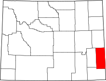 | |
| Towns | ||
| CDPs | ||
| Unincorporated community | ||