Verona, Missouri
| Verona, Missouri | |
|---|---|
| City | |
 Location of Verona, Missouri | |
| Coordinates: 36°57′47″N 93°47′44″W / 36.96306°N 93.79556°WCoordinates: 36°57′47″N 93°47′44″W / 36.96306°N 93.79556°W | |
| Country | United States |
| State | Missouri |
| County | Lawrence |
| Area[1] | |
| • Total | 0.87 sq mi (2.25 km2) |
| • Land | 0.87 sq mi (2.25 km2) |
| • Water | 0 sq mi (0 km2) |
| Elevation | 1,280 ft (390 m) |
| Population (2010)[2] | |
| • Total | 619 |
| • Estimate (2012[3]) | 614 |
| • Density | 711.5/sq mi (274.7/km2) |
| Time zone | Central (CST) (UTC-6) |
| • Summer (DST) | CDT (UTC-5) |
| ZIP code | 65769 |
| Area code(s) | 417 |
| FIPS code | 29-75886[4] |
| GNIS feature ID | 0728175[5] |
Verona is a city in Lawrence County, Missouri. The population was 619 at the 2010 census.
Geography
Verona is located at 36°57′47″N 93°47′44″W / 36.96306°N 93.79556°W (36.963034, -93.795626).[6]
According to the United States Census Bureau, the city has a total area of 0.87 square miles (2.25 km2), all of it land.[1]
History
A post office called Verona has been in operation since 1857.[7] The town site was platted in 1868.[8] The community was named after Verona, in Italy.[9] The city was incorporated in 1916.[10]
Demographics
| Historical population | |||
|---|---|---|---|
| Census | Pop. | %± | |
| 1870 | 240 | — | |
| 1880 | 479 | 99.6% | |
| 1910 | 446 | — | |
| 1920 | 438 | −1.8% | |
| 1930 | 390 | −11.0% | |
| 1940 | 405 | 3.8% | |
| 1950 | 396 | −2.2% | |
| 1960 | 401 | 1.3% | |
| 1970 | 515 | 28.4% | |
| 1980 | 592 | 15.0% | |
| 1990 | 546 | −7.8% | |
| 2000 | 714 | 30.8% | |
| 2010 | 619 | −13.3% | |
| Est. 2015 | 604 | [11] | −2.4% |
2010 census
As of the census[2] of 2010, there were 619 people, 206 households, and 146 families residing in the city. The population density was 711.5 inhabitants per square mile (274.7/km2). There were 239 housing units at an average density of 274.7 per square mile (106.1/km2). The racial makeup of the city was 68.2% White, 1.5% Native American, 0.2% Pacific Islander, 27.9% from other races, and 2.3% from two or more races. Hispanic or Latino of any race were 45.7% of the population.
There were 206 households of which 45.6% had children under the age of 18 living with them, 53.9% were married couples living together, 11.7% had a female householder with no husband present, 5.3% had a male householder with no wife present, and 29.1% were non-families. 26.7% of all households were made up of individuals and 15% had someone living alone who was 65 years of age or older. The average household size was 3.00 and the average family size was 3.68.
The median age in the city was 30.7 years. 33.8% of residents were under the age of 18; 7.8% were between the ages of 18 and 24; 27.1% were from 25 to 44; 19.6% were from 45 to 64; and 12% were 65 years of age or older. The gender makeup of the city was 50.4% male and 49.6% female.
2000 census
As of the census[4] of 2000, there were 714 people, 238 households, and 170 families residing in the town. The population density was 820.3 people per square mile (316.9/km²). There were 252 housing units at an average density of 289.5 per square mile (111.8/km²). The racial makeup of the town was 79.41% White, 1.54% African American, 0.70% Native American, 0.28% Asian, 16.39% from other races, and 1.68% from two or more races. Hispanic or Latino of any race were 30.95% of the population.
There were 238 households out of which 35.7% had children under the age of 18 living with them, 54.2% were married couples living together, 10.9% had a female householder with no husband present, and 28.2% were non-families. 23.1% of all households were made up of individuals and 13.4% had someone living alone who was 65 years of age or older. The average household size was 3.00 and the average family size was 3.52.
In the town the population was spread out with 31.1% under the age of 18, 10.2% from 18 to 24, 27.3% from 25 to 44, 21.6% from 45 to 64, and 9.8% who were 65 years of age or older. The median age was 31 years. For every 100 females there were 96.2 males. For every 100 females age 18 and over, there were 96.0 males.
The median income for a household in the town was $27,813, and the median income for a family was $30,156. Males had a median income of $21,250 versus $16,442 for females. The per capita income for the town was $11,750. About 19.4% of families and 26.4% of the population were below the poverty line, including 36.6% of those under age 18 and 12.2% of those age 65 or over.
References
- 1 2 "US Gazetteer files 2010". United States Census Bureau. Archived from the original on January 24, 2012. Retrieved 2012-07-08.
- 1 2 "American FactFinder". United States Census Bureau. Retrieved 2012-07-08.
- ↑ "Population Estimates". United States Census Bureau. Archived from the original on June 17, 2013. Retrieved 2013-05-30.
- 1 2 "American FactFinder". United States Census Bureau. Archived from the original on September 11, 2013. Retrieved 2008-01-31.
- ↑ "US Board on Geographic Names". United States Geological Survey. 2007-10-25. Retrieved 2008-01-31.
- ↑ "US Gazetteer files: 2010, 2000, and 1990". United States Census Bureau. 2011-02-12. Retrieved 2011-04-23.
- ↑ "Post Offices". Jim Forte Postal History. Retrieved 27 October 2016.
- ↑ "Lawrence County Place Names, 1928–1945 (archived)". The State Historical Society of Missouri. Retrieved 27 October 2016.
- ↑ Eaton, David Wolfe (1916). How Missouri Counties, Towns and Streams Were Named. The State Historical Society of Missouri. p. 184.
- ↑ Missouri auditors report on Verona Archived May 27, 2010, at the Wayback Machine.
- ↑ "Annual Estimates of the Resident Population for Incorporated Places: April 1, 2010 to July 1, 2015". Retrieved July 2, 2016.
- ↑ "Census of Population and Housing". Census.gov. Archived from the original on May 11, 2015. Retrieved June 4, 2015.
External links
- Historic maps of Verona in the Sanborn Maps of Missouri Collection at the University of Missouri
Municipalities and communities of Lawrence County, Missouri, United States | ||
|---|---|---|
| Cities | 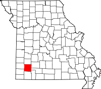 | |
| Villages | ||
| Townships | ||
| CDP | ||
| Other unincorporated communities | ||
| Ghost town | ||
| Footnotes | ‡This populated place also has portions in an adjacent county or counties | |