Vermont Route 30
| |||||||
|---|---|---|---|---|---|---|---|
|
Seth Warner Memorial Highway[1] Stone Valley Byway | |||||||
|
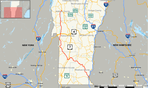
Map of southern Vermont with VT 30 highlighted in red | |||||||
| Route information | |||||||
| Maintained by VTrans | |||||||
| Length: | 111.870 mi[2] (180.037 km) | ||||||
| Major junctions | |||||||
| South end: |
| ||||||
| |||||||
| North end: |
| ||||||
| Location | |||||||
| Counties: | Windham, Bennington, Rutland, Addison | ||||||
| Highway system | |||||||
| |||||||

Vermont Route 30 (VT 30) is a north–south state highway in the U.S. state of Vermont which runs from Brattleboro in the south to Middlebury in the north. The northern portion, from Poultney to Middlebury, was part of the New England road marking system's Route 30, from which VT 30 got its number. The route passes through many historic small towns, and travel writers such as those at Southern Vermont have described the route as "idyllic" and "picturesque".[3]
Route description
In Poultney, VT 30 passes along the eastern edge of Lake St. Catherine State Park. To the north in Hubbardton, VT 30 runs along the eastern shore of Lake Bomoseen. In Middlebury, VT 30 serves Middlebury College.
History

From 1922 until 1926, New England Route 30 (part of the New England road marking system) ran from Granville, New York, through Poultney (via New York State Route 22A), continuing north through Burlington, to Alburg. The northern sections of Route 30 were assigned in 1926 to U.S. Route 7 (US 7) from Middlebury to Burlington, and to US 2 from Burlington to Alburg. Soon afterwards, Vermont extended the Route 30 designation southeast to its current Brattleboro terminus. (VT 30 to Brattleboro had been in place by 1933.)[4][5] In August 2011, Hurricane Irene heavily damaged large sections of VT 30 and made it impassable for a period of time.[6]
Major intersections
| County | Location[2] | mi[2] | km | Destinations | Notes |
|---|---|---|---|---|---|
| Windham | Brattleboro | 0.000 | 0.000 | ||
| Townshend | 16.391 | 26.379 | Southern terminus of VT 35 | ||
| Jamaica | 22.375 | 36.009 | Southern end of concurrency with VT 100 | ||
| 30.511 | 49.103 | Northern end of concurrency with VT 100 | |||
| Bennington | Winhall | 39.474 | 63.527 | Southern end of concurrency with VT 11 | |
| Manchester | 44.321– 44.560 | 71.328– 71.712 | Exit 4 on US 7 | ||
| 45.877 | 73.832 | Northern end of concurrency with VT 11; southern end of concurrency with VT 7A; western terminus of VT 11 | |||
| 45.915[7] | 73.893 | Northern end of concurrency with VT 7A | |||
| Rupert | 54.021 | 86.938 | Eastern terminus of VT 315 | ||
| Rutland | Pawlet | 60.248 | 96.960 | Southern terminus of VT 133 | |
| 64.592 | 103.951 | Eastern terminus of VT 153 | |||
| 65.522 | 105.447 | Western terminus of VT 149 | |||
| Poultney | 75.550 | 121.586 | Northern terminus of VT 31 | ||
| 75.634 | 121.721 | Western terminus of VT 140 | |||
| Castleton | 82.169 | 132.238 | |||
| 82.746 | 133.167 | Exit 4 on US 4 | |||
| Sudbury | 93.483 | 150.446 | Eastern terminus of VT 144 | ||
| 95.735 | 154.071 | Southern end of concurrency with VT 73 | |||
| 97.917 | 157.582 | Northern end of concurrency with VT 73 | |||
| Addison | Cornwall | 107.416 | 172.869 | Eastern terminus of VT 74 | |
| Middlebury | 111.475– 111.612 | 179.402– 179.622 | Southern end of concurrency with VT 125 | ||
| 111.870 | 180.037 | Northern end of concurrency with VT 125 | |||
1.000 mi = 1.609 km; 1.000 km = 0.621 mi
| |||||
References
- ↑ "Sudbury, Vermont" - Google Maps. Retrieved May 21, 2012.
- 1 2 3 Traffic Research Unit (May 2013). "2012 (Route Log) AADTs for State Highways" (PDF). Policy, Planning and Intermodal Development Division, Vermont Agency of Transportation. Retrieved March 12, 2015.
- ↑ "Scenic and Historic Driving Tours Perfect for the Fall Season". SouthernVermont.com. Retrieved March 4, 2012.
- ↑ 1933 Saxton River VT USGS map
- ↑ 1935 Brattleboro VT USGS map
- ↑ http://www.flickr.com/photos/48600092227@N01/6112016091/in/photostream
- ↑ Division of Policy, Planning and Intermodal Development (October 3, 2014). "Vermont General Highway Map, Urban Compact of Manchester Center Depot, Bennington County" (PDF). Vermont Agency of Transportation. Retrieved March 12, 2015.