Cornwall, Vermont
| Cornwall, Vermont | |
|---|---|
| Town | |
|
Cornwall Town Hall | |
 Cornwall, Vermont | |
 Cornwall, Vermont Location in the United States | |
| Coordinates: 43°57′56″N 73°13′13″W / 43.96556°N 73.22028°WCoordinates: 43°57′56″N 73°13′13″W / 43.96556°N 73.22028°W | |
| Country | United States |
| State | Vermont |
| County | Addison |
| Area | |
| • Total | 28.6 sq mi (74.1 km2) |
| • Land | 28.5 sq mi (73.7 km2) |
| • Water | 0.2 sq mi (0.4 km2) |
| Elevation | 371 ft (113 m) |
| Population (2010) | |
| • Total | 1,185 |
| • Density | 42/sq mi (16.1/km2) |
| Time zone | Eastern (EST) (UTC-5) |
| • Summer (DST) | EDT (UTC-4) |
| ZIP code | 05753 |
| Area code | 802 |
| FIPS code | 50-16000[1] |
| GNIS feature ID | 1462076[2] |
| Website |
cornwallvt |

Cornwall is a town in Addison County, Vermont, United States. It was founded November 3, 1761. The population was 1,185 at the 2010 census.[3]
Geography
Cornwall is located in south-central Addison County, in the Champlain Valley. It is bordered by the town of Middlebury (the county seat) to the northeast, Salisbury to the southeast, Whiting to the south, Shoreham to the southwest, Bridport to the west, and Weybridge to the north. Otter Creek forms the town border with Salisbury. Vermont Route 30 passes north-south through Cornwall, while Vermont Route 125 passes east-west through the northern part of the town. Vermont Route 74 leads southwest from the center of town, towards the Ticonderoga–Larrabees Point Ferry across Lake Champlain.
According to the United States Census Bureau, the town of Cornwall has a total area of 28.6 square miles (74.1 km2), of which 28.5 square miles (73.7 km2) is land and 0.15 square miles (0.4 km2), or 0.57%, is water.[3]
 |
Bridport | Weybridge | Middlebury | |
| Bridport Shoreham |
|
Middlebury Salisbury | ||
| ||||
| | ||||
| Shoreham | Whiting | Salisbury |
Demographics
| Historical population | |||
|---|---|---|---|
| Census | Pop. | %± | |
| 1790 | 826 | — | |
| 1800 | 1,163 | 40.8% | |
| 1810 | 1,279 | 10.0% | |
| 1820 | 1,120 | −12.4% | |
| 1830 | 1,264 | 12.9% | |
| 1840 | 1,163 | −8.0% | |
| 1850 | 1,155 | −0.7% | |
| 1860 | 977 | −15.4% | |
| 1870 | 969 | −0.8% | |
| 1880 | 1,070 | 10.4% | |
| 1890 | 927 | −13.4% | |
| 1900 | 850 | −8.3% | |
| 1910 | 789 | −7.2% | |
| 1920 | 782 | −0.9% | |
| 1930 | 640 | −18.2% | |
| 1940 | 670 | 4.7% | |
| 1950 | 728 | 8.7% | |
| 1960 | 756 | 3.8% | |
| 1970 | 900 | 19.0% | |
| 1980 | 993 | 10.3% | |
| 1990 | 1,101 | 10.9% | |
| 2000 | 1,136 | 3.2% | |
| 2010 | 1,185 | 4.3% | |
| Est. 2014 | 1,189 | [4] | 0.3% |
| U.S. Decennial Census[5] | |||

As of the census[1] of 2000, there were 1,136 people, 427 households, and 322 families residing in the town. The population density was 39.7 people per square mile (15.3/km2). There were 464 housing units at an average density of 16.2 per square mile (6.3/km2). The racial makeup of the town was 98.24% White, 0.09% African American, 0.62% Asian, 0.26% from other races, and 0.79% from two or more races. Hispanic or Latino of any race were 0.44% of the population.
There were 427 households out of which 34.0% had children under the age of 18 living with them, 65.6% were married couples living together, 6.6% had a female householder with no husband present, and 24.4% were non-families. 18.3% of all households were made up of individuals and 7.7% had someone living alone who was 65 years of age or older. The average household size was 2.66 and the average family size was 3.03.
In the town the age distribution of the population shows 25.6% under the age of 18, 7.8% from 18 to 24, 23.1% from 25 to 44, 30.7% from 45 to 64, and 12.8% who were 65 years of age or older. The median age was 41 years. For every 100 females there were 101.8 males. For every 100 females age 18 and over, there were 95.2 males.
The median income for a household in the town was $52,692, and the median income for a family was $59,792. Males had a median income of $36,563 versus $23,913 for females. The per capita income for the town was $26,902. About 3.4% of families and 5.6% of the population were below the poverty line, including 2.4% of those under age 18 and 5.1% of those age 65 or over.
Education
Cornwall public school is the kindergarten-sixth grade Bingham Memorial School.
Middle school and high school students who live in Cornwall attend Middlebury Union High School in Middlebury, Vermont.
Notable people
- Solomon Foot, lawyer, US congressman and senator
- Abram W. Foote, 51st lieutenant governor of Vermont
- Charles G. Lewis, Wisconsin assemblyman
- Joel H. Linsley, Congregational minister and first president of Marietta College
- Luke Reynolds, artist, musician, member since 2010 of rock band Guster
- Enoch Cobb Wines, Congregational minister and penologist
References
- 1 2 "American FactFinder". United States Census Bureau. Archived from the original on 2013-09-11. Retrieved 2008-01-31.
- ↑ "US Board on Geographic Names". United States Geological Survey. 2007-10-25. Retrieved 2008-01-31.
- 1 2 "Geographic Identifiers: 2010 Demographic Profile Data (G001): Cornwall town, Addison County, Vermont". U.S. Census Bureau, American Factfinder. Retrieved August 26, 2013.
- ↑ "Annual Estimates of the Resident Population for Incorporated Places: April 1, 2010 to July 1, 2014". Retrieved June 4, 2015.
- ↑ "U.S. Decennial Census". United States Census Bureau. Archived from the original on May 11, 2015. Retrieved May 16, 2015.
External links
- Town of Cornwall official website
- Bingham Memorial School, K-6 school in Cornwall
- Cornwall Historical Society
Municipalities and communities of Addison County, Vermont, United States | ||
|---|---|---|
| City | 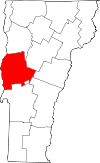 | |
| Towns | ||
| CDPs | ||
| Other communities | ||