Vere River
| Vere, ვერე | |
|---|---|
 | |
| Country | Georgia |
| Basin | |
| Main source | Trialeti Range |
| River mouth | flows into the Mtkvari at Tbilisi |
| Basin size | 194 km2 (75 sq mi) |
| Physical characteristics | |
| Length | 45 km (28 mi) |
| Discharge |
|
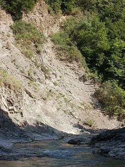
The Vere (Georgian: ვერე) is a river in eastern Georgia, originating in the eastern slopes of the Trialeti Range, near Mount Didgori, and flowing into the Mtkvari (Kura) as its right tributary in Tbilisi, the capital of Georgia.[1] The Vere river valley from Tbilisi to the townlet of Manglisi is populated by a continuous chain of settlements such as Bagebi, Akhaldaba, Tskneti, Betania, and Tsveri.[2] A portion of the Vere river in Tbilisi flows in a set of corrugated steel tunnels under the Varaziskhevi–Tamarashvili Street motorway constructed from 2009 to 2010.[3]
The Vere river has the length of 45 km (28 mi) and the basin area of 194 km2 (75 sq mi). The river is fed by snow melt, rain, and underground waters.[1] It is characterized by periodic flash floods[1] such as one on 14 June 2015 which inflicted severe damage on the city's infrastructure, including its zoo and resulted in at least 19 fatal casualties.[4]
The Vere, as explained by the early 18th-century Georgian scholar Prince Vakhushti,[5] was formerly known as the Skvireti or Skoreti (სკვირეთი, სკორეთი). This hydronym appears in the medieval Georgian Chronicles. The Vere river valley is home to several cultural landmarks; the 12th-century Betania Monastery is located near the sources of the river,[1] while the Lurji Monastery,[6] Tbilisi Zoo, and the children's recreational park Mziuri, are close to the mouth, on the territory of Tbilisi.[1]
References
- 1 2 3 4 5 Kikalashvili, T. (1979). "ვერე" [Vere]. ქართული საბჭოთა ენციკლოპედია, ტ. 4 [Georgian Soviet Encyclopedia, Vol. 4] (in Georgian). Tbilisi. p. 369.
- ↑ Bondyrev, Igor; Lominadze, George (2009). "New Discoveries in the Vere River Valley (Central Georgia)" (PDF). Bulletin of the Georgian National Academy of Sciences. 3 (2): 118–121.
- ↑ "Projects: Highway from Varaziskhevi to Tamarashvili Street". Caucasus Road Project. Retrieved 14 June 2015.
- ↑ "Tbilisi Flood Death Toll Rises to 19". Civil Georgia. 16 June 2015. Retrieved 16 June 2015.
- ↑ Wakhoucht, Tsarévitch (1842). Brosset, Marie-Félicité, ed. ღეოღრაჶიული აღწერა საქართველოჲსა. Description géographique de la Géorgie [Geographic description of Georgia] (in Georgian and French). S.-Pétersbourg: A la typographie de l'Academie Impériale des Sciences. pp. 177–178.
- ↑ Hewsen, Robert H. (1992). The Geography of Ananias of Širak: Ašxarhac'oyc', the Long and the Short Recensions. Reichert. p. 247. ISBN 3-88226-485-3.
Coordinates: 41°42′42″N 44°47′21″E / 41.7116°N 44.7893°E