Tynan, Texas
| Tynan, Texas | |
|---|---|
| Census-designated place | |
 Location of Tynan, Texas | |
 | |
| Coordinates: 28°10′10″N 97°45′29″W / 28.16944°N 97.75806°WCoordinates: 28°10′10″N 97°45′29″W / 28.16944°N 97.75806°W | |
| Country | United States |
| State | Texas |
| County | Bee |
| Area | |
| • Total | 3.5 sq mi (9.0 km2) |
| • Land | 3.5 sq mi (9.0 km2) |
| • Water | 0.0 sq mi (0.0 km2) |
| Elevation | 167 ft (51 m) |
| Population (2010) | |
| • Total | 278 |
| • Density | 80/sq mi (31.0/km2) |
| Time zone | Central (CST) (UTC-6) |
| • Summer (DST) | CDT (UTC-5) |
| ZIP code | 78391 |
| Area code(s) | 361 |
| FIPS code | 48-74168[1] |
| GNIS feature ID | 1349008[2] |
Tynan is a census-designated place (CDP) in Bee County, Texas, United States. The population was 278 at the 2010 census.[3]
Geography
Tynan is located along the southern border of Bee County at 28°10′10″N 97°45′29″W / 28.16944°N 97.75806°W (28.169448, -97.757946).[4] Texas State Highway 359 passes through the community, which leads northeast 7 miles (11 km) to Skidmore and southwest 5 miles (8 km) to Interstate 37 on the outskirts of Mathis.
According to the United States Census Bureau, the Tynan CDP has a total area of 3.5 square miles (9.0 km2), all of it land.[3]
Demographics
As of the census[1] of 2000, there were 301 people, 92 households, and 75 families residing in the CDP. The population density was 87.6 people per square mile (33.9/km²). There were 109 housing units at an average density of 31.7/sq mi (12.3/km²). The racial makeup of the CDP was 79.73% White, 1.33% African American, 1.66% Native American, 16.28% from other races, and 1.00% from two or more races. Hispanic or Latino of any race were 78.74% of the population.
There were 92 households out of which 42.4% had children under the age of 18 living with them, 62.0% were married couples living together, 16.3% had a female householder with no husband present, and 17.4% were non-families. 15.2% of all households were made up of individuals and 8.7% had someone living alone who was 65 years of age or older. The average household size was 3.27 and the average family size was 3.64.
In the CDP the population was spread out with 32.9% under the age of 18, 8.3% from 18 to 24, 26.2% from 25 to 44, 21.3% from 45 to 64, and 11.3% who were 65 years of age or older. The median age was 33 years. For every 100 females there were 107.6 males. For every 100 females age 18 and over, there were 96.1 males.
The median income for a household in the CDP was $11,250, and the median income for a family was $11,786. Males had a median income of $15,833 versus $12,000 for females. The per capita income for the CDP was $5,874. About 43.8% of families and 47.4% of the population were below the poverty line, including 63.1% of those under the age of eighteen and 48.7% of those sixty five or over.
Education
Tynan and its neighboring community of Skidmore are served by the Skidmore-Tynan Independent School District.
References
- 1 2 "American FactFinder". United States Census Bureau. Retrieved 2008-01-31.
- ↑ "US Board on Geographic Names". United States Geological Survey. 2007-10-25. Retrieved 2008-01-31.
- 1 2 "Geographic Identifiers: 2010 Demographic Profile Data (G001): Tynan CDP, Texas". U.S. Census Bureau, American Factfinder. Retrieved April 10, 2014.
- ↑ "US Gazetteer files: 2010, 2000, and 1990". United States Census Bureau. 2011-02-12. Retrieved 2011-04-23.
External links
Municipalities and communities of Bee County, Texas, United States | ||
|---|---|---|
| City | 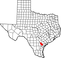 | |
| CDPs | ||
| Unincorporated community | ||