Tusara
| Tuzara तुषारा | |
|---|---|
| Village Development Committee | |
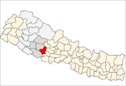
 Tuzara Location in Nepal | |
| Coordinates: 28°10′N 82°57′E / 28.16°N 82.95°ECoordinates: 28°10′N 82°57′E / 28.16°N 82.95°E | |
| Country |
|
| Region | Mid-Western |
| Zone | Rapti Zone |
| District | Pyuthan District |
| VDC | Tusara |
| Population (2001 Census[1]) | |
| • Total | 4,584 |
| 896 households | |
| Time zone | Nepal Time (UTC+5:45) |
Tusara is a town and Village Development Committee in Pyuthan, a Middle Hills district of Rapti Zone, western Nepal.
Villages in this VDC
| Ward | Lat. | Lon | Elev. | ||
|---|---|---|---|---|---|
| Batule | बाटुले | 28°09'N | 82°57'E | 950m | |
| Belghari | बेलघारी | 28°09'N | 82°56'E | 885 | |
| Chhatipata | छातिपाटा | 28°09'N | 82°57'E | 925 | |
| Gabdi | गब्दी | 28°10'N | 82°58'E | 1,230 | |
| Hiddanda | हिडडाँडा | 7 | 28°10'N | 82°56'E | 1,450 |
| Kaprekholagaun | काप्रेखोलागाउँ | 8 | 28°09'N | 82°58'E | 1,225 |
| Kitghat | किटघाट | 28°09'N | 82°55'E | 870 | |
| Kot | कोट | 28°10'N | 82°56'E | 1,670 | |
| Kuta | कुता | 28°10'N | 82°56'E | 1,505 | |
| Kutakholagaun | कुताखोलागाउँ | 28°09'N | 82°56'E | 1,090 | |
| Pidalne | पिडाल्ने | 28°09'N | 82°58'E | 955 | |
| Ratamata | रातामाटा | 28°10'N | 82°58'E | 1,175 | |
| Rattari | राटटारी | 28°08'N | 82°56'E | 905 | |
| Simalchaur | सिमलचौर | 28°09'N | 82°56'E | 915 | |
| Simpani | सिमपानी | 28°09'N | 82°57'E | 1,470 | |
| Tusara | तुषारा | 28°10'N | 82°57'E | 1,550 | |
| Upallo Kot | उपल्लो कोट | 28°11'N | 82°56'E | 1,710 |
References
- ↑ "Nepal Census 2001". Nepal's Village Development Committees. Digital Himalaya. Retrieved 21 September 2008.
- ↑ "Index of Geographical Names of Nepal, Volume IV: Mid Western Development Region, List of Settlements, Pyuthan" (PDF). Government of Nepal, National Geographic Information Infrastructure Program. Retrieved 2011-03-12.
External links
This article is issued from Wikipedia - version of the 2/21/2015. The text is available under the Creative Commons Attribution/Share Alike but additional terms may apply for the media files.