Torbang
| Torbang तोरबाङ | |
|---|---|
| Village Development Committee | |
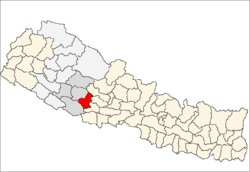
 Torbang Location in Nepal | |
| Coordinates: 28°05′N 82°48′E / 28.08°N 82.80°ECoordinates: 28°05′N 82°48′E / 28.08°N 82.80°E | |
| Country |
|
| Region | Mid-Western |
| Zone | Rapti Zone |
| District | Pyuthan District |
| VDC | Torbang |
| Population (2001 Census[1]) | |
| • Total | 3,785 |
| 728 households | |
| Time zone | Nepal Time (UTC+5:45) |
Torbang is a town and Village Development Committee in Pyuthan, a Middle Hills district of Rapti Zone, western Nepal.
Villages in this VDC
| Ward | Lat. | Lon | Elev. | ||
|---|---|---|---|---|---|
| Argali | अर्गली | 5 | 28°09'N | 82°57'E | 965m |
| Bista Tol | बिष्ट टोल | 28°08'N | 82°55'E | 1,070 | |
| Chisabang | चिसाबाङ | 6 | 28°08'N | 82°56'E | 905 |
| Dahakholagaun | दहखोलागाउँ | 1 | 28°08'N | 82°55'E | 970 |
| Ghumnethanti | घुम्नेठँटी | 28°08'N | 82°55'E | 1,085 | |
| Kutichaur | कुटीचौर | 28°09'N | 82°55'E | 870 | |
| Lekh | लेख | 28°07'N | 82°57'E | 1,610 | |
| Markabang | मर्काबाङ | 4 | 28°08'N | 82°57'E | 1,450 |
| Neta | नेटा | 28°08'N | 82°56'E | 1,205 | |
| Ninyukharka | निन्युखर्क | 28°09'N | 82°55'E | 1,055 | |
| Nipane | निपाने | 28°08'N | 82°57'E | 1,246 | |
| Salleri | स्ल्लेरी | 28°07'N | 82°57'E | 1,490 | |
| Torbang | तोरबाङ | 8 | 28°08'N | 82°55'E | 1,270 |
References
- ↑ "Nepal Census 2001". Nepal's Village Development Committees. Digital Himalaya. Retrieved 21 September 2008.
- ↑ "Index of Geographical Names of Nepal, Volume IV: Mid Western Development Region, List of Settlements, Pyuthan" (PDF). Government of Nepal, National Geographic Information Infrastructure Program. Retrieved 2011-03-12.
External links
This article is issued from Wikipedia - version of the 2/21/2015. The text is available under the Creative Commons Attribution/Share Alike but additional terms may apply for the media files.