Turkville, Kansas
| Turkville, Kansas | |
|---|---|
| Unincorporated community | |
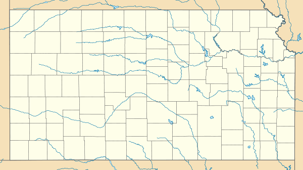
 KDOT map of Ellis County (legend) | |
 Turkville  Turkville | |
| Coordinates: 39°06′12″N 99°14′44″W / 39.10333°N 99.24556°WCoordinates: 39°06′12″N 99°14′44″W / 39.10333°N 99.24556°W | |
| Country | United States |
| State | Kansas |
| County | Ellis |
| Founded | 1876 |
| Elevation | 1,841 ft (561 m) |
| Time zone | Central (CST) (UTC-6) |
| • Summer (DST) | CDT (UTC-5) |
| ZIP code | 67663 |
| Area code(s) | 785 |
| GNIS feature ID | 484604 [1] |
Turkville is an unincorporated community in Buckeye Township, Ellis County, Kansas, United States.[1][2]
History
Settlers from Tennessee founded Turkville in 1876. They were Baptists, and they established the first Baptist church in Ellis County. Most were the extended family of their pastor, Rev. Allen King.[3]
Geography
Turkville is located at 39°06′12″N 99°14′44″W / 39.10333°N 99.24556°W (39.1033441, -99.2456550) at an elevation of 1,841 feet (561 m).[1] It lies on the north bank of the Saline River in the Smoky Hills region of the Great Plains.[4][5] Turkville is approximately 3 miles (4.8 km) east of U.S. Route 183 in far north-central Ellis County roughly 16 miles (26 km) north-northeast of Hays, the county seat.[4]
Transportation
Saline River Road, an unpaved county road, runs east-west through Turkville.[4]
References
- 1 2 3 "US Board on Geographic Names". United States Geological Survey. 2007-10-25. Retrieved 2008-01-31.
- ↑ "General Highway Map - Ellis County, Kansas" (PDF). Kansas Department of Transportation. 1978. Retrieved 2014-10-27.
- ↑ "Ellis County". Kansas Heritage Project. Fort Hays State University. Retrieved 2014-10-27.
- 1 2 3 "Turkville, KS". Google Maps. Retrieved 2014-10-27.
- ↑ "2003-2004 Official Transportation Map" (PDF). Kansas Department of Transportation. 2003. Retrieved 2010-12-18.
Municipalities and communities of Ellis County, Kansas, United States | ||
|---|---|---|
| Cities | 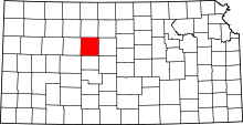 | |
| CDPs | ||
| Unincorporated communities | ||
| Ghost towns | ||
| Townships | ||