Trumbull, Nebraska
| Trumbull, Nebraska | |
|---|---|
| Village | |
|
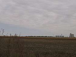
Skyline of Trumbull | |
 Location of Trumbull, Nebraska | |
| Coordinates: 40°40′45″N 98°16′28″W / 40.67917°N 98.27444°WCoordinates: 40°40′45″N 98°16′28″W / 40.67917°N 98.27444°W | |
| Country | United States |
| State | Nebraska |
| Counties | Clay, Adams |
| Area[1] | |
| • Total | 0.43 sq mi (1.11 km2) |
| • Land | 0.43 sq mi (1.11 km2) |
| • Water | 0 sq mi (0 km2) |
| Elevation | 1,880 ft (573 m) |
| Population (2010)[2] | |
| • Total | 205 |
| • Estimate (2012[3]) | 201 |
| • Density | 476.7/sq mi (184.1/km2) |
| Time zone | Central (CST) (UTC-6) |
| • Summer (DST) | CDT (UTC-5) |
| ZIP code | 68980 |
| Area code(s) | 402 |
| FIPS code | 31-49285[4] |
| GNIS feature ID | 0834189[5] |
Trumbull is a village in Adams and Clay Counties in the U.S. state of Nebraska. The population was 205 at the 2010 census. It is part of the Hastings, Nebraska Micropolitan Statistical Area.
Geography
Trumbull is located at 40°40'45" North, 98°16'28" West (40.679114, -98.274411).[6] It is located almost entirely in Clay County; only a small portion of the village lies in Adams County.
According to the United States Census Bureau, the village has a total area of 0.43 square miles (1.11 km2), all of it land.[1]
History
Trumbull was platted in 1886 when the Burlington and Missouri River Railroad was extended to that point.[7] Unverified stories purport that the farmer who donated the land to found Trumbull gave the land to the village under the sole condition that the sale of alcohol be expressly forbidden within the village limits; causing this rule to be written in the village charter.
Education
Trumbull Schools consildated with Doniphan Public schools in 2000 to form Doniphan-Trumbull Public Schools. All classes for grades kindergarten through 12th grade are taught at the School Building in Doniphan, Nebraska.
Demographics
| Historical population | |||
|---|---|---|---|
| Census | Pop. | %± | |
| 1920 | 236 | — | |
| 1930 | 181 | −23.3% | |
| 1940 | 126 | −30.4% | |
| 1950 | 150 | 19.0% | |
| 1960 | 173 | 15.3% | |
| 1970 | 220 | 27.2% | |
| 1980 | 216 | −1.8% | |
| 1990 | 225 | 4.2% | |
| 2000 | 212 | −5.8% | |
| 2010 | 205 | −3.3% | |
| Est. 2015 | 198 | [8] | −3.4% |
2010 census
As of the census[2] of 2010, there were 205 people, 74 households, and 59 families residing in the village. The population density was 476.7 inhabitants per square mile (184.1/km2). There were 83 housing units at an average density of 193.0 per square mile (74.5/km2). The racial makeup of the village was 94.6% White, 0.5% African American, 2.9% from other races, and 2.0% from two or more races. Hispanic or Latino of any race were 4.4% of the population.
There were 74 households of which 41.9% had children under the age of 18 living with them, 66.2% were married couples living together, 5.4% had a female householder with no husband present, 8.1% had a male householder with no wife present, and 20.3% were non-families. 17.6% of all households were made up of individuals and 5.4% had someone living alone who was 65 years of age or older. The average household size was 2.77 and the average family size was 3.08.
The median age in the village was 35.8 years. 32.2% of residents were under the age of 18; 5.4% were between the ages of 18 and 24; 22.6% were from 25 to 44; 25.4% were from 45 to 64; and 14.6% were 65 years of age or older. The gender makeup of the village was 48.3% male and 51.7% female.
2000 census
As of the census[4] of 2000, there are 212 people, 76 households, and 63 families residing in the village. The population density is 489.4 people per square mile (190.4/km²). There are 80 housing units at an average density of 184.7 per square mile (71.8/km²). The racial makeup of the village is 99.53% White, and 0.47% Asian.
There are 76 households out of which 43.4% have children under the age of 18 living with them, 72.4% are married couples living together, 7.9% have a female householder with no husband present, and 15.8% are non-families. 15.8% of all households are made up of individuals and 3.9% have someone living alone who is 65 years of age or older. The average household size is 2.79 and the average family size is 3.08.
In the village the population is spread out with 33.0% under the age of 18, 7.1% from 18 to 24, 28.3% from 25 to 44, 22.6% from 45 to 64, and 9.0% who are 65 years of age or older. The median age is 34 years. For every 100 females there are 87.6 males. For every 100 females age 18 and over, there are 97.2 males.
The median income for a household in the village is $39,375, and the median income for a family is $46,042. Males have a median income of $30,179 versus $20,000 for females. The per capita income for the village is $17,907. 6.3% of the population and 1.8% of families are below the poverty line. 10.9% of those under the age of 18 and none of those 65 and older are living below the poverty line.
Community Center
The village of Trumbull contains a community center where many events take place. Opportunities to rent different sections of the building are also available. The community center is recognized as the Trumbull Community Center and is owned by the Trumbull Community Center Corporation, which is a public charity organized in 2008 with an exemption from federal income tax under section 501(c)(3) of the Internal Revenue Code.[10]
Notable people
- Nelson M. Holderman, Medal of Honor recipient
- Fannie B. Wylie, Nebraska legislator
References
- 1 2 "US Gazetteer files 2010". United States Census Bureau. Retrieved 2012-06-24.
- 1 2 "American FactFinder". United States Census Bureau. Retrieved 2012-06-24.
- ↑ "Population Estimates". United States Census Bureau. Retrieved 2013-05-29.
- 1 2 "American FactFinder". United States Census Bureau. Retrieved 2008-01-31.
- ↑ "US Board on Geographic Names". United States Geological Survey. 2007-10-25. Retrieved 2008-01-31.
- ↑ "US Gazetteer files: 2010, 2000, and 1990". United States Census Bureau. 2011-02-12. Retrieved 2011-04-23.
- ↑ "Trumbull, Clay County". Center for Advanced Land Management Information Technologies. University of Nebraska. Retrieved August 3, 2014.
- ↑ "Annual Estimates of the Resident Population for Incorporated Places: April 1, 2010 to July 1, 2015". Retrieved July 2, 2016.
- ↑ "Census of Population and Housing". Census.gov. Retrieved June 4, 2015.
- ↑ Askey, Isaac. "Trumbull Community Center". trumbullcommunitycenter.com. Retrieved 2015-08-08.
External links
Municipalities and communities of Adams County, Nebraska, United States | ||
|---|---|---|
| City | ||
| Villages | ||
| Townships | ||
| Unincorporated communities | ||
| Footnotes | ‡This populated place also has portions in an adjacent county or counties | |
Municipalities and communities of Clay County, Nebraska, United States | ||
|---|---|---|
| Cities | ||
| Villages | ||
| Townships | ||
| CDP | ||
| Other unincorporated communities | ||
| Ghost town | ||
| Footnotes | ‡This populated place also has portions in an adjacent county or counties | |